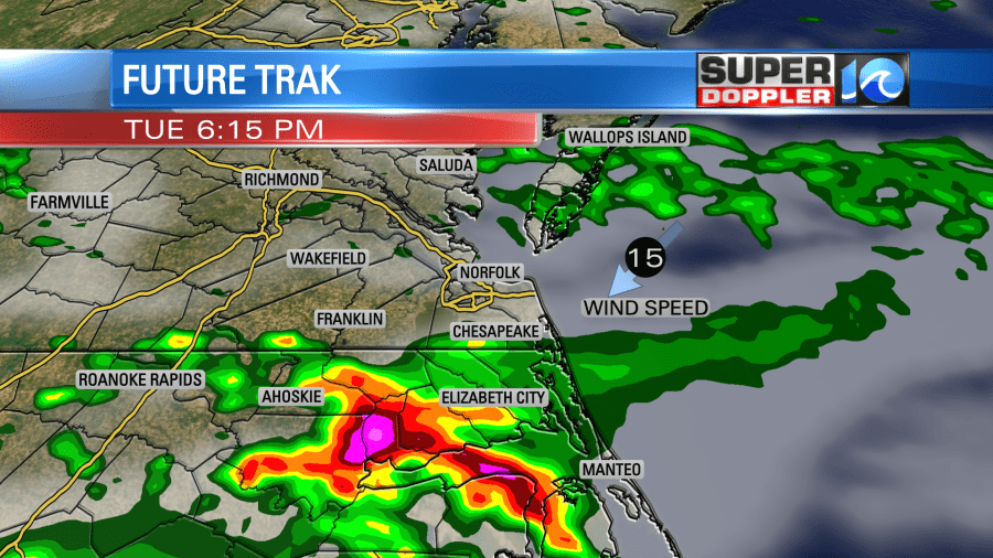
A Severe Thunderstorm Watch has been issued for parts of Hampton Roads and most of NE North Carolina until 10 pm Tuesday. Damaging wind and hail will be the primary concerns with the thunderstorms that do develop this evening.
Thunderstorms capable of producing damaging wind and hail will develop along a stalled front this evening, primariy south and west of the James River / the metro. Storm activity should take us into sunset before fading through the night. The northeast wind (which is protecting the Peninsulas and most of the southside) will takeover for all of us overnight. Refreshing sunshine guides us through the day tomorrow.
______________________________________________________________________________________________________
As of Tuesday morning, we have a stationary front that is stretched across our region. At 5am, I analyzed this front around the Peninsula – with winds out of the northeast across the Eastern Shore and SW across VA Beach and Southside. It’s important to know where this front is, because that could determine where our storm chances are this afternoon.
Why does the wind direction matter? Well, a NE wind brings in cooler, drier and more stable air. This results in a lower severe weather risk. Across the southside and interior portions of VA where we’ll see warmer temperatures and a SW wind today – the risk for storms is higher. The SPC outlook map outlines this pretty well I think.
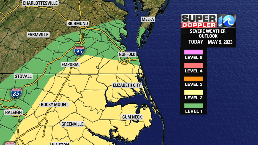
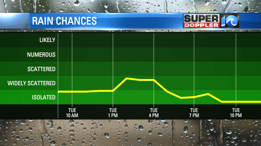
The primary timeframe for storms will be between 2-8 pm with the highest threat for severe weather in the level 2 risk zone.

Temperatures will rise into the 70s to near 80 inland spots, cooler along the coast and eastern shore today. As the front moves south, temperatures will drop a bit into the 60s by this evening into the metro.
Tomorrow we will see cooler temperatures as our wind blows out of the northeast. Temperatures will be in the 60s through much of the day – but this cool down is short lasting. We’ll be back into the 70s by Thursday and climb towards the upper 70s to near 80 by the weekend.
Mothers Day weekend looks to be mild, but could feature a few showers.
Hope you have a great Tuesday!
Meteorologist Ricky Matthews
Follow Ricky on Facebook and Twitter