Yesterday, the sea breeze did not kick in. So high temps managed to reach the low-mid 90s in many places in Hampton Roads. The heat index was in the upper 90s for many.. Today we will have another hot and humid day. One difference will be that we’ll have some more clouds than yesterday. Another difference is that we will have some isolated showers and storms popping up closer to Hampton Roads. We still have high pressure offshore, but it has drifted east just a bit.

Last night we had a small upper level disturbance move down from Pennsylvania and Maryland. It brought a cluster of showers and storms down to the Northern Neck and Eastern Shore.
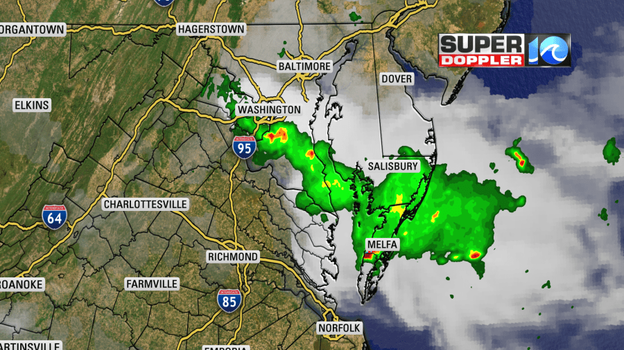
This was a great thing! I wish it could have dropped down to Cape Charles, but at least it brought a little over an inch of rain to Wallops Island.
Today the rest of the area will only have a 20% chance for some pop-up showers and storms.
Tomorrow an area of low pressure will move in from the southwest. It may move over land, or it may move along the North Carolina coast. Either way it will bring us some scattered showers and a few storms.
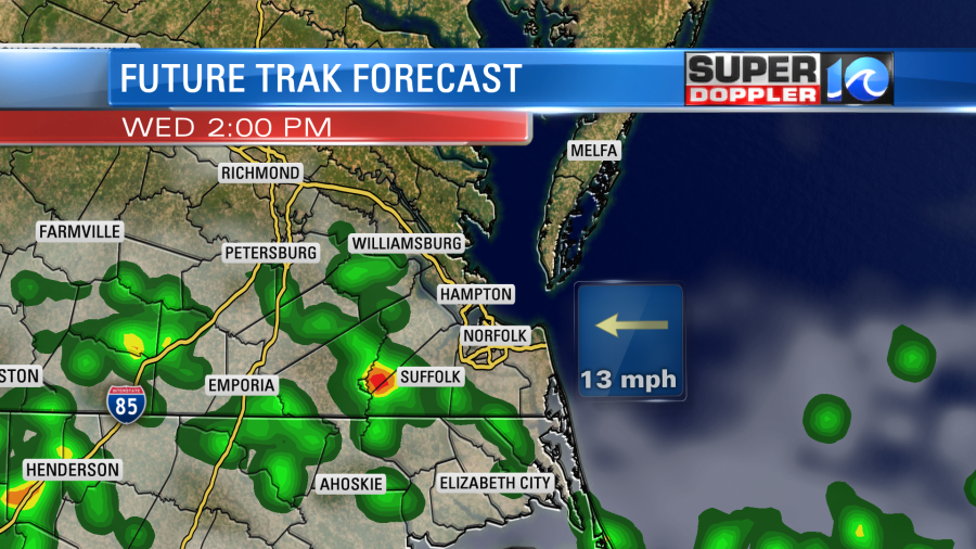
The extra clouds and rain should keep the temps down a bit, but humidity will be very high. So the high temps will be in the upper 80s, but the heat index will still be in the low-mid 90s.
On Thursday the area of low pressure will either be just offshore or very close to the coast. The European Model has it just offshore, and possibly becoming tropical.
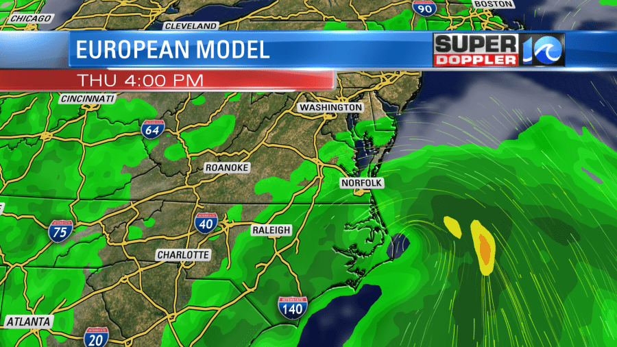
Meanwhile the GFS model has it more to the southwest and a little inland near Moorehead City, NC.
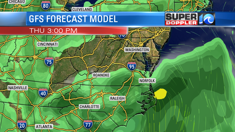
As you can see though…either way we get a lot of rain in the region, but it is more widespread on the Euro. I’ll talk more about possible rainfall amounts in tomorrow’s weather blog.
The system should push north on Friday. However, an upper level low will sink in on the back side. That feature will keep a chance for scattered showers and storms going from Friday through the weekend. High temps are aiming for the upper 80s to low 90s during that time, but that part of the forecast may change. Stay tuned for updates.
Meteorologist: Jeremy Wheeler