Yesterday was warm as expected. In fact Norfolk even warmed up a couple of degrees above the forecast.

Today we started off milder. Temps were in the 60s with quite a bit of clouds. We have high pressure to our south, and the wind has stayed up since the overnight out of the southwest.
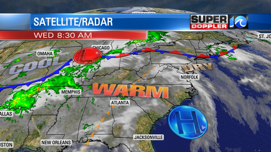
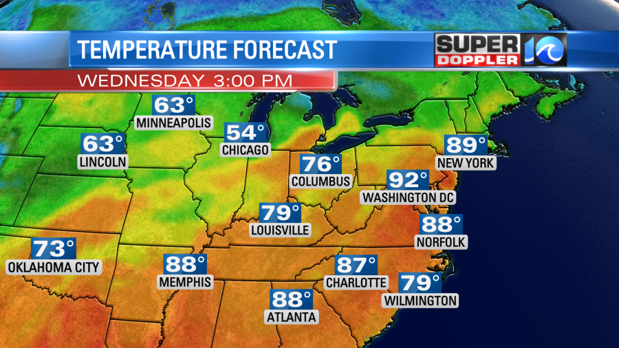
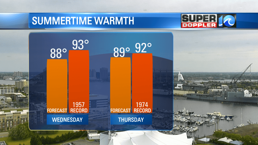
We’ll be in the warm zone today. Many high temperatures in the region will be in the 80s with a few 90s possible inland.
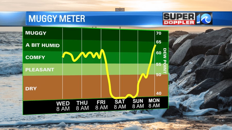
We’ll have clearing skies. Luckily there is a nice breeze. Also, the humidity still isn’t too bad. Dew points are in the 50s today and tomorrow, but they could sneak up to over 60 once in a while.
We will likely see a repeat tomorrow with some clouds in the morning and clearing in the afternoon. High temps will run in the upper 80s with possibly a few 90s. These will likely be shy of the records which are in the low 90s.
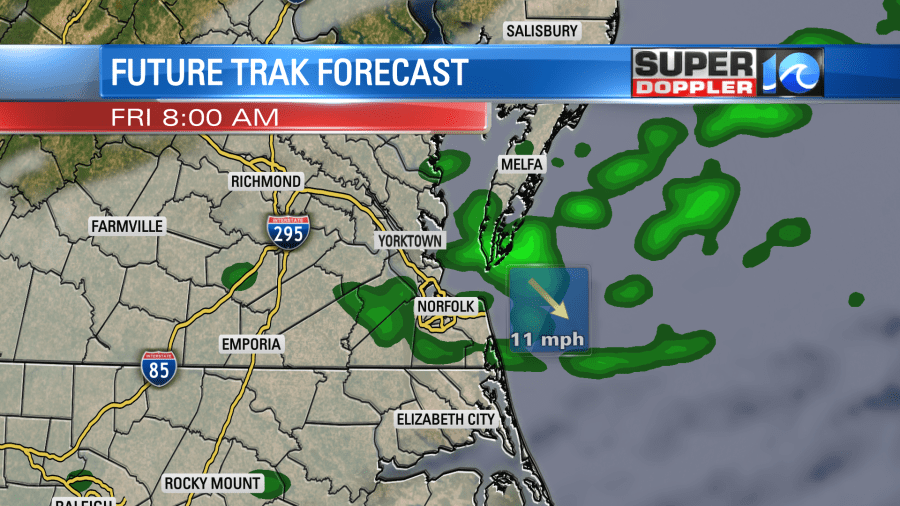
by Friday we’ll have a cold front enter the region. This will create more clouds and some scattered showers. I talked yesterday about the GFS model vs the Euro model during this time-frame. The GFS was later and wetter. The Euro was early, and it didn’t show much rain. Today they are starting to come together. So I have scattered showers in the forecast right now, but I think the coverage will be lower. Here is what Future Trak shows for Friday morning.
It will definitely be cooler. High temps will be in the upper 70s. However, it will be humid. We’ll cool down and dry out over the weekend. Skies will be partly cloudy with highs in the 60s on Saturday and mid 70s on Sunday.
I’m hoping that we get at least some rain on Friday to wash out the pollen. The tree and grass pollen are at high levels today. They should drop over the weekend whether we get rain or not, but they will drop a lot more if we do get a soaking rain.
Meteorologist: Jeremy Wheeler