This morning was the quiet before the storms. We did have some clouds and fog, but there wasn’t any rain for the morning commute.
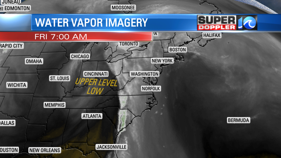
A warm front was lifting to our north with a cold front far off to the west.
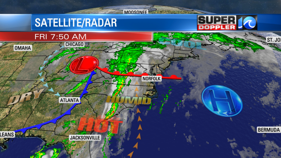
Clouds will thicken up through the day, but the breeze will stay steady out of the south. So high temps should be able to warm to the low 80s with a few mid 80s possible. Some upper level energy is already moving towards the region.
Notice the white/light green band over western Virginia and North Carolina. That is what I am talking about.
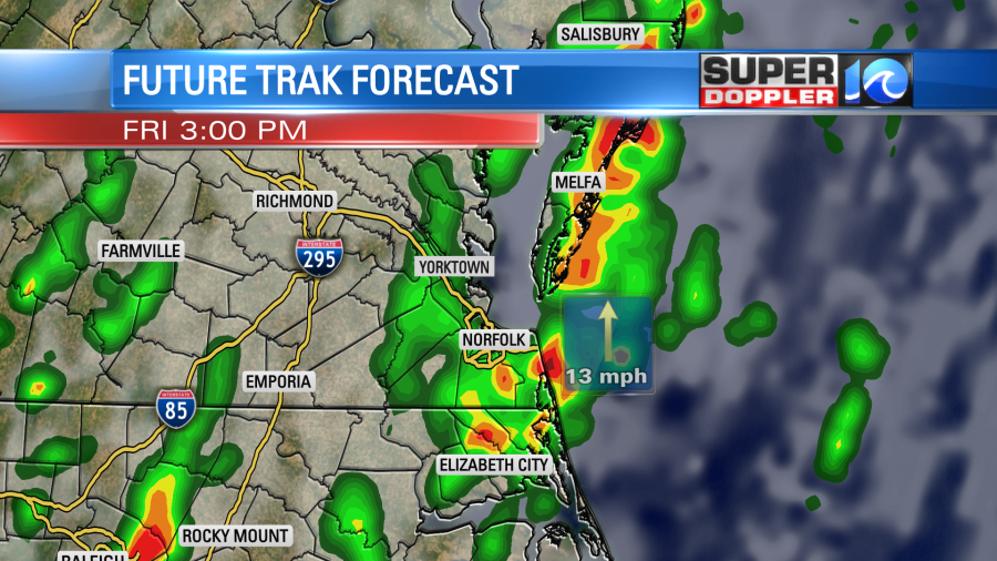
This means that a few showers and storms will kick off by the midday hours.
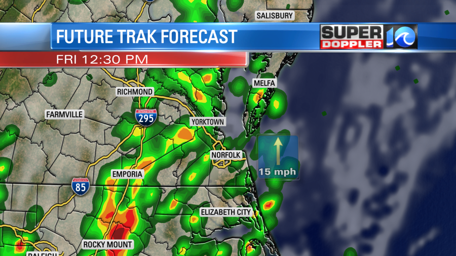
The models are a bit split on how soon storms fire up, but looking at the latest I’m siding with the ones that kick things off by midday.
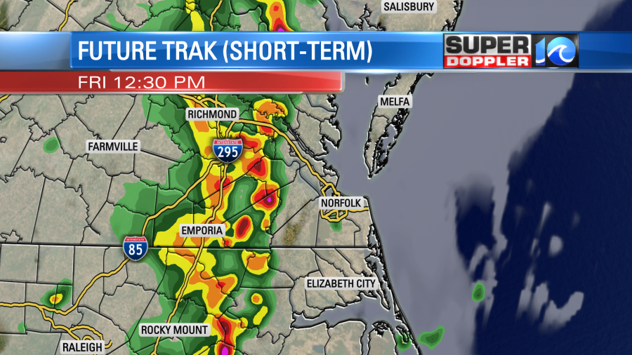
Storms will continue through the mid-late afternoon.
This may help (slightly) as we won’t have time for the atmosphere to really cook. However, there will be enough moisture and wind shear that strong to severe storms will still be possible today. We do have a slight risk for severe weather for a large portion of the viewing area.
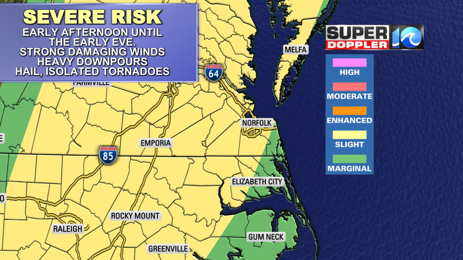
Strong damaging winds will be the main threat. Remember, winds will already be gusting up to 25mph out of the south before any storms even arrive. The storms could easily produces some gusts to 50mph or higher. There will be some brief heavy downpours. I’m hoping that they storms will be on the move. So for now I’m thinking that there could be some isolated street flooding. There will be a chance for large hail. Also isolated tornadoes will be possible in the region.
The first round of storms may take some of the punch of out the 2nd round this evening. However, there will be a few showers and storms possible until the late evening. The cold front won’t come through until tonight. It might just put down a few scattered light rain showers until early tomorrow morning.
After that we’ll have some nice weather for the holiday weekend. We’ll have partly cloudy skies for most of Saturday with highs in the 80s. We’ll dry out through the day. Then we’ll be dry and warm Sunday and Monday.
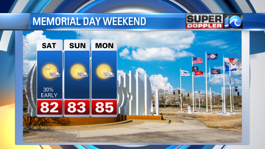
Have a good and safe holiday weekend!
Meteorologist: Jeremy Wheeler