We are coming off of another great weather weekend. We had a lot of sunshine both days. Temps were mainly in the 80s. It was very summery outside. Me and my family hit the beach on Friday. It was nice! The water was cool, but not too cold. It was pretty dry, and it felt good with the breeze.
As we start this work week we’ll have quiet weather for a little while longer. However, we’ll have some storms arriving later today.
High pressure is sliding offshore. We have a strong cold front to the west.
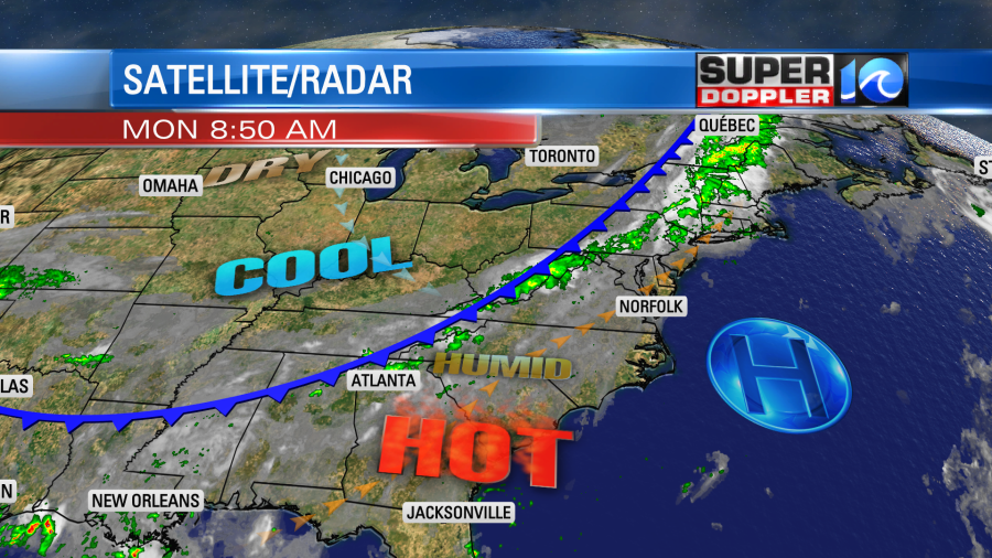
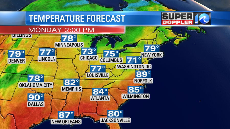
We’ll heat up today compared to the weekend. High temps will rise to the upper 80s to near 90 degrees.
We’ll have a south/southwest wind. This will pull up more heat and humidity, but it will also pull up some smoke from the Hyde county N.C. fire. It has consumed up to 2,000 acres. Winds will be out of the south/southwest at 10-15mph.
We’ll have a few scattered showers and storms popping up during the afternoon while the line of storms grows to our west.
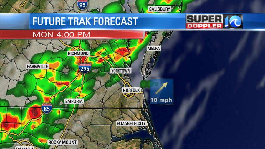
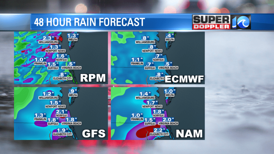
The line of showers and storms will move into Hampton Roads during the evening commute. Heavy rain will be possible. This could really slow down traffic for a time.
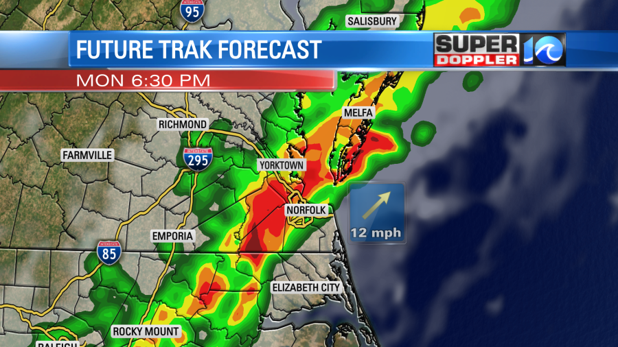
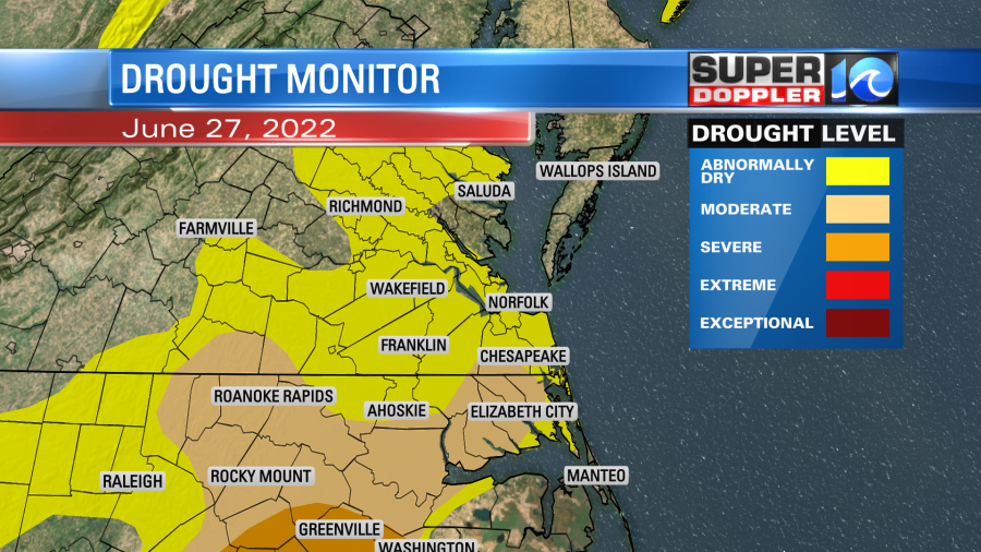
It’s possible that it could speed up or slow down a bit. Unfortunately, it might weaken as it drops south into North Carolina later in the evening. The problem with that is that they need rain much more than residents in Hampton Roads. Take a look at the updated U.D. Drought monitor:
The rain showers will become spotty overnight, and they will go into early tomorrow morning. Then we’ll be dry and cooler for the rest of the day. We could see about a half inch to three quarters of an inch of rain. A few locations could see over an inch. I think a lot of the models are overdone, but It’s nice that 3 out 4 have over an inch.
Most of Tuesday should be nice. High temps will be in the upper 70s with a northeast breeze.
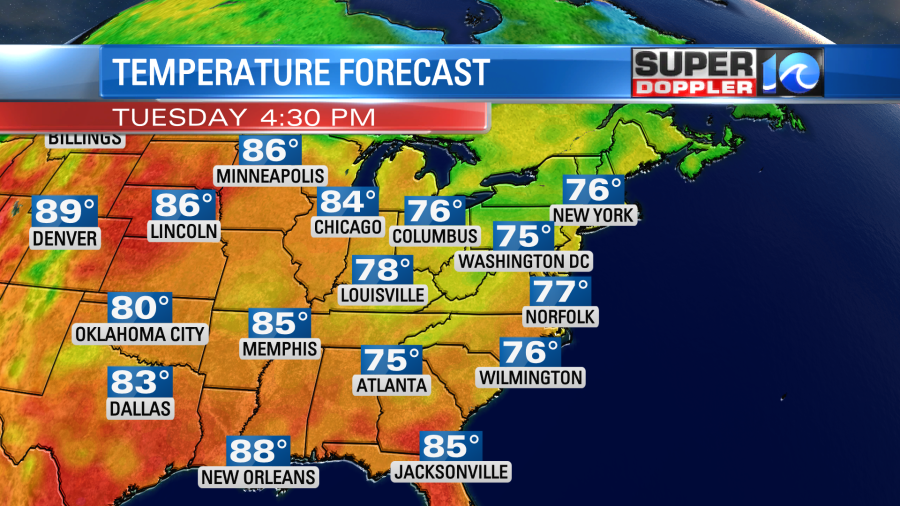
We’ll have pretty nice weather on Wednesday as well. We’ll be partly cloudy with a low chance for a shower. High temps will be in the lower 80s. Then we’ll heat up to near 90 by the end of the week.
My gut says that pretty soon we are going to start getting longer periods of that heat. Maybe some extreme heat in July. Eventually, the source of these cool shots of air (around Hudson Bay) will start to warm up. That could allow for a large section of the country getting extreme heat. We’ll see.
Meteorologist: Jeremy Wheeler