When I came into work this morning I told the news producers that I had about a million little things to talk about. It was tough to update it all, and sort it all out. Luckily, I can take my time with this weather blog.
So yes…First things first. Some kids did head back to school today. It was mainly kids in northeast North Carolina and on the Peninsula. Some colleges and universities have also started. So some of the kids in North Carolina ended up having a school delay due to thick fog. The humidity was thick everywhere. So we also had some low-level cumulus clouds over the region.
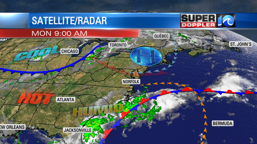
There was a warm front lifting to our north, but it was slowly falling apart. High pressure is to the northeast. There is a cool front over the Midwest.
We’ll be hot and humid today. High temps will be in the upper 80s to near 90 degrees. However, the heat index will be in the low-mid 90s.
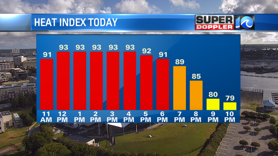
That will be an issue for the afternoon bus stops and for any after school activities. We’ll be partly cloudy with some isolated pm showers and storms. Overall, the day looks quiet. We’ll have a light east wind.
Tomorrow we’ll heat up even more as the winds turns out of the south/southwest. We’ll be partly cloudy with some more isolated pm showers and storms. High temps will rise to the upper 80s to near 90.
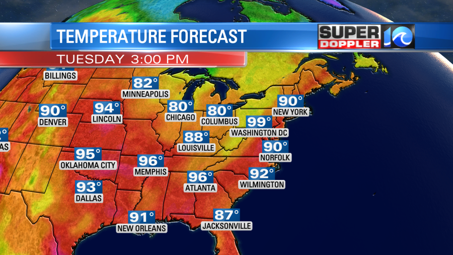
The heat index will be in the mid 90s. As we head into the evening there will be a line of showers and storms heading towards our region ahead of the front. The front will temporarily stall out, but the line will keep going. So our Future Trak model has them falling apart as they arrive.
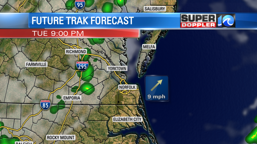
However, I think at least a handful of them will survive and come through. My logic is that it is going to be very warm and humid. So there will still be some fuel for storms in the evening. We probably just won’t have any strong upper level winds.
Either way we’ll start cooling down and drying out on Wednesday. But the front will be moving very slowly. So the drying will also happen very slowly. There still might be an isolated shower or storm in the afternoon. High temps will be in the upper 80s.
We’ll finally get to some more comfortable air Thursday into the weekend. High temps will drop to the low 80s. The dew points will drop to the 60s. Maybe even in the upper 50s.
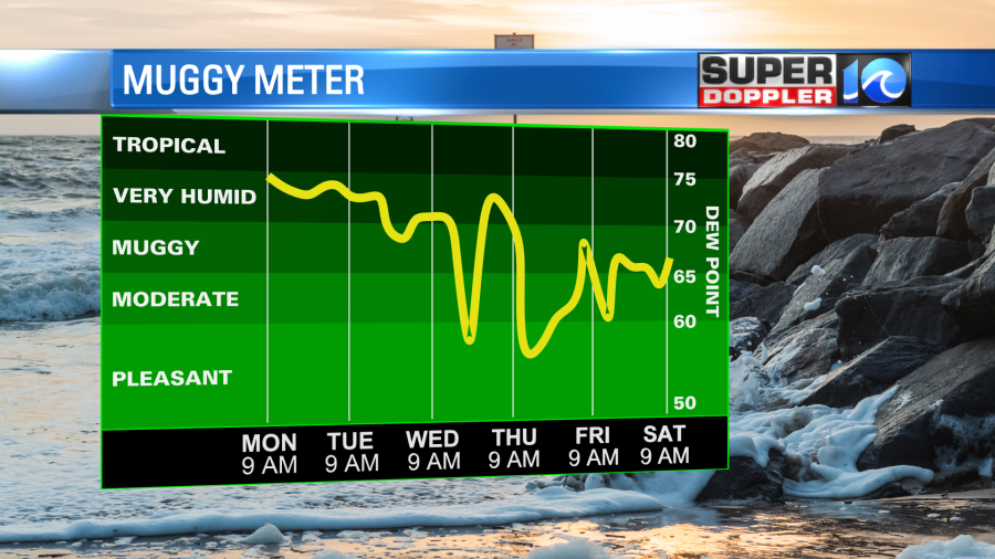
While I doubt the humidity will stay down over the next couple of months, at least this could be a sign that we’ll start to get some breaks from the super muggy air.
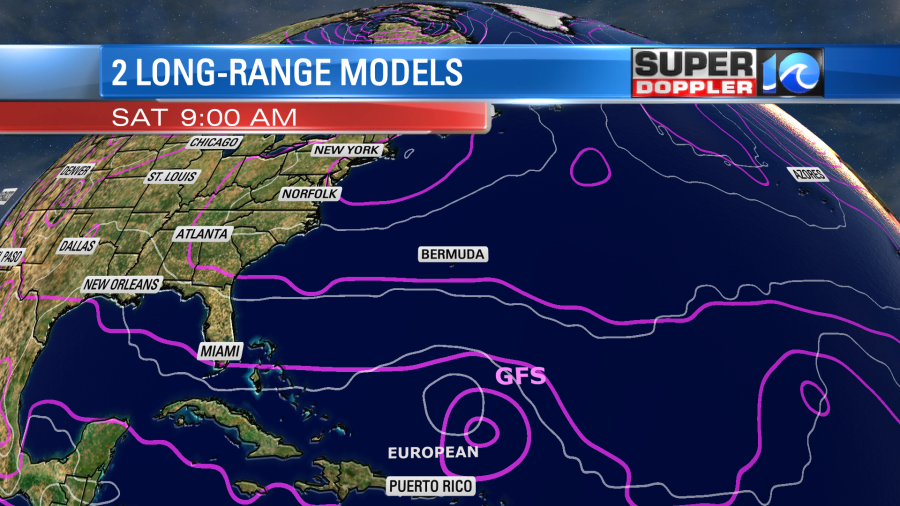
Speaking of tropical humidity…the tropics are starting to pick up again. We have 4 tropical disturbances that we are watching. The 3 weaker ones have a fairly low chance of formation in the next 2-4 days. However, the one over the central Atlantic is a different story.
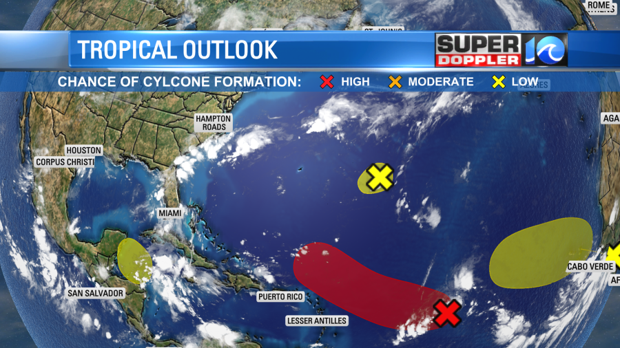
It has a medium to high chance of formation over the next few days. It is moving generally to the west/northwest. Lately there has been some dry Saharan air just to the north of it. This has probably helped to keep it at bay. However, that Saharan air pocket will likely dissolve in a couple of days. This could give the disturbance a chance to form.
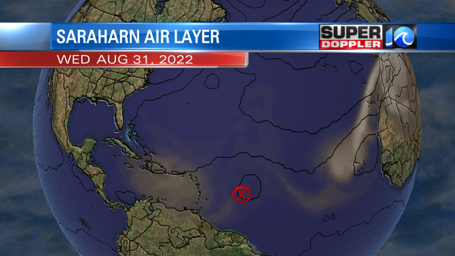
The GFS and Euro both have it becoming a system in a few days. We’ll see whether or not that happens.
Meteorologist: Jeremy Wheeler