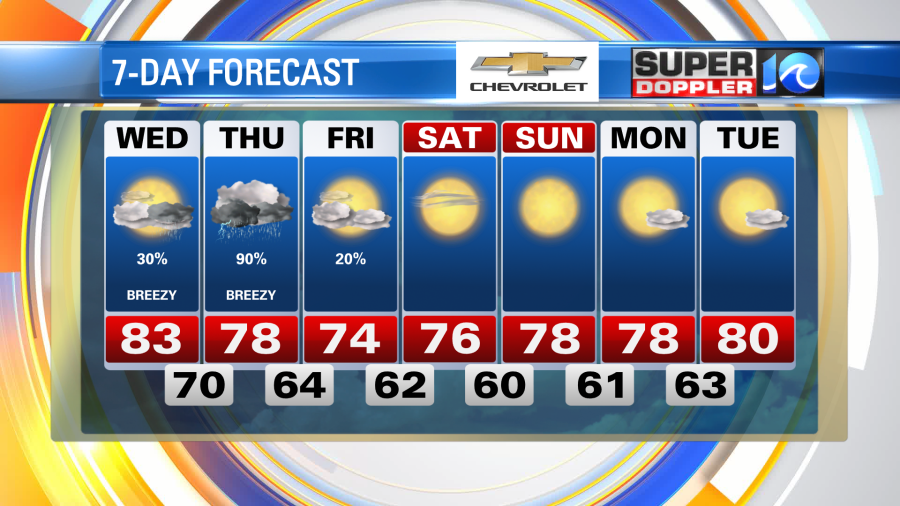
As we bring in the fall season today, it won’t feel like it. But an approaching cold front will punch through the region to eventually give us autumnal weather by the weekend.
Expect increasing clouds and a few hit or miss showers by the afternoon. As the balmy breeze gets cranked out of the south today our highs should be in the low 80s. Dew points will be elevated near 70° all day so it’ll also feel pretty humid. Again, definitely not feeling like autumn, but it will eventually!
Update: A Coastal Flood Statement is in place through this afternoon for parts of northeast North Carolina and southern Virginia Beach.
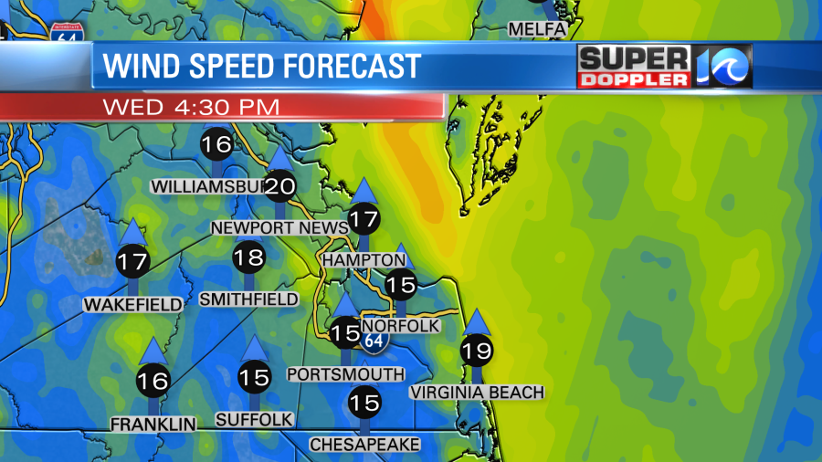
The strong, south-southeasterly breeze today will become a nuisance for low lying areas in southern Virginia Beach, Pasquotank, Camden, Bertie, Chowan & Perquimans. Shallow and nuisance flooding is likely in areas along the waterways/shoreline.
Showers start to work into the region overnight and by the time we wake up early to start our Thursday there should be scattered showers across the region. These become more widespread for the morning commute, some of which could be heavy. A few thunderstorms will be thrown in there as well, so just use some extra caution on the roadways.
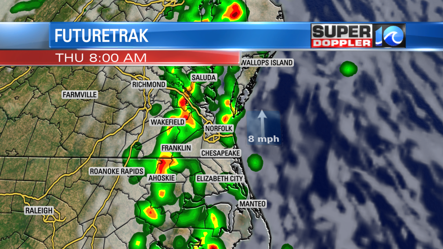
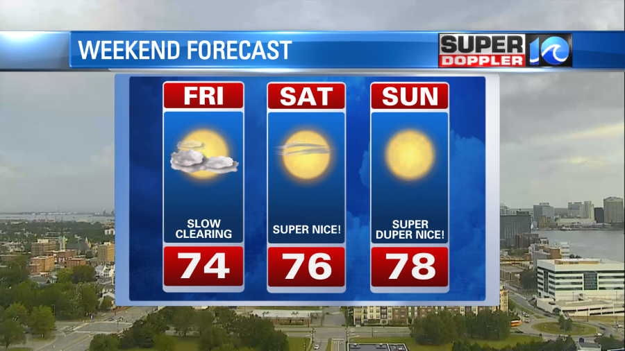
The rain will still be with us through late morning and early afternoon, it’s not until the end of the day and the evening hours that things start to taper off. Upwards of an inch is possible in some locations, so low lying areas may see some flooding. By this point, the breeze will be flipped out of the north, holding temperatures in the 70s all day long. Clouds will then be stubborn by Friday morning, a lingering shower or two is possible near the coast before gradual clearing is expected into the weekend. That’s also when the drier, more refreshing air moves in, enjoy a fantastic first weekend of fall.
Out in the tropics, both Peter and Rose are fading tropical depressions, as they stay out to sea they shouldn’t last much longer. What was once Odette could potentially redevelop into a sub-tropical system in the far north Atlantic – whatever comes from that will stay in the northern Atlantic. A couple thousands of miles away a cluster of showers and thunderstorms is developing into a tropical cyclone.
Over the next day or so we’ll likely see our next system form, which will eventually be named Sam. This will be a long lived system trekking across the south-central Atlantic so we have plenty of time to monitor it. As of now, we have no concerns tropically, just a nice taste of fall in the near future.
Meteorologist Steve Fundaro