
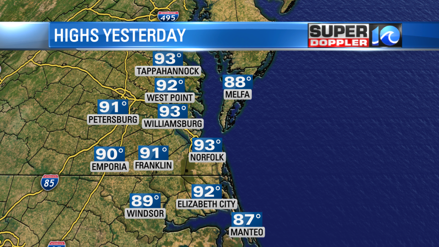
Yesterday was hot. We didn’t break any records, but the high temperatures made it into the low 90s. Plus, it was fairly humid outside.
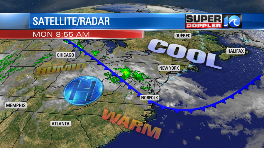
Today a cool front is sliding into the region. High pressure is pushing away from us to the west.
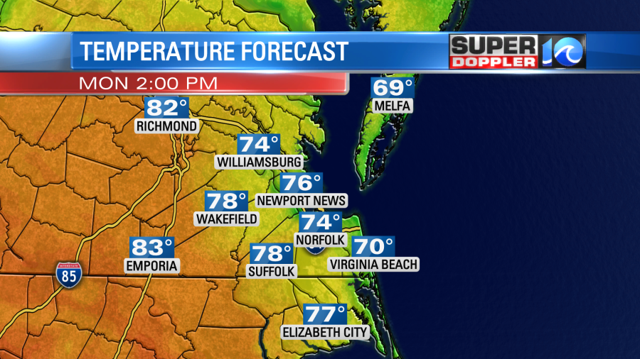
We’ll be much cooler than yesterday even though this morning started off fairly mild. High temps will be in the low-mid 70s this afternoon with cooler temps near the shore and some warmer temps inland (upper 70s to near 80).
We’ll be partly cloudy. There will be some isolated showers today with a higher chance for rain and storms to our west.
Tomorrow the front will stall out inland. It will edge eastward a little bit. So our high temps will warm to near 80 with some upper 70s near the shore and some low-mid 80s inland. We’ll have a light southeast breeze. As the front stalls out it will create some scattered showers. Our model has quite a bit of rain in the region Tuesday morning, but other models have less rain. Here is the latest Future Trak forecast:
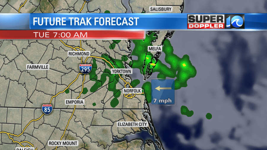
When the area is dry for a long period of time, then sometimes that will eat away at the rain chances. So that’s why I’m going with the lesser rain chances tomorrow. However, we could be pleasantly surprised by some rain showers in our neighborhoods. We’ll see. Either way we really need it.
The warm front will lift to our north on Wednesday. So we’ll heat up quite a bit. High temps will be back to the low 90s. We’ll be partly cloudy with some low rain chances late.
After that the models get a little iffy. The basic theme though is that the temps will drop Thursday into the weekend, and the rain chances will go up. Our best chance for rain may be Friday night into Saturday. However, I’m going to wait to go into detail on that until tomorrow. Hopefully, the models will get a better handle on the forecast by then.
Tropical depression Ana has fallen apart over the central Atlantic.
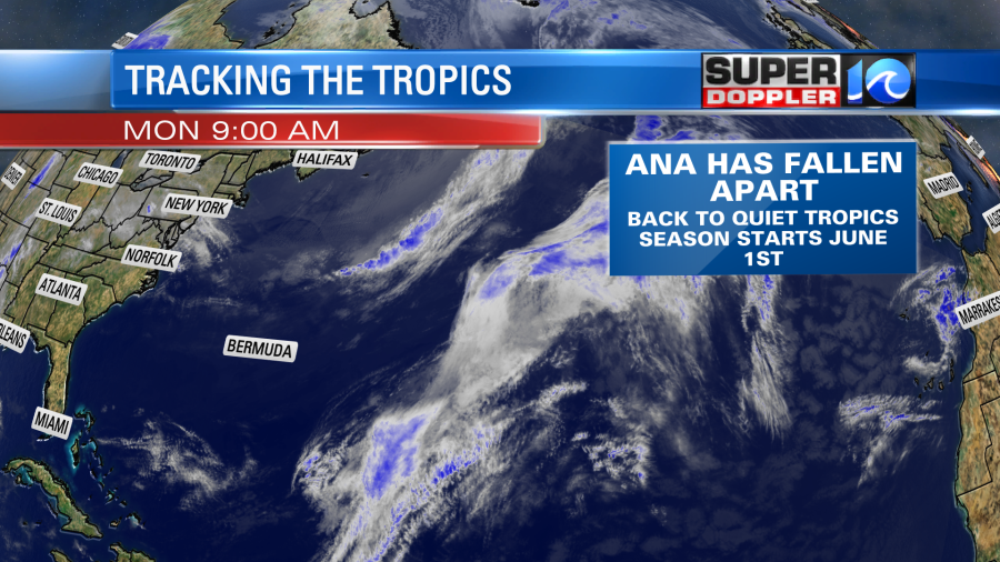
Since the system has fallen apart the wave heights will start to decrease. It is 2-3ft today with 3-4ft waves along the Outer Banks. There is still a high threat for rip currents today, but waves will calm down by tomorrow, and the rip current threat should drop.
In national news… I mentioned before that the periodic cicadas that pop out very so often have been changing over the years. I’ve seen bits and pieces of news about it over the last 10-20years. Humans have really been changing the landscape which affects the buried larvae. Also pesticides and predators have made a difference as well. So today I found a good article that describes what has been happening over the years. Here it is: Humans affecting cicada
Don’t get me wrong. There will still be a lot of cicadas out there, but the numbers may be less and less over the next couple of decades.
Meteorologist: Jeremy Wheeler


