We are still tracking the nor’easter in the northeast states today. It actually drifted a bit back to the west instead of moving out to sea, but that was expected. Heavy rain and strong winds will continue there today. This morning there were some gusts to 50mph around Boston with higher gusts over Cape Cod.

While the nor’easter spins over the northeast today an area of high pressure sits quietly to our west.
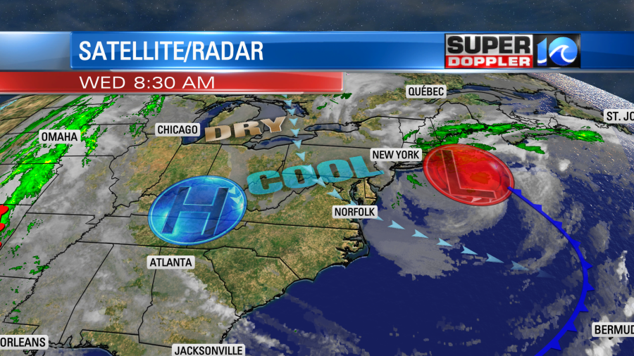
We have a strong breeze between the 2 that is affecting our region. We’ll have a northwest/north wind at 10-20mph with some gusts up to 25mph. It will make it feel chilly at times.

The wind should settle a little bit this afternoon into the early evening. We’ll have a mix of sun and clouds today as occasional clouds blow in from the north/northeast. We have really dried out though. Dew points are in the 40s. So I’m not expecting any rain. High temps will be held down in the mid-upper 60s today. There may be a few 70s to the south.
Tomorrow the low will push east and move farther out to sea. It could briefly become subtropical as it will move over some warmer waters for a time. However, whether it becomes tropical or not the effects will be the same. We’ll have some high waves over the next couple of days near the shore. They will run at 3-5ft today with 6-7ft near the shore. Also, there may be some nuisance to minor tidal flooding Thursday into Friday.
By Friday a strong area of low pressure will develop to our west. We’ll have a strong southeast breeze develop ahead of it. This will pull in a lot of moisture into the region. That will create a large area of rain showers. Here is what Future Trak shows for Friday morning:
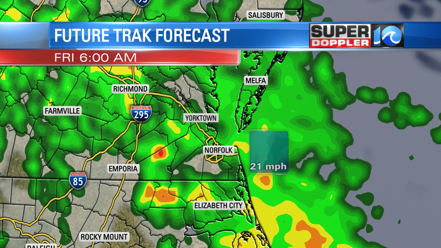
The rain should taper off later in the day, but that might take a while.

The finer details are yet to be determined, but the overall forecast is set. We have a high chance for rain during the day. Especially in the morning. We’ll have a strong southeast breeze. So high temps will rise to the low 70s .
The weekend still looks cool and dry overall, but some isolated showers may sneak in. For now I have a dry forecast for Halloween, but the GFS model is hinting at some isolated showers in the region. I’ll have the bigger update on that tomorrow. Temps will likely be in the 60s in the evening. Stay tuned for updates!
Meteorologist: Jeremy Wheeler


