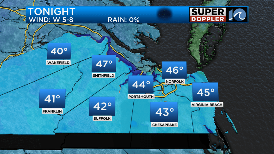
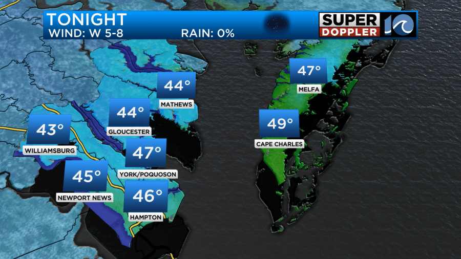
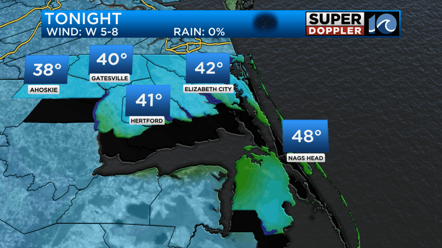
Whew! A pleasant little taste of November was in the air this morning as many locations across town woke up with temperatures in the low to mid 40s. There were even a few upper 30s far inland. And now that the cooler air has settled in… we’ll have another night of chilly conditions for early October!
Temperatures through the night as skies feature only a few clouds will be very similar to this mornings lows. Think low to mid 40s for most locations with a couple spots farther to the west dipping into the upper 30s.
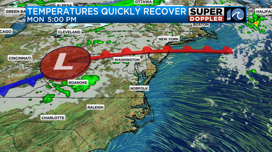
These are typical low temperatures we see in the heart of November opposed to early October – fortunately, this bought of chilly weather is only an appetizer. The big area of low pressure sitting over the Great Lakes back tracks to the west and pulls in some moisture from the west as we progress into the next few days, allowing our temperatures to slowly rebound.

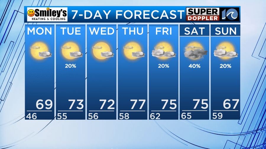
Temperatures climb to near 70° as we transition to more seasonal levels this week. After mostly sunny skies Monday afternoon, a few extra clouds build in by Monday night and Tuesday. This is as a weak frontal system slides by to our north, a spotty shower or two is possible on Tuesday as a result.
Temperatures gradually rebound as the week goes on with highs in the 70s and lows in the 50s, by the end of the week we’ll be looking at warmer weather ahead of our next dose of rainfall.
Take advantage of the nice weather this week and get a glimpse of the changing season! The trees to our west in the mountains are beginning to show their fall colors. In a week or so, the coloring should really amplify, especially with some of the cooler mornings of recent.

Around Hampton Roads, the fall foliage tends to peak in coloring later this month.
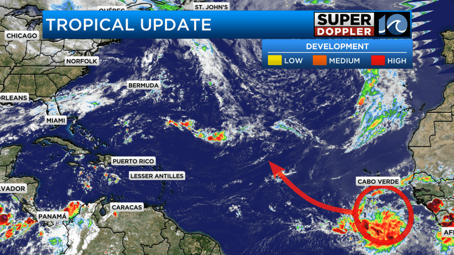
Tropically, a system may develop several thousand miles away in the eastern Atlantic, whatever comes of it, the system shouldn’t last all too long in the open Atlantic.
Meteorologist Steve Fundaro
