Yesterday was great. It was cloudy, cool, drizzly. There were scattered rain showers. Normally, that wouldn’t sound appealing, but it was a really nice change of pace. We had a couple tenths of an inch of rain in the region.
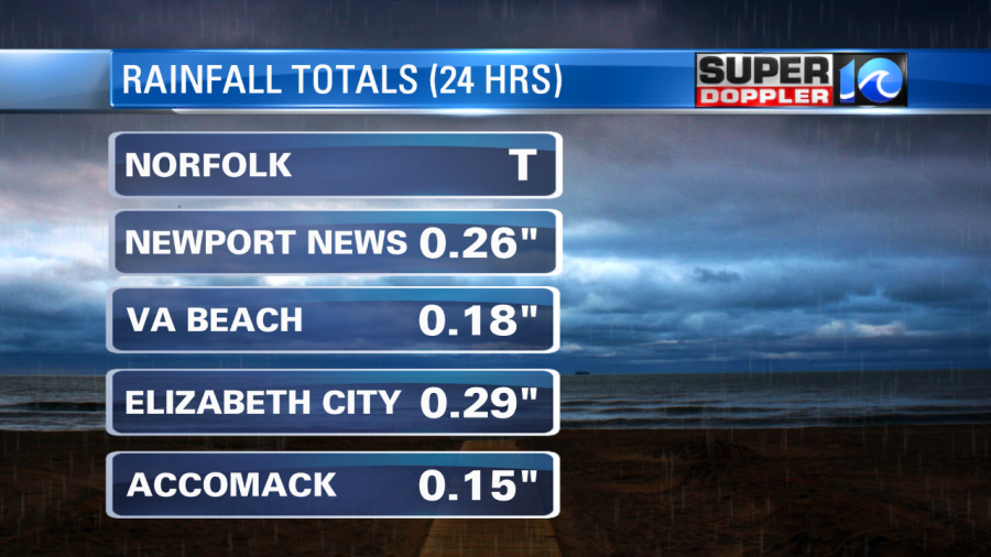
The sensor was down for a bit in Norfolk. So I think it missed some of the rain before it came back up. A few locations had higher amounts. My weather watcher, A.J. on the lower Eastern Shore, recorded a little over 0.4″. Parts of the Outer Banks had a good amount. I think it was over an inch, but I don’t have that confirmed.
Today will be somewhat similar, but I think we’ll have less rain showers. A cold front has moved offshore. It is wrapping around an offshore area of low pressure.
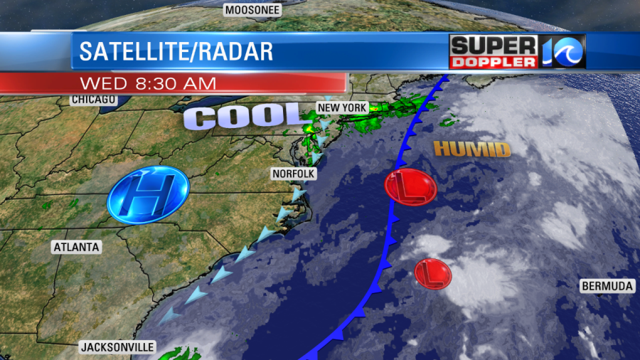
High pressure is to our west, but it’s not building into the region. With this setup we’ll have cloudy skies today. There won’t be as many rain showers as yesterday, but there will be pockets of drizzle with a few light rain showers. The wind will stay up out of the north. It will run at 10-15mph with gusts to 25mph. We’ll stay cool with highs in the upper 60s. There will be a couple of 70s inland/south.
Tomorrow we’ll have mostly cloudy skies. The sun will try to peek out a bit. The breeze won’t be as strong, but it will be a persistent northerly breeze at 10-15mph. There will be some isolated showers with a little bit of drizzle. There probably won’t be too much though. Highs will be in the upper 60s to near 70.
By Friday the high should push east enough that we’ll have some more sunshine. High temperatures will be in the low-mid 70s. Then we’ll be partly cloudy on Saturday with highs in the upper 70s. Another cold front will move through the region on Sunday. High temps will drop to near 70 again. We may have some more scattered showers on Sunday as the front swings through.
There are actually 3 areas of low pressure offshore.
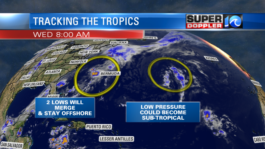
The one in the central Atlantic could briefly become subtropical, but it will likely stay out to sea. The 2 closer lows that are offshore of the U.S. east coast will likely merge at one point. There is less of a chance for them to become tropical now before that happens. The merged low will then sit offshore of the northeast coast for a couple of days.
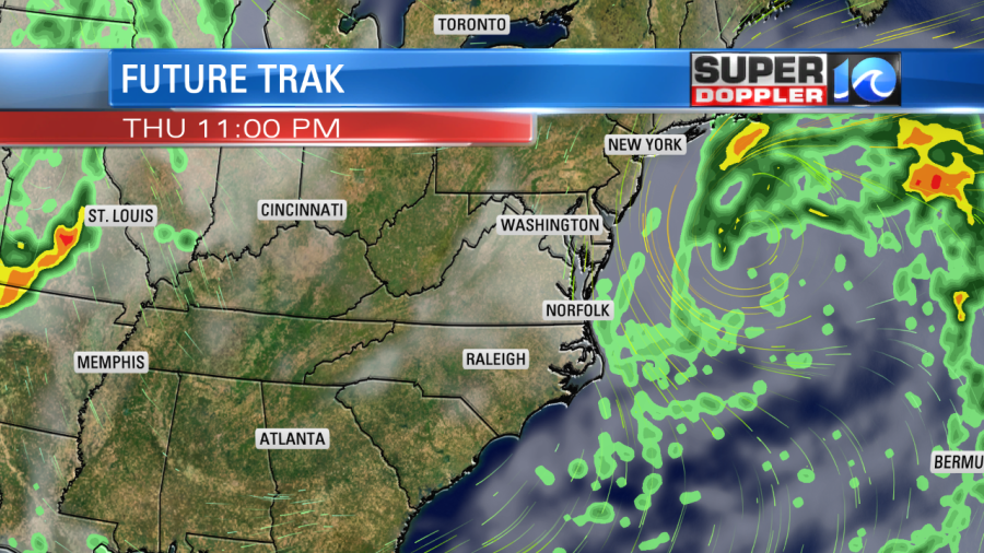
With the high to the west and the low to the northeast we will continue to have a northerly breeze through Friday. This will lead to some minor tidal flooding in the region.
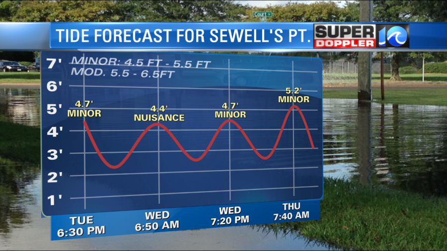
It could come up a little higher by late Thursday. The waves will also be up along the oceanfront. There could even be a little minor beach erosion. The storm will have bigger impacts over the northeast states.
Stay tuned for updates.
Meteorologist: Jeremy Wheeler