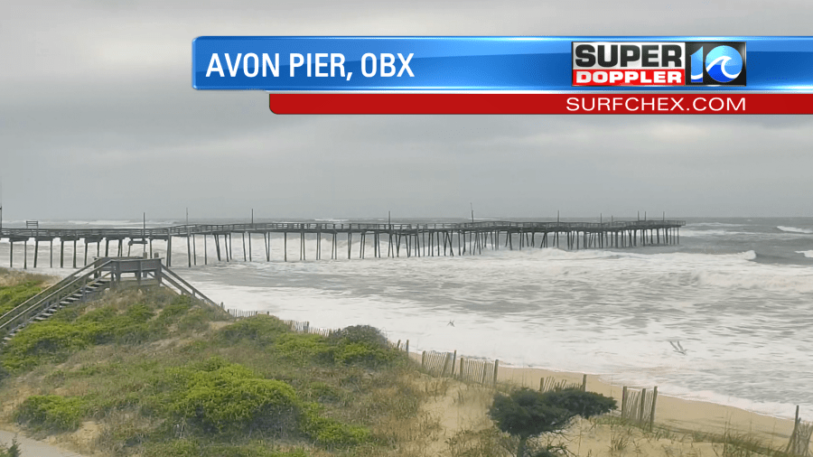
Yesterday was cloudy, windy, and drizzly pretty much all day. Sorry moms! The area of low pressure moved offshore over the weekend, and now it continues to churn out to sea. We started this morning with lots of clouds and waves near the oceanfront, but there was sunshine inland.
There wasn’t hardly any rain, but there were a few sprinkles and some drizzle near the shore. There shouldn’t be much rain going forward, and that will help when it comes to tidal flooding. More on that in a moment.
While low pressure is sitting offshore, there is an area of high pressure to the northwest.
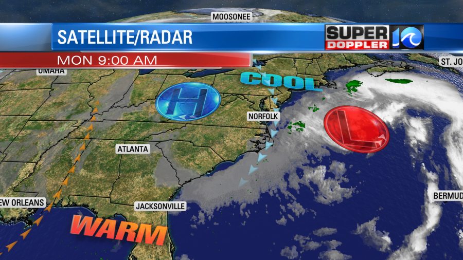
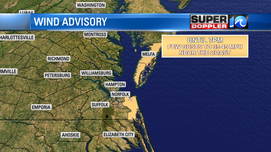
It is why we’ll have more sunshine inland with some in the metro. However, the squeeze play between the two different pressure systems is causing the strong winds to continue. Winds today will be out of the north/northeast. They will run at 10-20mph with gusts up to 30mph.
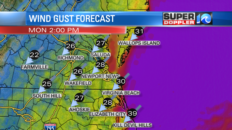
There will be a few gusts between 35-45mph near the shore. This has prompted Wind Advisories from the National Weather Service.
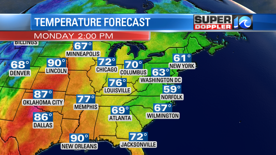
The wind will stay strong from this afternoon into tonight. This is going to keep the temps down during the day. In fact we are going to be about 15-20 degrees below average here. Meanwhile the heat is on over the central U.S.
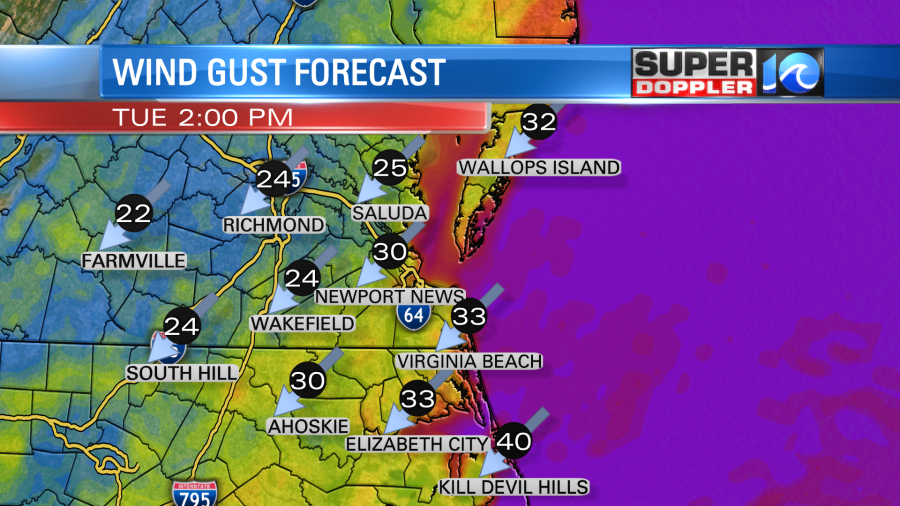
Tomorrow the wind will be about the same with more gusts to 30mph possible in the metro and higher gusts near the shore.
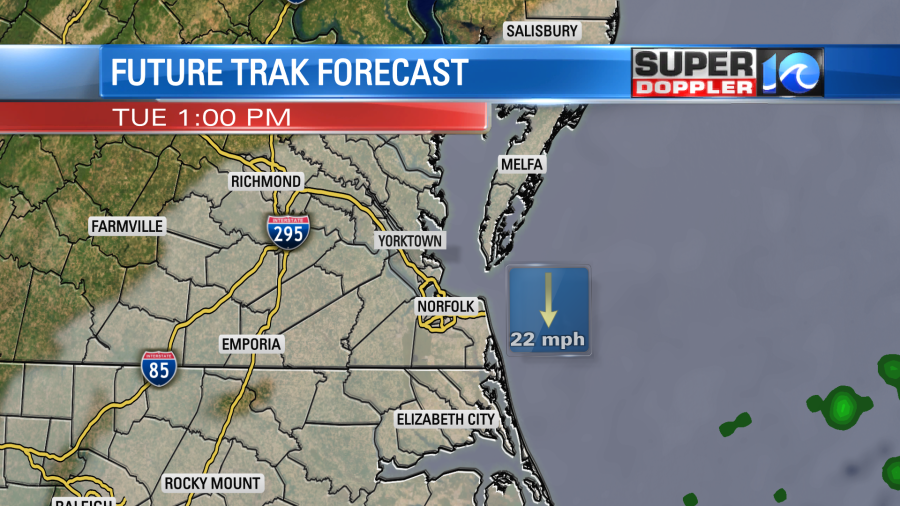
We got some good rain between last Friday and Sunday. As mentioned, going forward we won’t have much rain for the next couple of days. However, there will be some more drizzle. Today that will be more common along the coast. However, tomorrow the low will shift back to the west a bit. So clouds will cover most of the region with sprinkles or drizzle possibly reaching as far west as I-95.
It will be cool again with highs in the upper 50s to near 60.
The low will weaken by Wednesday. It should become more broad as well. So the wind should calm down a little. Though it may decrease gradually. Waves will still probably be high, but the tide should come down. Let’s talk about that.
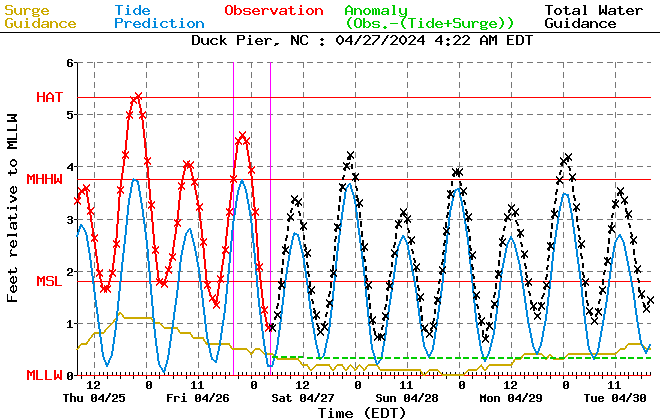
This morning the tide forecast came in a little below forecast. It was closer to 5.1ft instead of the previous forecast of about 5.5-5.7ft. Whew! This was minor tidal flooding for most. The tide is still expected to increase this afternoon and tomorrow, but the forecast has come down as well. Before it was looking like solid moderate tidal flooding. The high tides were expected to reach around 6 to 6.2ft this afternoon and tomorrow morning. Now we are aiming for for 5.5 to 5.7ft between late this afternoon and tomorrow morning. That is closer to the low end moderate.
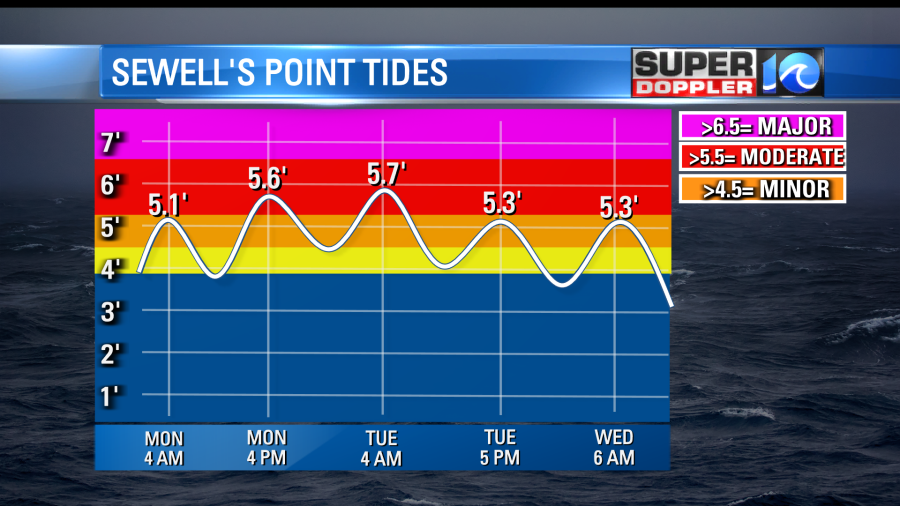
This is good news, but it is still considered moderate tidal flooding. It is expected to be higher over the Outer Banks. They could see moderate to major there. Here is the tide forecast for the Outer Banks, Yorktown, and Kiptopeke:
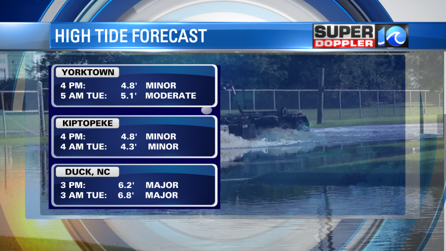
The Outer Banks is tricky. The wind will be more northerly than northeasterly for a while So I don’t know which model is handling that better. The National Weather Service’s forecast is up to major levels.
However, another model used by NOAA (The ETSS) has a much lower forecast.
That is the Extra Tropical Storm Surge model. You can follow the links above for the updates. Either way I think you’ll have at least some moderate tidal flooding and ocean overwash down along highway 12. There will likely be some beach erosion as well. Waves are running up to about 11ft near the shore.
Things will calm down and warm up going into Thursday. However, the energy and some moisture from the system could drift west next Friday into Saturday. That might bring us a more more rain showers. We haven’t broken the drought. So we still need more rain in the long run, but I’m hoping for at least 1 dry/warm day next weekend. I’ll talk more about that in tomorrow’s weather blog.
Meteorologist: Jeremy Wheeler
