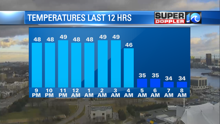
When I came in this morning temperatures were in the 40s and 50s with 30s to the north. A strong cold front had moved in early, and it dropped the temperatures like a brick!
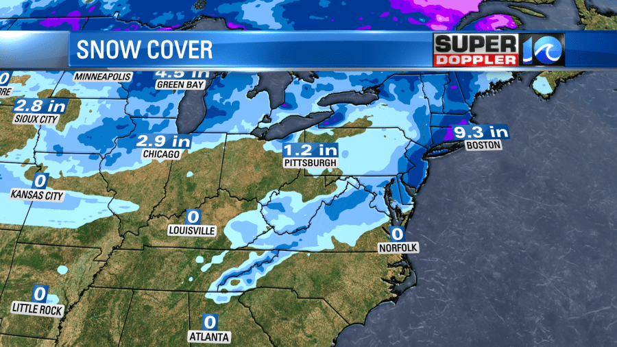
There was a brief wintry mix north of the metro. Otherwise we only had a few flurries.
A weak area of low pressure and an upper level low were tracking east/northeast along the front.
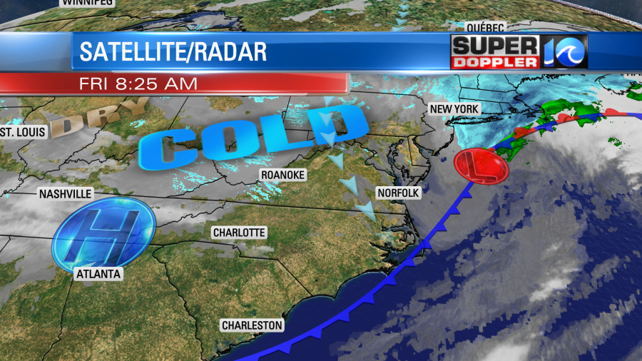
It put down a band of snow from Kentucky up to the northeast states.
After some isolated flurries this morning we’ll be partly cloudy, cold, and windy today. Temperatures will only rise to the upper 30s to near 40 degrees this afternoon. Wind chills will stay in the 20s through the early afternoon.
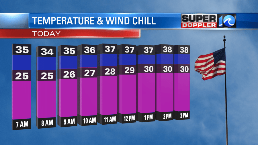
Winds will gust to 25-30mph this morning. Especially near the shore. They should come down a little this afternoon. Gusts will run more between 20-25mph.
Tonight high pressure will build into the area. This will clear out our skies. Winds will be light and out of the north. Low temps will drop down to the mid 20s with possibly some low 20s inland. Folks may want to slow-drip the faucets overnight. This might not be necessary in the metro area, but it is recommended for those inland spots that will be colder for longer.
Tomorrow we’ll be mostly sunny, but high temps will only be in the upper 30s to near 40 again.
We’ll be mostly sunny through the day.
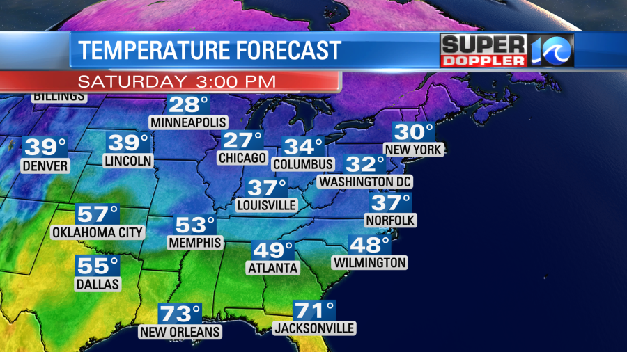
We’ll warm up on Sunday into the 50s during the day. For now temps are aiming for the upper 50s. We’ll have increasing clouds with some isolated showers possible by the late afternoon. We’ll have some rain Sunday night into Monday morning. This could wrap up as a wintry mix again. Forecast surface temps are above freezing during that time. Stay tuned for updates on that through the weekend.
Meteorologist: Jeremy Wheeler