The weather Friday and Saturday will be fairly quiet, but we’ll have some messy weather move into the region on Sunday. We’ll have some impacts here, but the bigger impacts will likely be to our west where accumulating snow is forecast. I’ll briefly tackle the weather through Saturday, then I’ll have a bigger focus on Sunday.
Today, there is an area of low pressure off the coast. This has increased in strength, but luckily it’s pretty far offshore. High pressure is to our southwest. A cold front is getting closer to us from the north.
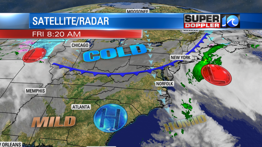
The low is far enough offshore that we should stay dry today. I can’t rule out a sprinkle or two, but overall we should be dry, cool, and breezy. Winds will stay up out of the north and northwest. They will run at 10-15mph with gusts to 25mph. This will keep the temperatures in check. We’ll top off in the upper 40s to low 50s.
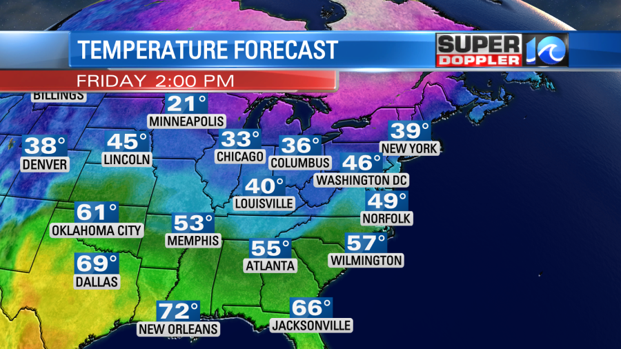
Tomorrow that strong cold front will sink to our south. It will be cold and a little breezy. Also, clouds will increase into the afternoon. This means that our high temperatures will only be in the mid-upper 30s.
By tomorrow night an area of low pressure will be setting up over the Tennessee River Valley. Moisture will stream up ahead of it in our region. We’ll cloud up here going into the morning.
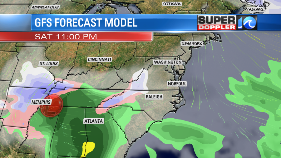
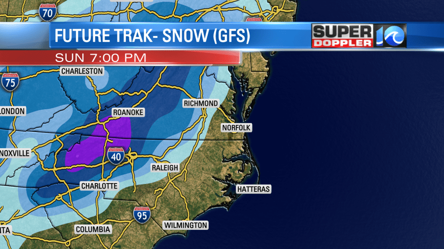
Low temps will probably drop to the 20s, but if the clouds increase and the winds pick up as forecast, then temps should rise a little before dawn. The models do show enough moisture to create some precip Sunday morning. They do disagree on the timing. Our Future Trak model has a brief wintry mix over our southwestern towns and counties early. Then it has that mix creeping northward.
It has the mix reaching as far east as western Suffolk and James City County.
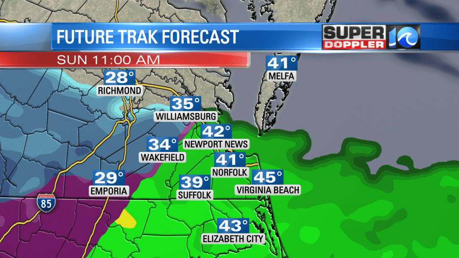
However, it has mostly rain developing over the rest of the region. It also has temps above freezing through that time. The GFS model is a little earlier with the precip. However, it has more rain in the region with the rain/snow line closer to I-95.
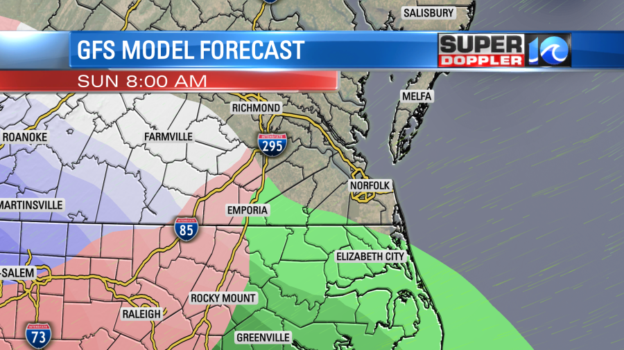
The Euro is a bit in-between those two. The NAM does have a wintry mix early in the inland areas (with rain developing elsewhere). Then also it takes it all northward. All the models transition the precip over to rain through the day. The GFS model even takes the rain/snow line west of Richmond for a time.
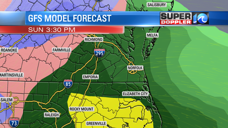
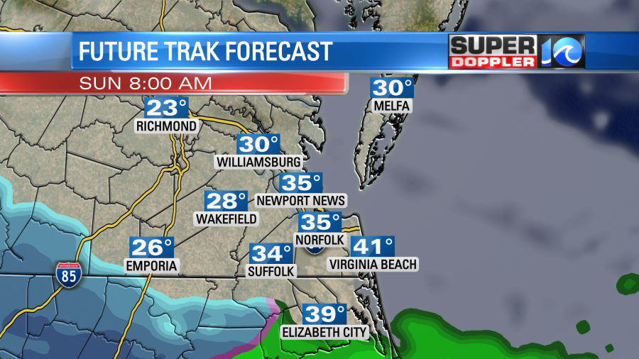
The models have all rain here Sunday night with possibly some heavy downpours. I wouldn’t even be surprised if we get a few thunderstorms in the region. The area of low pressure will move to the northeast of here by early Monday morning. We could get a brief mix on the back-side, but this should be light and scattered. Then we’ll dry out into the midday hours.
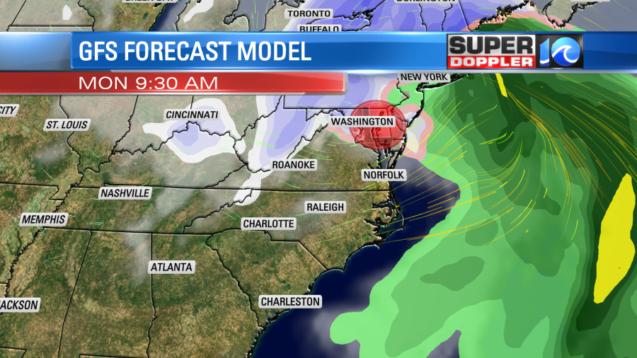
Winds will be strong before, during, and after this system moves through. Winds could gust to between 35-40mph. Especially near the shore. They should be easterly/southeasterly ahead of it. They will be out of the northwest behind it. This could cause some power outages if the winds end up on the higher end of the forecast. Also, the strong wind could create some minor tidal flooding in the region. That part of the forecast could easily change as there are a lot of factors. Here is the coastal flooding forecast page from the National Weather Service: NWS Coastal Flooding.
Aside from that there could be some isolated flooding just from the rainfall. We could get 1-2″ of rain rainfall in the region.
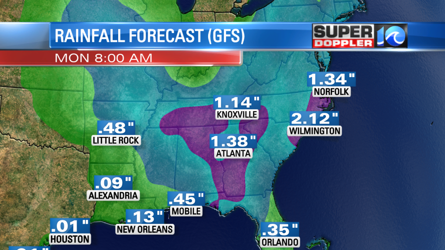
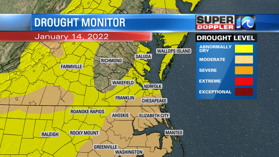
That will help out some more with the current drought conditions.
As far as snow goes….We might have a dusting over some inland/western spots if the mix starts early enough. This would mainly be on grassy areas, decks, and vehicles. However, anything that would try to stick would likely melt. I think the bulk of the accumulating snow will be off to our west.
It’s possible a little could try to stick Monday morning before sunrise as the system wraps up, but the ground will be wet from the Sunday night rainfall. So that will be tough to do. The forecast still could change before that time. We could still easily get colder….or milder. So stay tuned for updates to the forecast through the weekend. We still have some time.
Meteorologist: Jeremy Wheeler