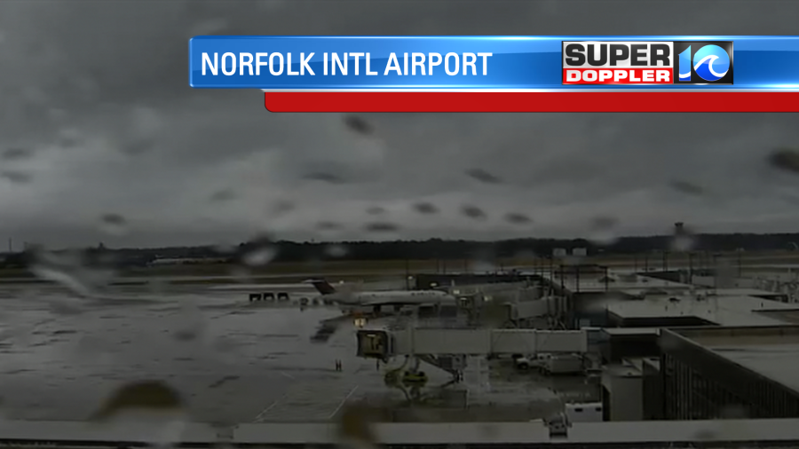
Today will be a nasty day weather-wise. There is no sugar coating it! We started this morning with cold rain over Hampton Roads. There was a mix of rain, sleet, and freezing rain just west, northwest, and north of Hampton Roads.
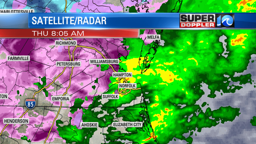
Sleet and freezing rain was reported from Isle of Wight county to Northern Newport News to Williamsburg up into Gloucester county.

Oddly enough there were also some thunderstorms this morning between North Carolina and the Southside. Normally, thunderstorms need warm/humid air that rises fast. However, surface temps were only in the 30s and 40s this morning. I think there was a thin sliver of warmer air in the mid-levels that pushed north over the state line. This probably caused enough lift in the mid-upper levels (of the troposphere) to create lightning/thunder.
We have a stationary front just to our south with an area of low pressure near the southern Outer Banks.
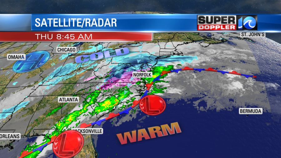
This is pushing the moisture up through and north of our region. Snow is falling from northern Virginia up into Pennsylvania and New York. There is also a a large dip in the jetstream, and it is running right over our region. We’ll have the wintry mix northwest of Hampton Roads up through the late morning.
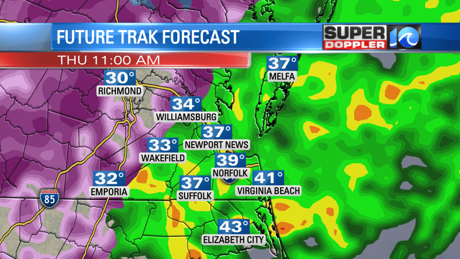
Temps should warm slightly. Then the wintry weather should turn into just rain this afternoon.
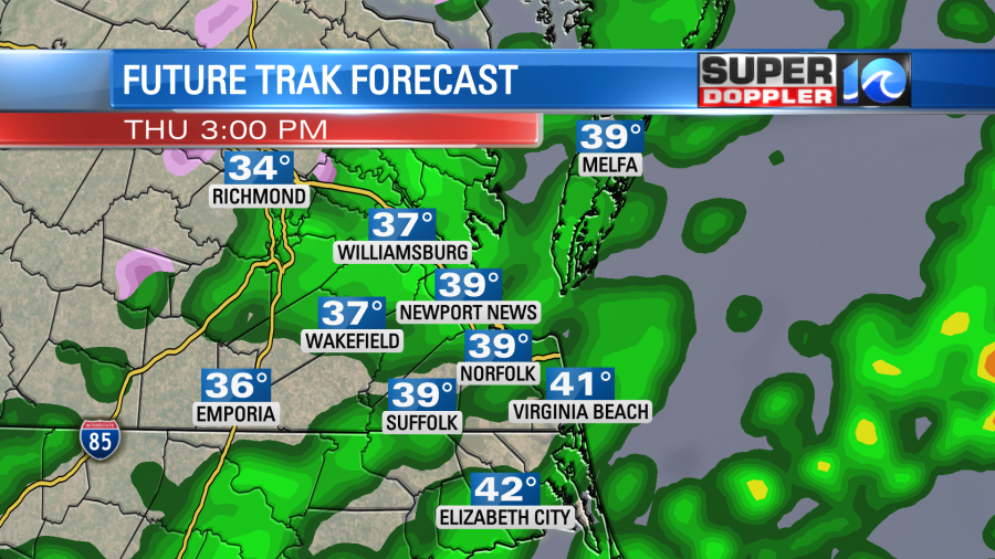
High temps will only rise up into the upper 30s this afternoon with a few 40s to the south/southeast. We’ll have a northeast wind running at 10-15mph with gusts to 25mph. There could be a few gusts to 30mph near the shore.
Rain will continue into tonight on and off. A wintry mix may form to the northwest again late.
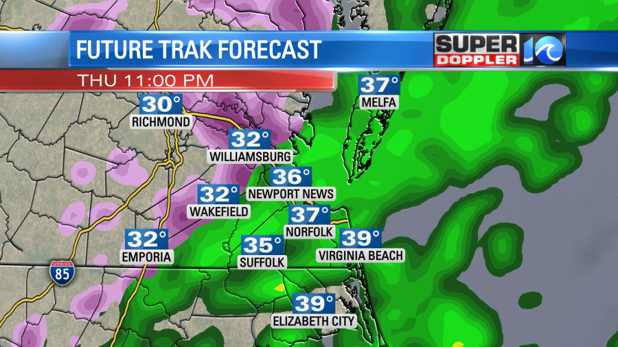
It’s possible that we could have a wintry mix again in a few inland locations tomorrow morning, but I don’t think it will last too long. When you add up the ice potential between today, tonight, and early tomorrow then you get some icing issues in a few areas.
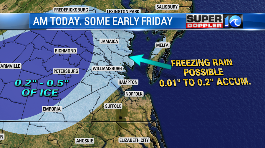
The highest ice accumulations will be closer to I-95. There could be some issues with power outages there. This is where the Winter Storm Warnings have been issued. This includes Sussex county.
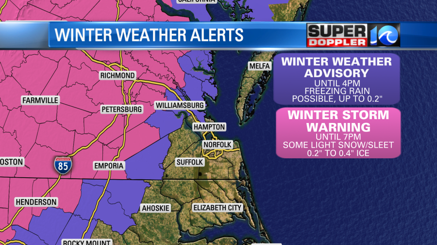
Some more alerts could be issued tonight, or a few of these could be extended. Any mix early tomorrow morning should change over to rain by the late morning. Then the rain will slowly drop to the southeast through the day as a second area of low pressure passes just offshore.
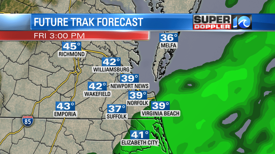
High temps will be in the low 40s tomorrow. There should be less wind. Rain will finally end tomorrow evening. Then we’ll dry out for the weekend.
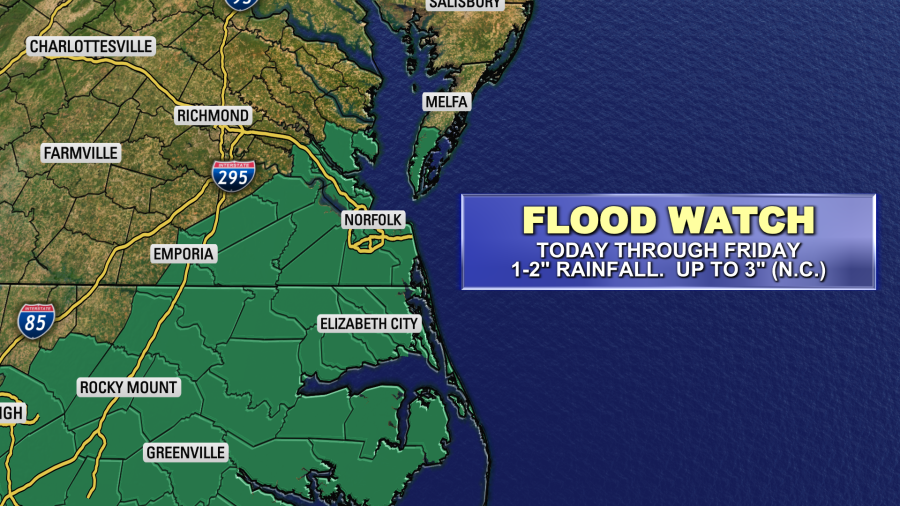
Tidal flooding is not expected in the region, but during high tide poor drainage could be an issue. High tide is generally around midday and the early afternoon. The viewing area is expected to get 1-2″ of rainfall between today and tomorrow. A few locations in North Carolina could see 3″.
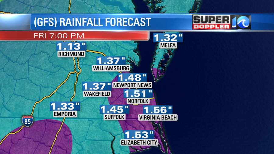
The ground is already saturated. The water has no where left to go. There is some minor flooding on some of our rivers and streams already. Between today and Friday there may be some street/road/yard flooding. So A Flood Watch has been issued for most of the area.
Finally, (yes, there’s more). Be careful when it comes to the cold today. Wind chills will be close to 30 degrees even this afternoon. If you get wet, then the wind will cut right through you. So hypothermia is possible if you are out for a long period of time (hours).
Ok. The light is at the end of the tunnel. So be safe and hang in there until the weekend.
Meteorologist: Jeremy Wheeler