
Locally we will have some nice weather today. A cool front moved into our region yesterday, and brought us some very comfortable air during the evening. That boundary will stall out inland today. We also have high pressure just of to our west.
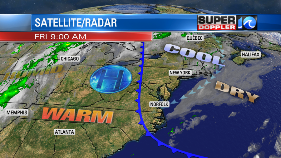
We’ll have a cool and steady northeast breeze through the day. We’ll also have lots of sunshine. The humidity isn’t too bad, and high temps will rise into the upper 70s with a couple of 80s inland. It’s nice and dry with dew points in the 40s and 50s. Pollen levels are low-moderate. So head out and enjoy the weather if you can!
Tomorrow the front will push offshore. We’ll have a light westerly wind. That is going to allow the heat to pour back in from the west.
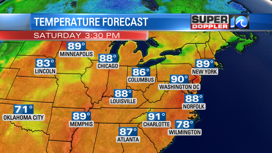
High temps will rise to the mid-upper 80s. There may even be a couple of 90s inland. Skies will be partly cloudy. We’ll be about the same on Sunday with high temps rising another degree or two. So now our next chance for rain isn’t until Monday. Even then it’s just a slight chance. A cold front will cool down temps to the 70s again Monday and Tuesday, but we’ll warm up later next week. There may be a few showers on Wednesday, but we’ll see.
We may be headed for the driest May on record. Take a look at the top 10 driest May’s on record:
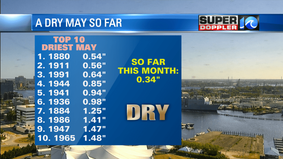
According to the National Weather Service, the driest May was in 1880 with only 0.54″ of rain. So far this May we have only had 0.34″. Wow! The grass is really starting to brown up.
There’s no tropical systems headed our way, but there are two features that I am watching. There is a weak tropical disturbance over the Gulf of Mexico.
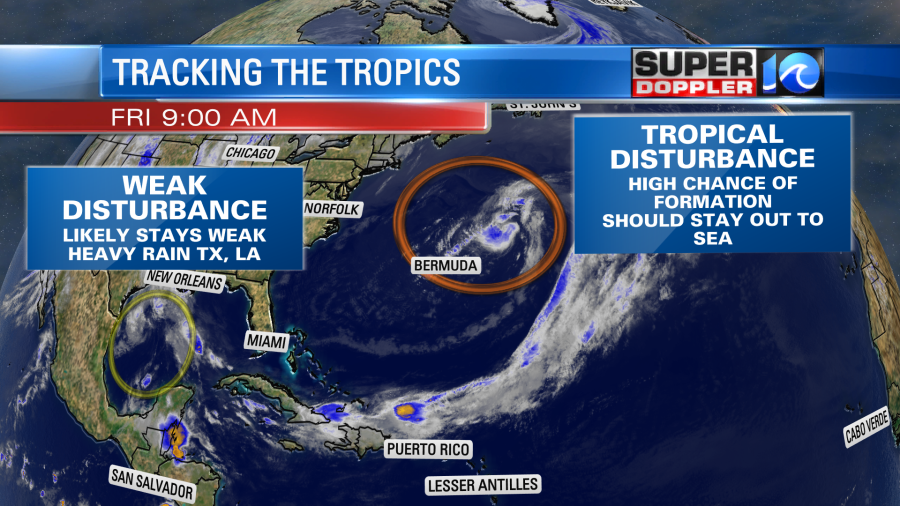
It has a low-moderate chance of formation before it moves onto land somewhere between Texas and Louisiana. However, the problem is that they have had a lot of flooding in that region recently, and this feature will bring them more rain. Possibly some flooding.
The other disturbance is near Bermuda. This one has a high chance of formation over the next day or two. It will likely get a little closer to Bermuda by tomorrow as it becomes a subtropical storm.
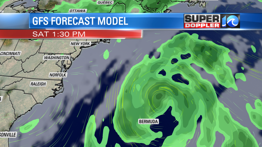
They will have some rain and wind, but they should be fine overall. The system will then move northeast Sunday into Monday. The upper level winds (wind shear) will increase. This should weaken the system as it moves northeast.
While this is going to stay out to sea it will send some waves/swells towards the coast. This will make some good conditions for surfers, but it will be tough for swimmers. There is a high threat for rip currents today at the local beaches.
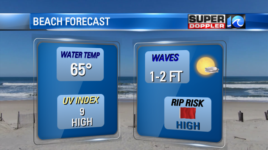
The high threat could continue into the weekend. Stay tuned for updates.
The hurricane season forecast is out from NOAA. They are calling for an above average season. Remember the average has recently been upgraded to update the climatology from the last few decades.
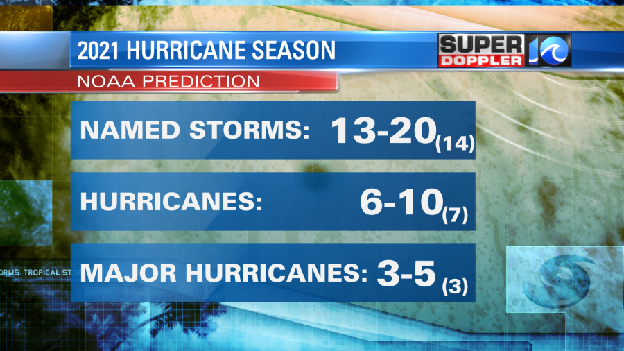
While they are calling for an above average season, they are not calling for a year as busy as last year. Dear God I hope not. I’m not big on the tropical season forecast, but there are many who follow it closely.
Meteorologist: Jeremy Wheeler


