Locally today we had some rain at the bus stops for the Virginia Beach kids heading back to school. Today isn’t going to be a washout, but there will be scattered showers on and off through the day. A cool front is dropping in from the northwest. It will pass through the metro around midday. It is running into a pretty warm and humid air mass.
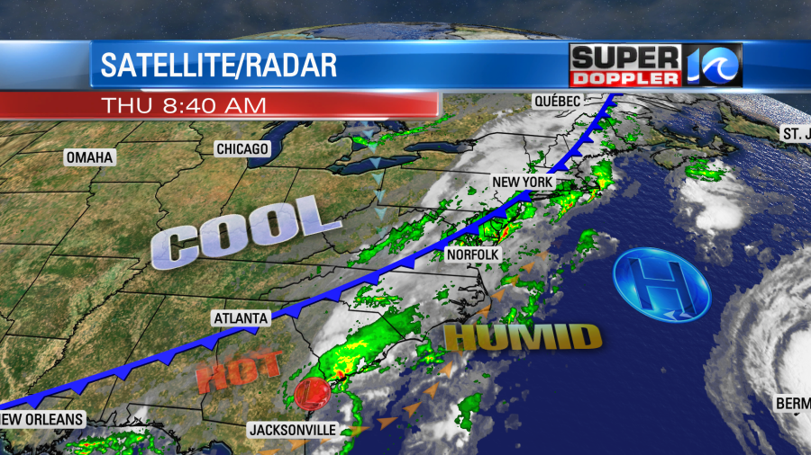
As the front pushes south during the early afternoon it will create some scattered thunderstorms. A few of these could have some heavy rain, but I don’t think we are looking at severe weather like yesterday’s storms.
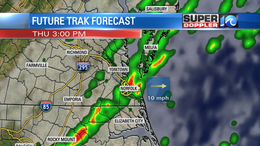
We’ll have lots of clouds today. Plus, the wind will turn out of the north. So high temps will only be in the upper 70s to low 80s. It is still pretty muggy. However, that will change soon. The rain showers will drop to the south during the early evening. Then we’ll dry out and clear out tonight. Tomorrow’s weather will be great! We’ll have partly sunny skies with high temps in the upper 70s. There will be a light north breeze. The great thing about tomorrow and the weekend will be the drier air moving in. Dew points will drop from the 70s today to the 50s tomorrow.
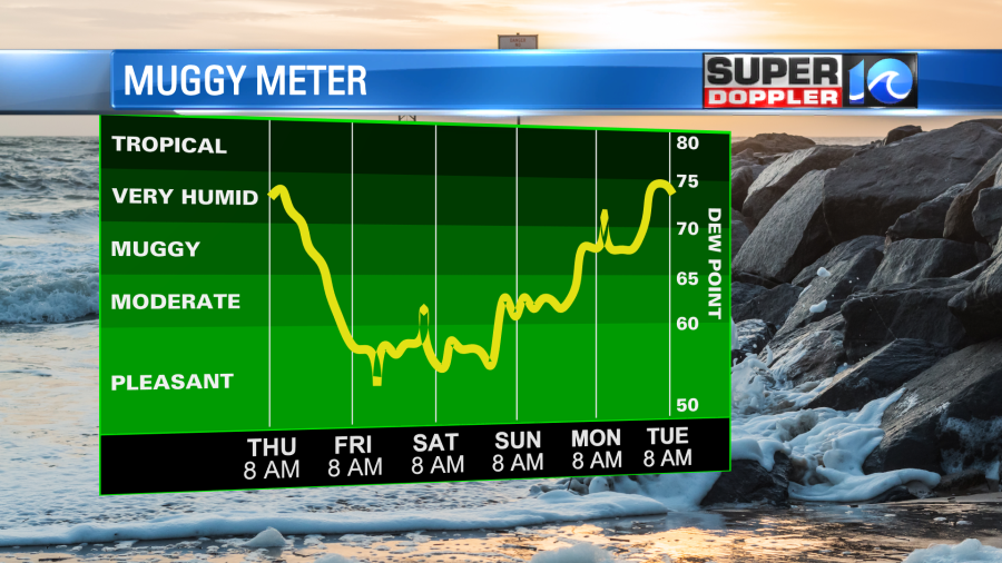
We’ll warm up early next week with humidity rising again. Highs will be in the upper 80s Monday and Tuesday.
Meanwhile we are tracking 2 systems in the tropics now.
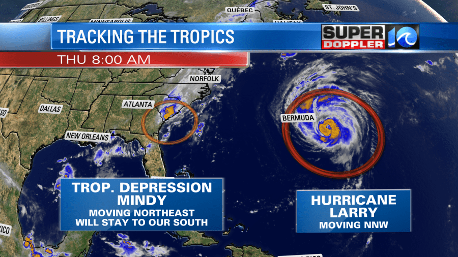
Last night tropical storm Mindy formed in the Gulf Of Mexico. It made landfall over the Florida panhandle, and then it quickly moved to the northeast over land. It weakened to a depression by the 5am update.
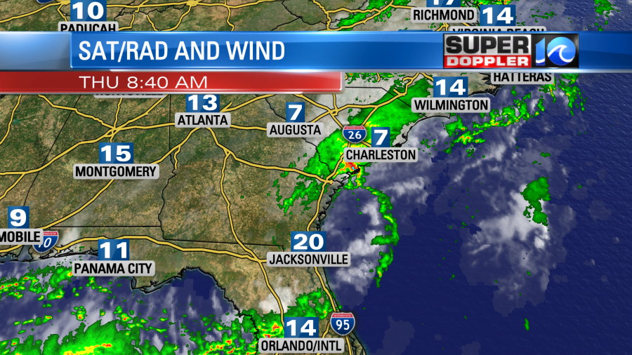
Now it is quickly moving towards the coast of Georgia. It looks like it is getting ripped apart on the latest satellite loop. It will move offshore today, and then it will weaken and fall apart over the Atlantic. Here is the forecast track, but keep in mind that it could fall apart sooner than forecast.
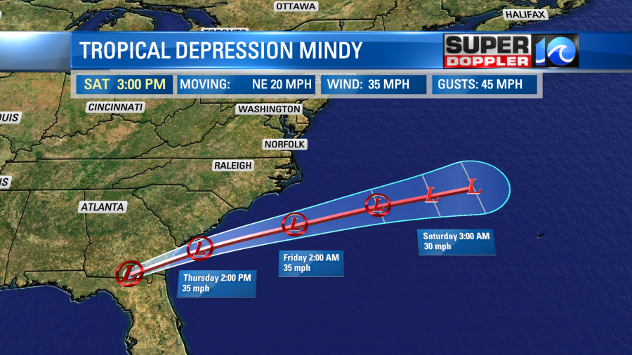
Some of the moisture from Mindy will move north, but a lot of it will get pinched off by the upper level winds. It’s those same winds that are pushing Mindy out to sea.
Meanwhile hurricane Larry is passing east of Bermuda today. The center of the category 2 storm will stay well east of Bermuda. However, they do have some rain bands and some surge there today. Larry will move northward this afternoon into tonight. It is forecast to move over Newfoundland as a category 1 hurricane by the weekend.
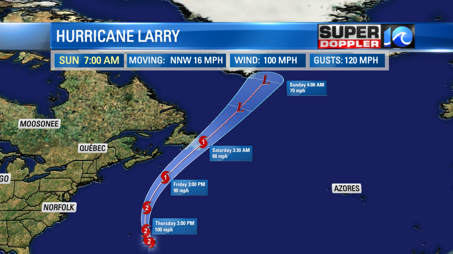
Then it will move over Greenland as a nor’easter-type storm. We are seeing some waves and rough surf here today. We have a high threat for rip currents at the local beaches. If the surf cleans up, then we should have some nice swells for experienced surfers over the next couple of days.
Meteorologist: Jeremy Wheeler