I’ll start off today’s weather blog with the local weather, and then I’ll get to that potential (sub) tropical system in just a bit.
As far as our region goes… I’m tracking a cool front that is just to our northeast this morning. We have a large area of high pressure overhead, but the front is on the way.
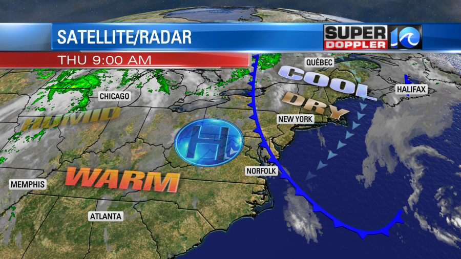
The front will move in around the lunch hour. However, conditions are dry north and south of the front. It will give us a few clouds today, but there won’t be any rain showers except for maybe one or two strays. The cool front will create a split in temps this afternoon with temps in the upper 70s near the shore with low-mid 80s inland.
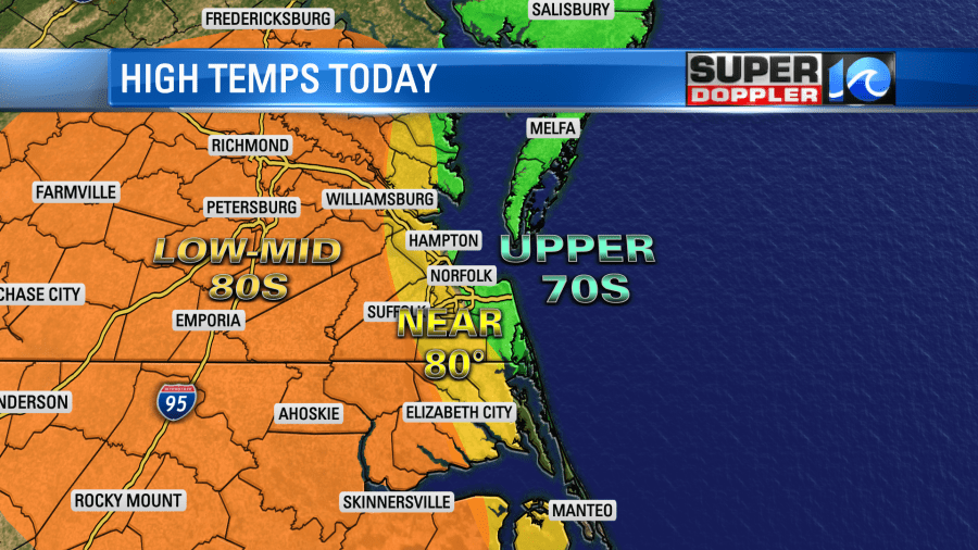
The wind will pick up out of the northeast then east at 5-15mph. It could even be a little stronger breeze at the oceanfront. This might drop temps a little later this afternoon in some inland locations late in the day. We’ll be dry and cool tomorrow as the front stalls out a bit inland. High temps will be in the upper 70s with a few 80s inland.
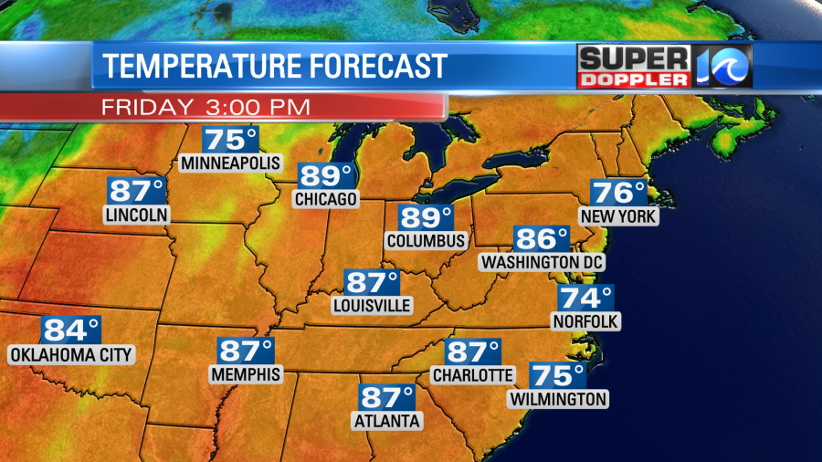
We’ll be mostly sunny with a northeast breeze at 10-15mph. Humidity levels will stay low. Pollen won’t be too bad. It should be very nice out.
The front will weaken and move offshore on Saturday. We’ll warm back up to the low-mid 80s. Skies will be partly cloudy. We’ll have similar weather on Sunday, but there may be some isolated showers in the area. Rain chances looks pretty meager over the next few days. I talked about that in yesterday’s weather blog.
There are no tropical systems headed our way to bring us some rain. However, there may be a (Sub) tropical system forming north/northeast of Bermuda.
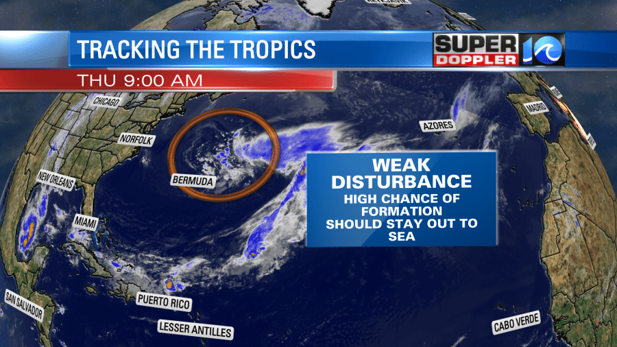
I say subtropical because it would A. likely be a broader system than a tropical one and B. may interact a bit with some cooler air/water. This feature is forecast to move a little closer to Bermuda over the next couple of days. Here is what the GFS model shows.
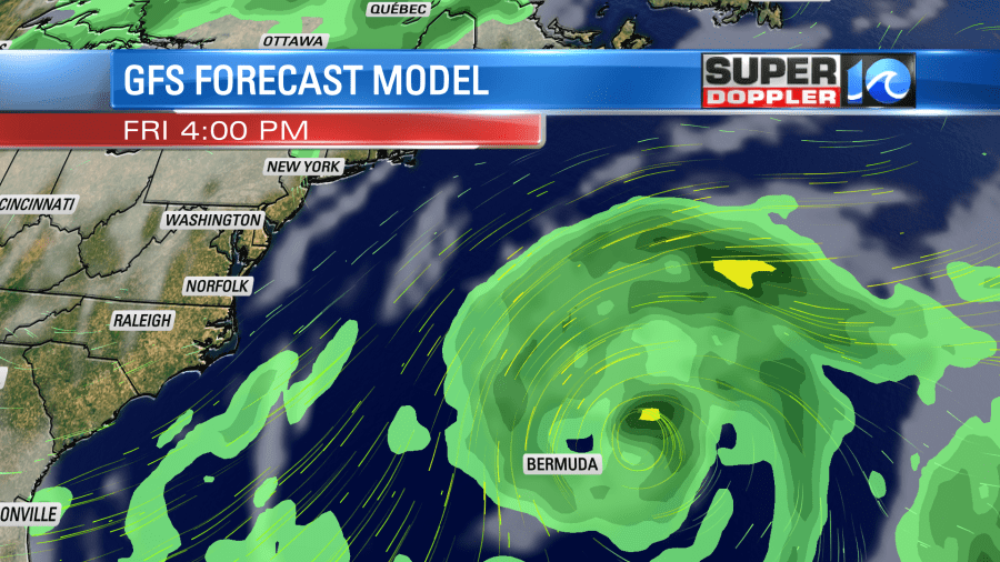
It will likely stay out to sea, and it will be in a more hostile environment 3-4 days out as it moves off to the northeast. So it should fall apart. However, this will likely send some decent ocean swells towards the East Coast this weekend. We could have some very nice surf. The threat for rip currents may increase, but there’s not a ton of people in the water just yet as water temps are just now starting to get more comfortable. Stay tuned for updates.
Meteorologist: Jeremy Wheeler


