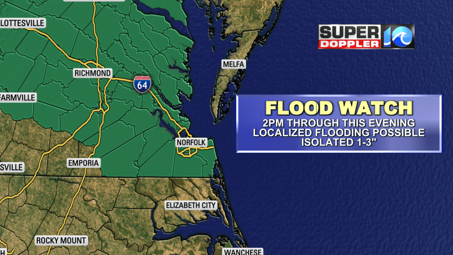
(Updated to add the Flood Watch. See Below.)
We are almost there … almost to the end of the latest heat wave. We are crawling to the finish line of the most recent heat wave. Yesterday we hit the mid 90s as predicted.
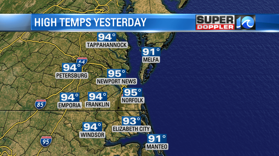
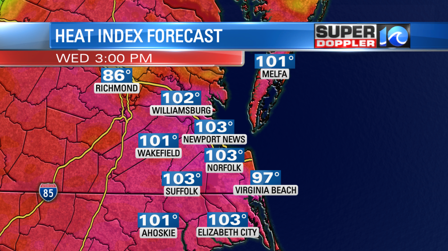
The heat index was in the low 100s. We had a lot of sunshine with some isolated pm showers and storms. Today will be similar with only a couple of subtle differences. We still have high pressure offshore. There is a cool front to our north, but it is much closer today. Also, you can see the second front now over the upper Midwest.
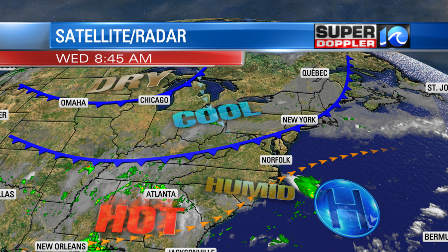
We’ll be partly cloudy today. There will definitely be more clouds than yesterday. Plus, we have a little higher chance for some scattered showers and storms this afternoon.
High temps will aim for the low-mid 90s. The thinking is that we’ll have enough clouds and some showers that will keep temps down a degree or two from yesterday. Still … the heat index will rise to the low 100s. So you basically won’t notice a difference.
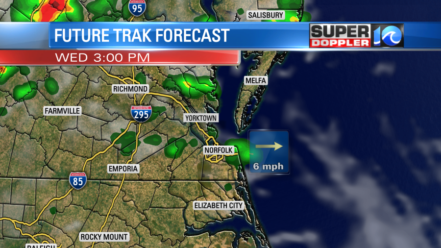
The wind will be out of the southwest at 10mph. As we head into the evening the cool front will slowly edge into the region. This will allow for a cluster of showers and storms to drop in from the north.
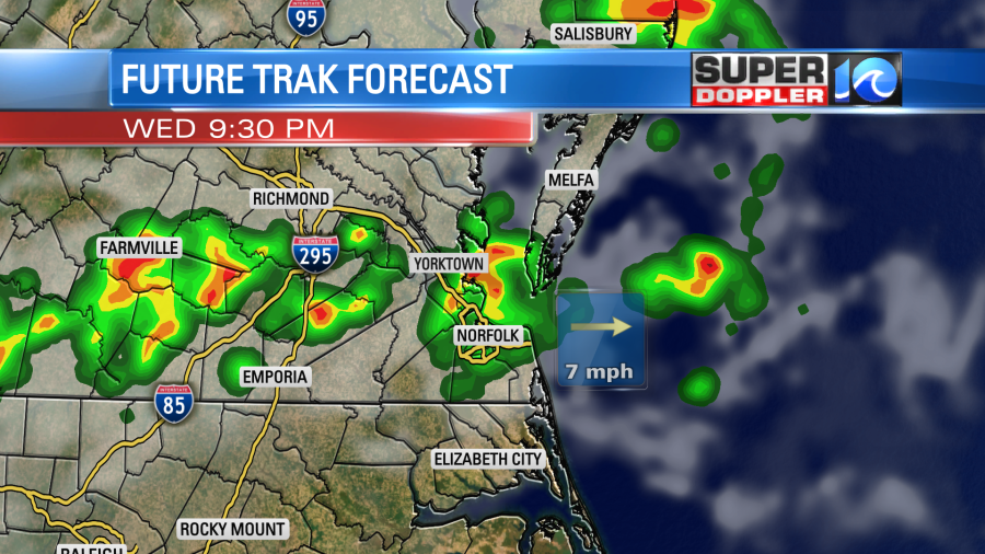
Some of these storms will put down some heavy downpours. A few strong gusts of wind to over 45mph will be possible.
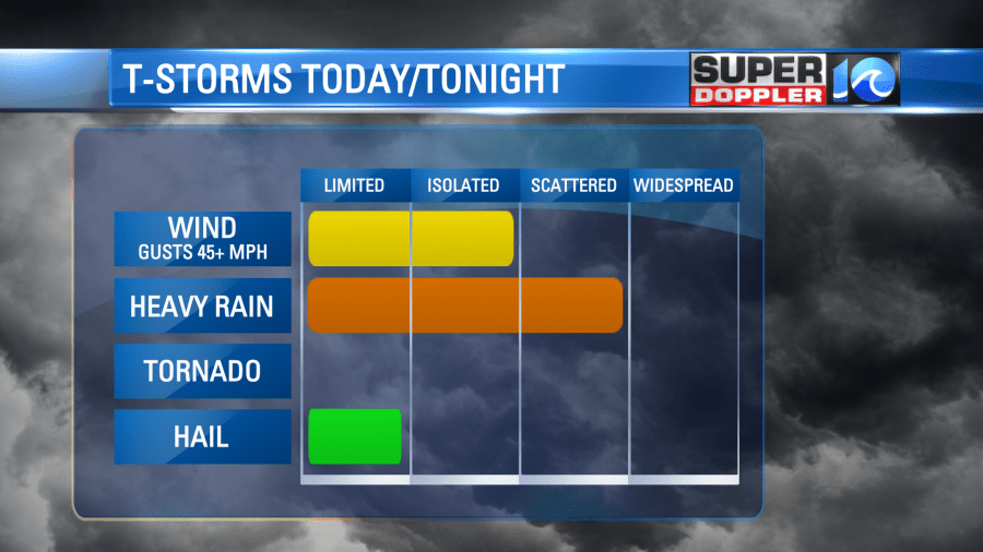
We have a marginal risk for severe weather (mainly for the evening). (UPDATE) There is also a Flood Watch up for most of southeast Virginia from 2pm through the evening.
These storms will taper off overnight. Then we’ll have some isolated showers tomorrow morning.
Tomorrow both fronts will slide south through the region. So we’ll have more clouds along with scattered showers and a few storms.
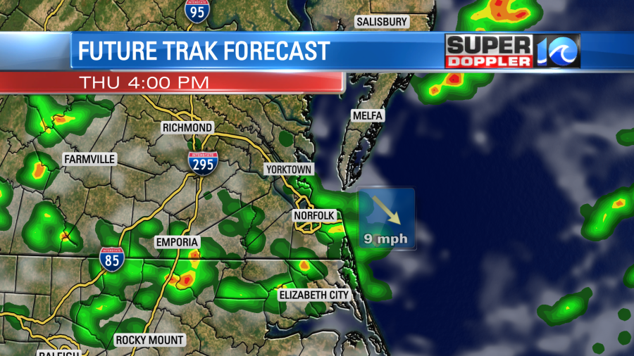
The wind will be out of the west/northwest at 8-12mph. It will turn out of the north by the evening, and it will pick up. High temps will be in the mid 80s on Thursday, but it will still be humid. The drier air will start pouring in on Friday behind the 2nd front.
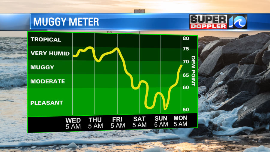
An upper level low might create some isolated showers on Friday. Otherwise, we’ll have a dry weekend with nice weather. High temps will be near 80 on Saturday and in the mid 80s on Sunday. Low temps will return to the 60s for a few days.
In the tropics we are still watching that little disturbance in the eastern Atlantic. It has a low chance of formation over the next few days as it moves off to west/northwest.
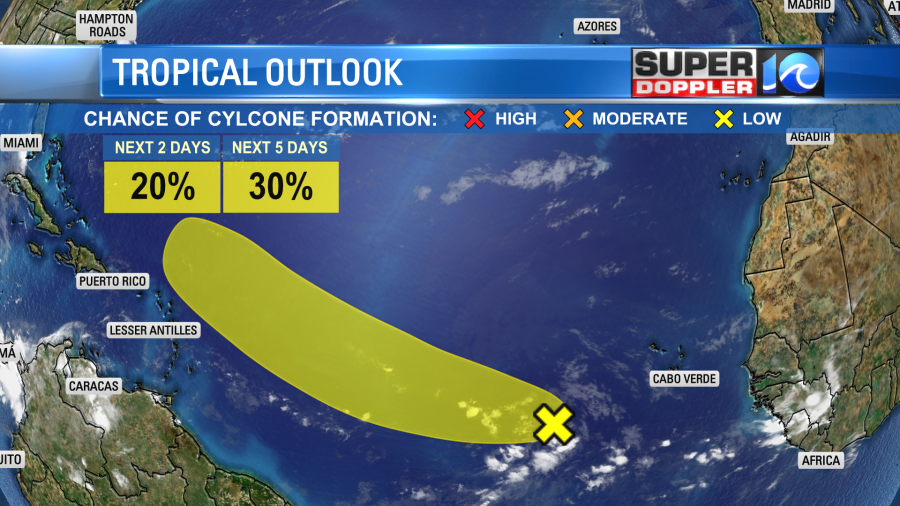
There is some dry air to the north of it, and the Saharan Air layer is impeding it as well.
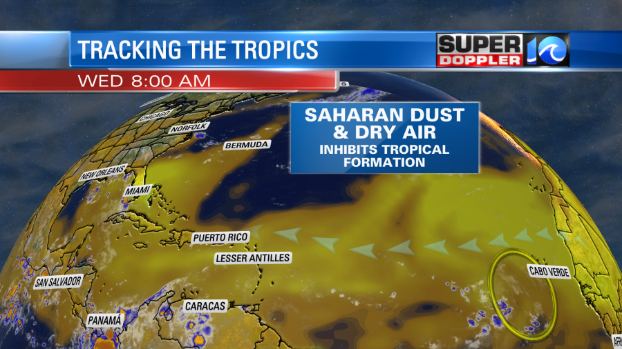
We’ll continue to track it, but I’m still not too concerned about it.
Meanwhile closer to home, I found a report of a waterspout in our region that did some damage a few days ago. The National Weather Service in Wakefield put out a report about a water spout that became a tornado and hit Smith Island. It was an EF-1, and it had maximum winds of 110mph. There was some damage to a mobile home and a local bed and breakfast. This was last Thursday. Here is the report with more details: Smith Island tornado.
Meteorologist: Jeremy Wheeler