For Saturday, we’ll have a mix of sun and clouds. A few isolated showers or a storm will be possible in the afternoon. This all comes as a front moves towards us and then stalls over us for a few days, leading to unsettled weather and some daily rain chances.

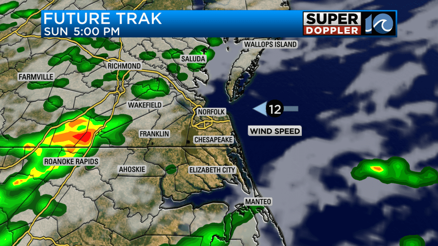
Sunday – I expect to see some higher rain chances. Best chances will be in the afternoon/evening, but a shower will be possible anytime during the day. Temperatures will be a little cooler Sunday, thanks to some extra cloud cover. Highs in the low to mid 80s.

As we go into the work week, we’ll still have this front near us – meandering north and south some through Monday and Tuesday. As a result, daily rain chances will occur. Rain could be locally heavy on Monday, leading to flooding in the typical flood prone locations. For kids heading back to school Monday – rain will be an issue too with some heavy rain possible Monday morning.

In the tropics – there’s two main things to keep an eye on. Franklin is expected to pass between us and Bermuda. While there will be no direct impact, we will see some increased ocean swell and rip currents early in the week. Franklin is expected to become a Category 3 hurricane – our first major hurricane of the season.

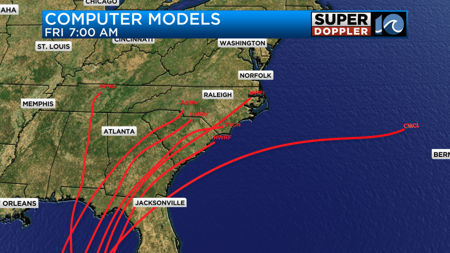
Meanwhile, to the south in the Gulf of Mexico – a tropical depression is expected to form. Models differ on strength and track of this system, but the general consensus is for the system to move towards Florida by mid week. The Euro/GFS both depict this with.

Depending on the eventual track/strength – we could see some impacts late next week. It’s too early to tell exactly what – but an inland track could give us some rain while an off the coast track could bring some wind/rain to mainly the OBX. The Euro wants to keep it off the SC/NC coast while the overnight run of the GFS wants to take it inland. At this time, looking at the spaghetti models – the general idea is to split the two and keep it near SE GA/SC.

Stay tuned for updates through the weekend. We should have our first track from the National Hurricane Center once a tropical depression forms by late weekend or early Monday.
Hope you have a great weekend!
Meteorologist Ricky Matthews
Follow Ricky on Facebook and Twitter


