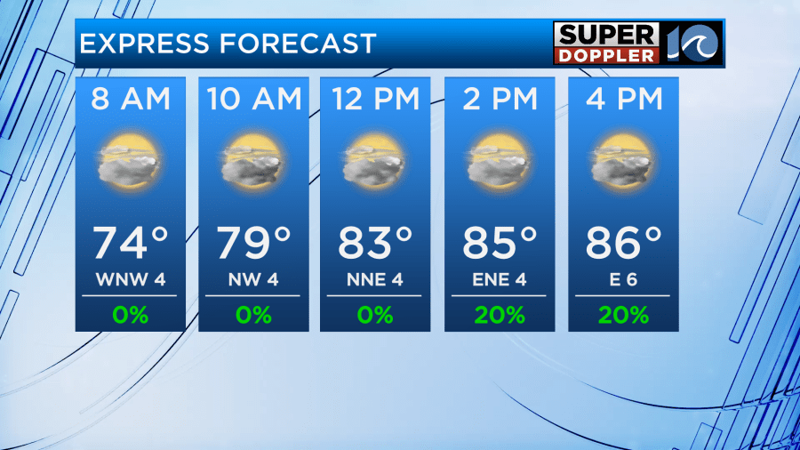
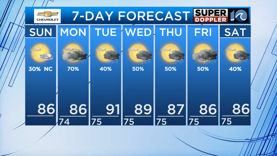
After a very rainy day Saturday, drier weather returns to most of the region for Sunday. We’ll see partly to mostly cloudy skies through the day, with temperatures in the mid 80s. An isolated shower or storm is possible, mainly along the VA/NC border and in NE NC but the majority of the region should stay dry.
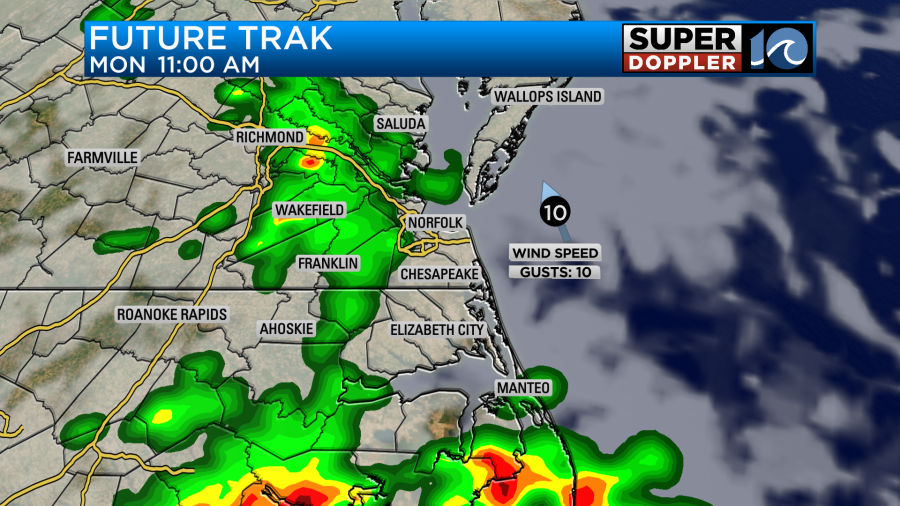
Rain returns to the forecast for Monday, with scattered showers and storms once again in the forecast. Downpours and some flooding will be possible. With high moisture levels in the atmosphere, anything that pops up will produce tremendous downpours. We may see another flood watch issued for Monday. It won’t be a constant all day rain, but anytime during the day there will be a chance for a storm to pop up.
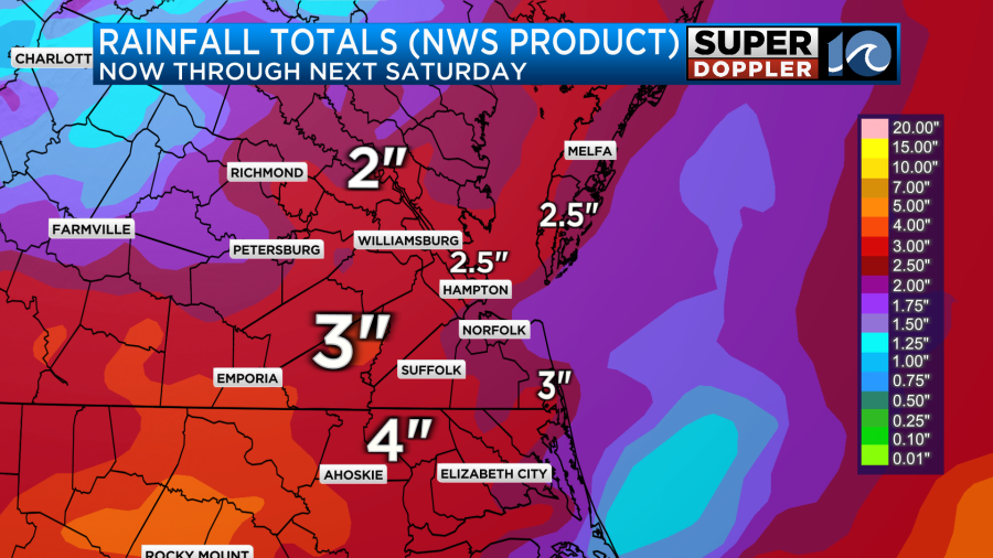
The scattered rain chances continue into Tuesday, as temperatures climb to near 90. With the humidity sticking around, it’ll feel like around 100 Tuesday afternoon. The scattered chances for rain continue through the rest of the week, with showers and storms mainly in the late afternoon and evening. Through the end of this week, we could see a few inches of rain!
Hope you have a great Sunday!
Meteorologist Ricky Matthews
Follow Ricky on Facebook and Twitter