Hopefully, you got outside yesterday and enjoyed some of the great weather. It was awesome! More so after the rain moved out in morning. High temps reached the upper 60s in the afternoon over the Southside and northeast North Carolina.
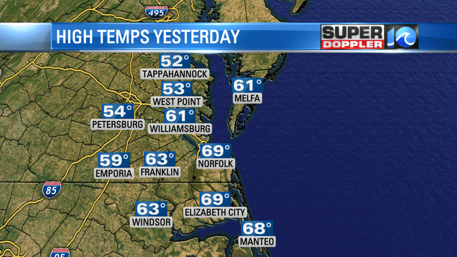
It was in the 50s north of the metro, but still very nice. Today will be a different world! We started with temperatures in the 20s and 30s. Wind chills were in the 20s and teens. High temps today will only rise to the upper 30s to near 40 degrees. Ouch! That is what you are probably saying after getting whiplash.
We have high pressure in the region. So at least we’ll have a good amount of sunshine today. There are 2 areas of low pressure far to our south.

One of them is causing more snow and wintry weather over the deep south. There is another low over Florida that is producing some rain. Both of these systems will ride north/northeast over the next 24 hours. They won’t move through our region, but they will pass just to our south. By late tonight the moisture will increase enough to produce scattered rain showers over much of the region. There will be a wintry mix northwest of Hampton Roads.
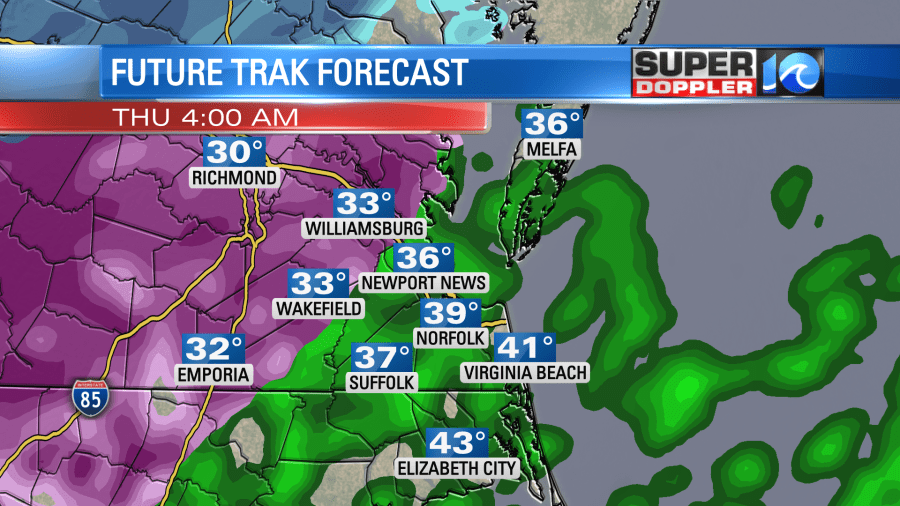
Notice that there isn’t much snow (blue color) this time around on the forecast map. Between 3 and 7 am Future Trak shows a mix of sleet and freezing rain between I-95, Wakefield, Williamsburg, and Gloucester. Some minor ice accumulations are possible in those locations until about 10-11am. By that point temps should warm up enough that almost everyone will be seeing rain showers.
So it doesn’t look like we’ll have much snow in the region, but there could be some light ice accumulations in the areas mentioned above. In fact, it could be pretty bad closer to I-95 and Richmond again.
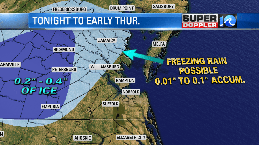
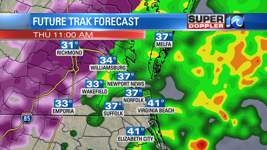
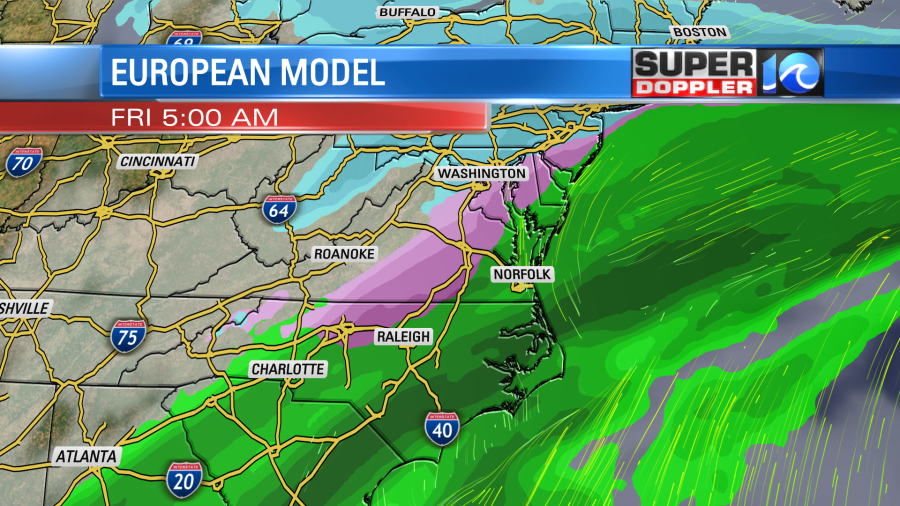
Remember, they are still recovering from last weekend’s storm. At least they should change over to rain for a time in the afternoon. Rain will hopefully taper off by the afternoon for everybody. High temps will only be near 40 degrees. Another low pressure system will pass to our south tomorrow night into Friday. This will create more rain showers for a time.
There could be another brief mix to the west/northwest of Hampton Roads in the morning, but that shouldn’t cause too many problems.
The rain should kick out by the mid afternoon. High temps will be in the 40s. Then we’ll be chilly and dry for the rest of the weekend.
One other problem that we may see on Thursday and Friday is localized flooding. The ground is already saturated. It can’t hold any more water. The local rivers are also up with some minor flooding reported. The forthcoming rain could add up to 1-2″ in the rain gauges through Friday.
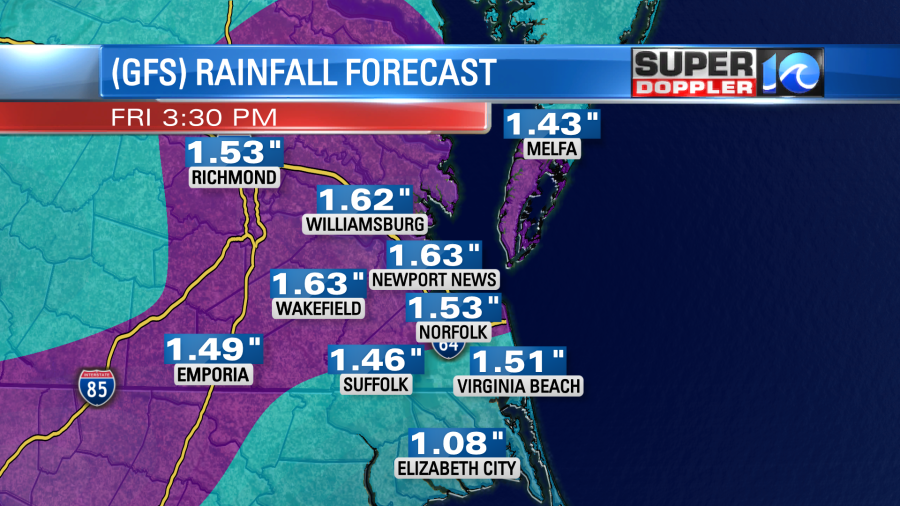
This could be enough to cover some roads. So stay tuned for updates on all of this over the next couple of days.
Meteorologist: Jeremy Wheeler