Yesterday was the last day of high heat and humidity for a while. We ended up hitting the mid 90s in Hampton Roads. It felt like 100 with the heat index.

Today the cooling process will begin (trumpets blare as the red carpet unfurls). However, we started the day with muggy conditions because the front was just starting to move through. This cold front will slowly drop to the south through the day.
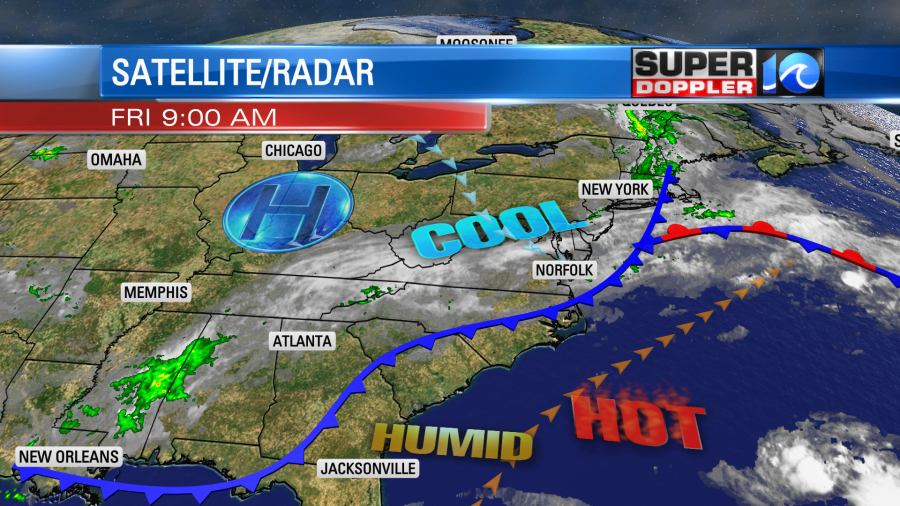
The cooler/drier air will gradually filter down to the south. High temps will be close to 80 degrees.

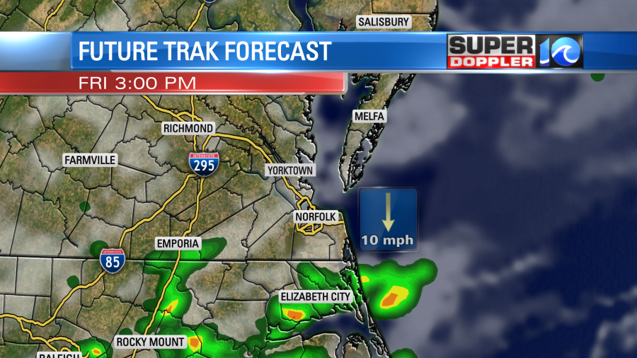
This will be a big cool down compared to yesterday. Also…dew points will drop from the upper 60s to the mid 50s. Winds will be out of the north/northeast at 8-12mph. There will be some spotty showers through the mid afternoon in southeast Virginia. However, there will be some scattered showers and storms over northeast North Carolina into the late afternoon.
Tomorrow the front will stall out to our south, and high pressure will build in. We’ll have some nice weather. High temps will be in the upper 70s to low 80s with fair skies. We’ll have some more nice weather on Sunday. High temps will be in the upper 70s to near 80 degrees with partly cloudy skies. The drop in humidity will really make it comfortable over the weekend.
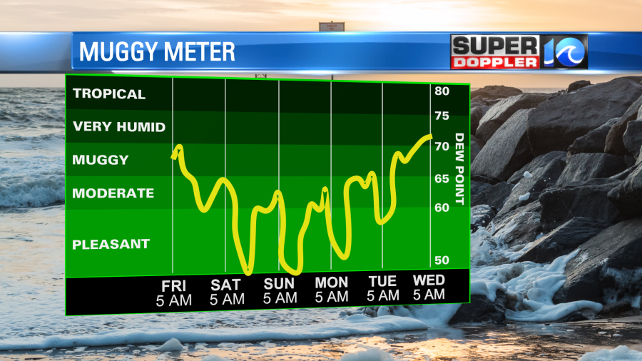
We’ll warm up a bit early next week with highs mainly in the 80s. We should have quiet weather until the middle of next week. That is…As long as the tropical forecast doesn’t change. Cue the tropical satellite:
As of this writing we were tracking a tropical feature that was deemed a “Potential Tropical Cyclone”. There were strong thunderstorms east/northeast of the Yucatan Peninsula around the feature.
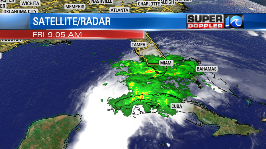
These storms were producing wind gusts to 40mph. This is already tropical storm force. However, the Hurricane Hunters early this morning couldn’t find a closed circulation. As soon as that becomes evident to the National Hurricane Center, whether that’s through the Hunters or via satellite, they will classify the system as a tropical storm. The forecast calls for Alex to form within the next 12-24 hours. After that time it will move over south Florida.
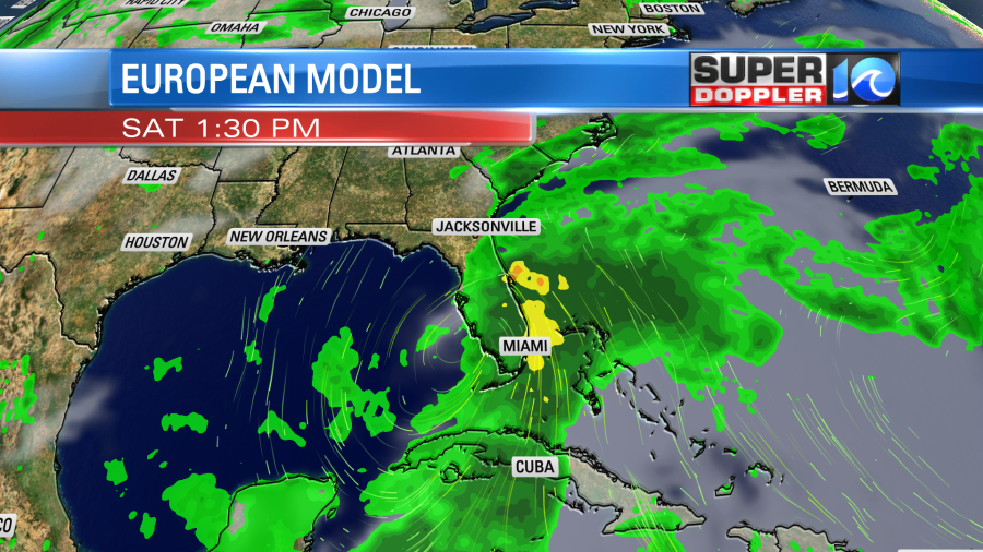
It is expected to dump a lot of rain over that region. They may see 6-10″. After that point it should move to the east/northeast and stay out to sea.
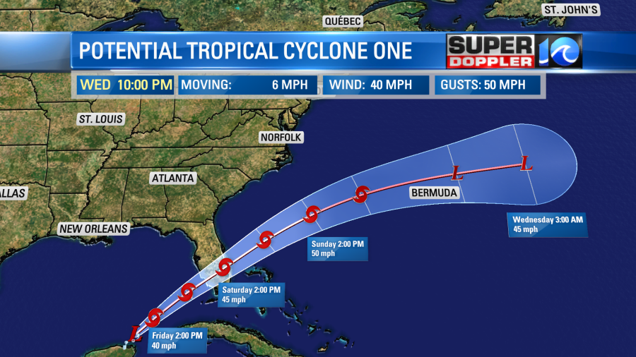
The storm may hit Bermuda. Hopefully, it won’t be too strong. There is some wind shear affecting the storm now and in the future. Also after crossing the Gulf Stream, then it will move over some cooler water. For us, based off of the latest track, we will probably only have a higher threat for rip currents. There should be some nice swells for surfers early next week. Hopefully, it does stay offshore after Florida. Stay tuned for updates on it over the weekend in case the forecast changes.
Meteorologist: Jeremy Wheeler