We are coming off of a great holiday weekend in terms of weather. It was warm enough to head to the beach, but not so hot that you felt like you were melting as soon as you stepped foot out the front door. High temps were in the 80s yesterday with a couple of 90s inland.
After adding up and averaging all the numbers it looks like we are going to finish the month a little above average for both temps and rainfall.
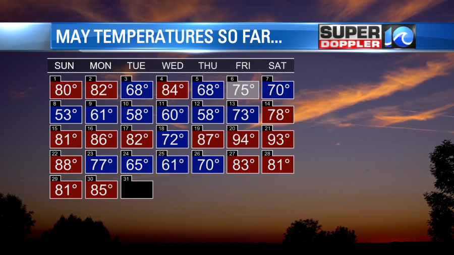
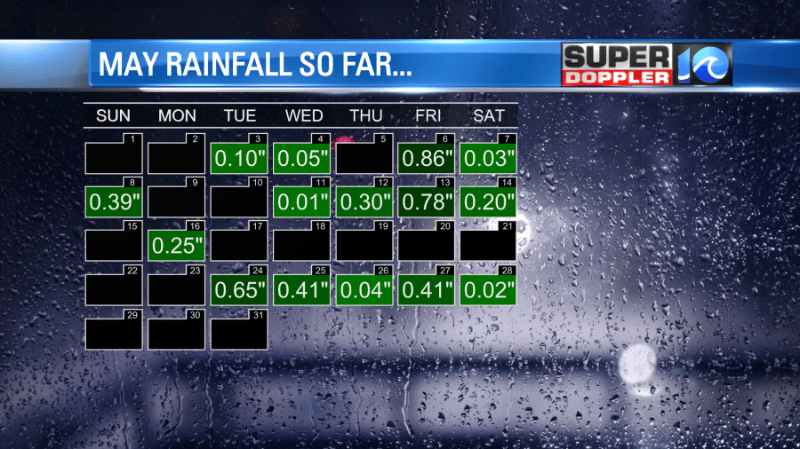
Going forward we are going to have another brief stretch of hot weather before we get a sizeable cool down by the end of the week.
Today we have a large area of high pressure in the region.
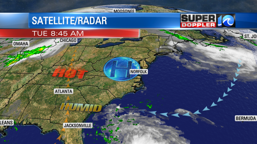
There will be some strong storms over the central U.S. today, but we’ll have some quiet/hot weather locally. We’ll have a lot of sunshine with only a stray shower or storm in the entire region. High temps will rise to the low 90s over much of the region.
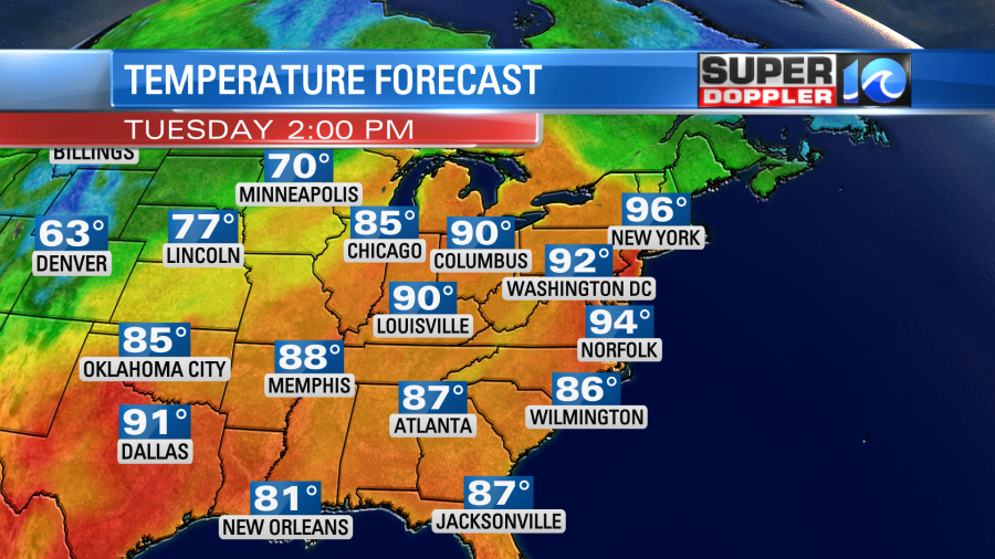
However, the heat and humidity combined will make it feel like it’s in the mid 90s.

This is about 10-15 degrees above average. There won’t be much wind. So that won’t help. It will be light and variable. A sea breeze may form, and that might cool down some areas near the shore, but I wouldn’t bank on it to cool you down. So stay hydrated! Take plenty of breaks in the shade. Keep the pets in a cool area with water available.
We’ll be hot again tomorrow with highs in the low 90s again. The heat index will be in the mid 90s again as well.
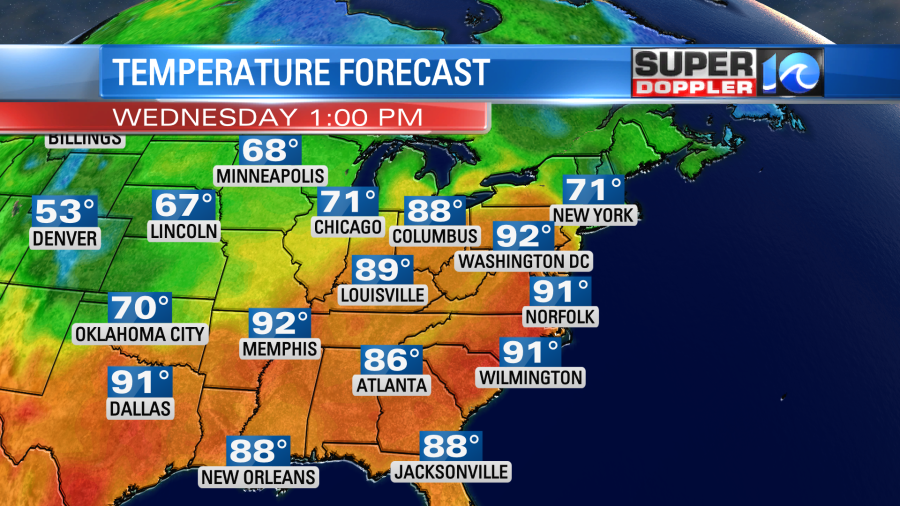
We’ll still be pretty hot on Thursday. Highs will be in the upper 80s to low 90s with high humidity. However, there may be a few late day showers and storms. The chance for rain and storms will increase Thursday evening into Thursday night. This will be ahead of a cold front that will move through overnight. Then we’ll cool down quite a bit on Friday. High temps will only be in the upper 70s. The humidity will drop dramatically going into next weekend. It will feel awesome again after a sultry few days.
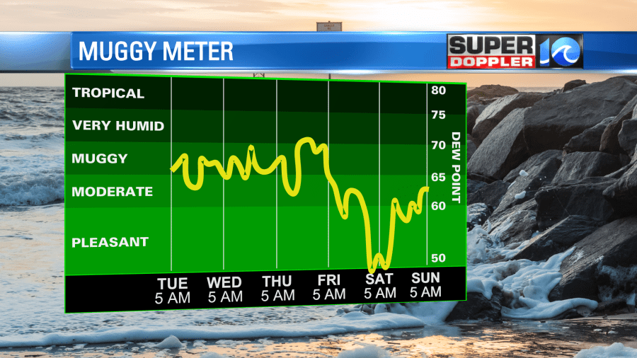
Next weekend looks mild and dry for now.
The first official day of hurricane season in the Atlantic Basin starts tomorrow. That is interesting timing as there may be a tropical system forming over the next few days between the southern Gulf of Mexico or the western Caribbean.
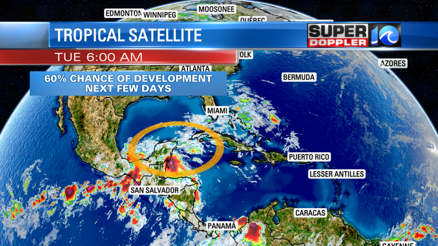
This will be from the remnants of Agatha which made landfall over Mexico as a category 2 hurricane yesterday. If it does re-form then it would likely move to the northeast. It’s too early to talk much about it beyond that. I’ll talk a lot more about that and the tropics in tomorrow’s weather blog.
Meteorologist: Jeremy Wheeler


