I wish I had a dry forecast for this Election Day. However, we are looking at some rain showers entering the region this afternoon and evening. We just had a cool front move through yesterday. So cool air is already in place. Today that front will fall apart offshore with a second front moving in from the northwest.
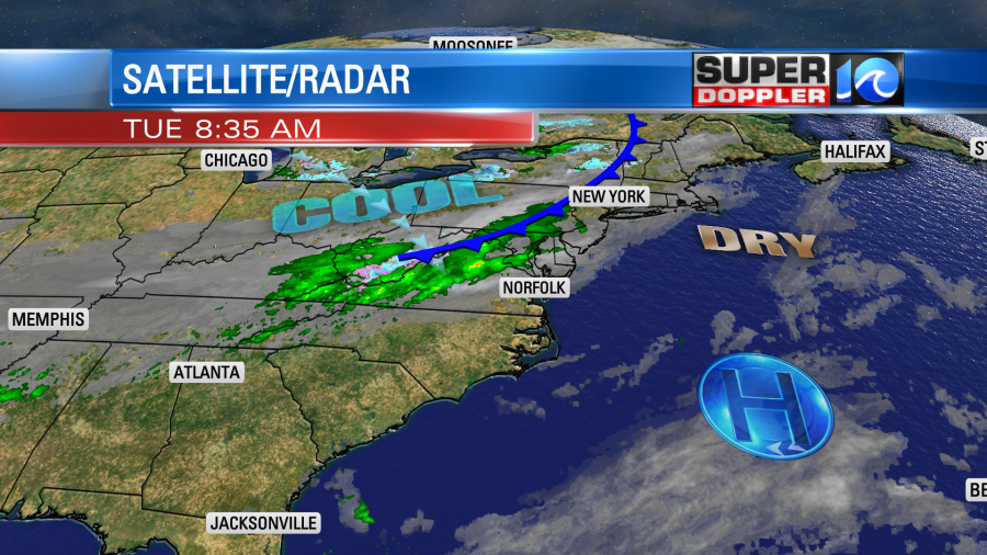
This will give us a second punch of colder air that will settle in over the next couple of days. Today we will be cooler with high temps in the lower 60s. There will be some mid 60s to the south. As the front slides east it will produce some scattered rain showers. We’ll stay dry through the morning for early voters. There may be some isolated showers by midday. However, scattered rain showers will be around for the afternoon into the evening.
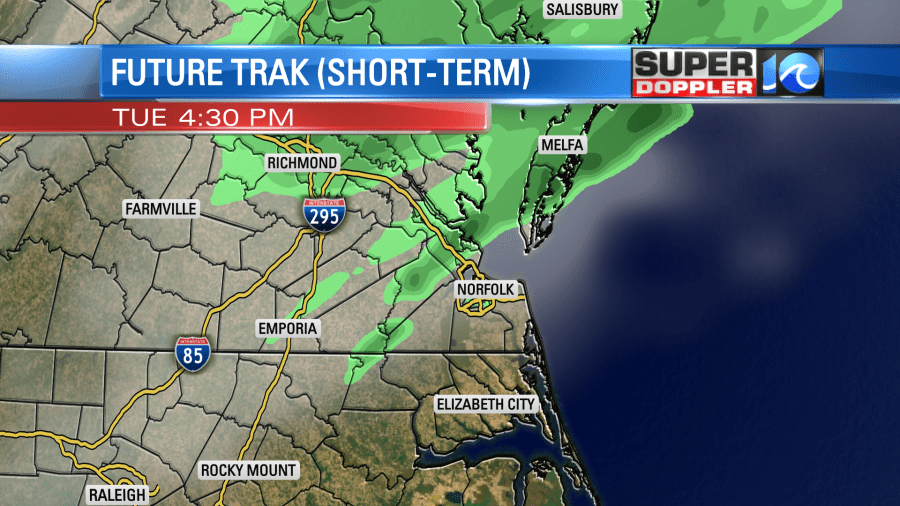
I think it will be light showers and drizzle. It will be too cool and stable for any thunderstorms. So that’ a bit of a silver lining. Winds will pick up out of the north. They will run at 8-12mph.
Showers will taper off tonight, and they will dry out by tomorrow morning. Temps will drop down to the 40s tomorrow morning. There could be a couple of 30s far inland/west. We’ll stay chilly tomorrow. High temps will only be in the mid 50s despite partly cloudy skies.
This will be some of the coolest/coldest air we will have had in months. Winds will be out of the north at 10-15mph.
The front will stall out to our south on Thursday. An area of low pressure will form along the front and move to the northeast. This will stay offshore, but it will push some moisture up into our region. There will be some scattered showers by the afternoon. The higher chance for rain will be over northeast North Carolina.
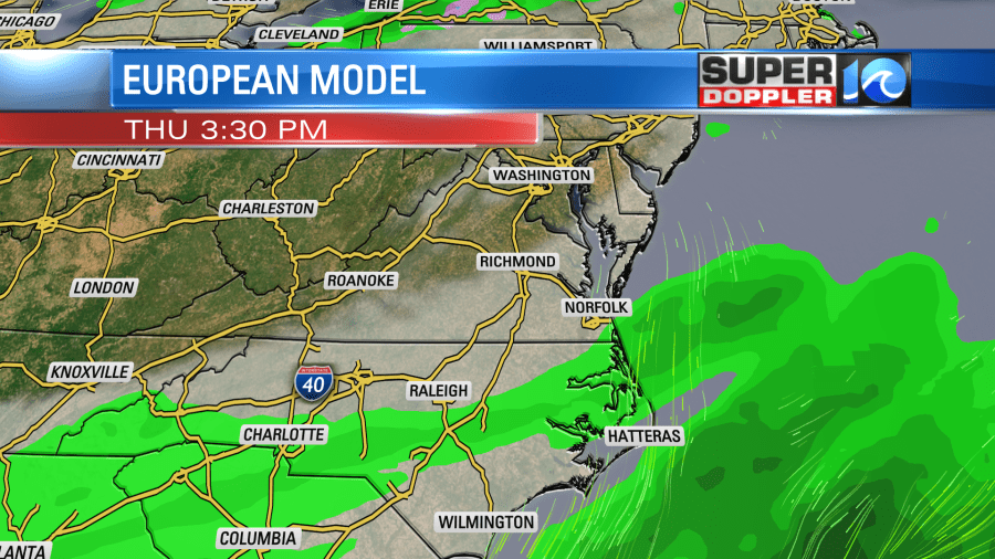
High temps will stay in the 50s Thursday and Friday. Lows will be in the 40s and possibly the 30s. We’ll dry out on Friday.
Wanda has become a tropical system now. It was subtropical for a while as it was wrapped up in a couple of fronts, but now it is warm-cored.
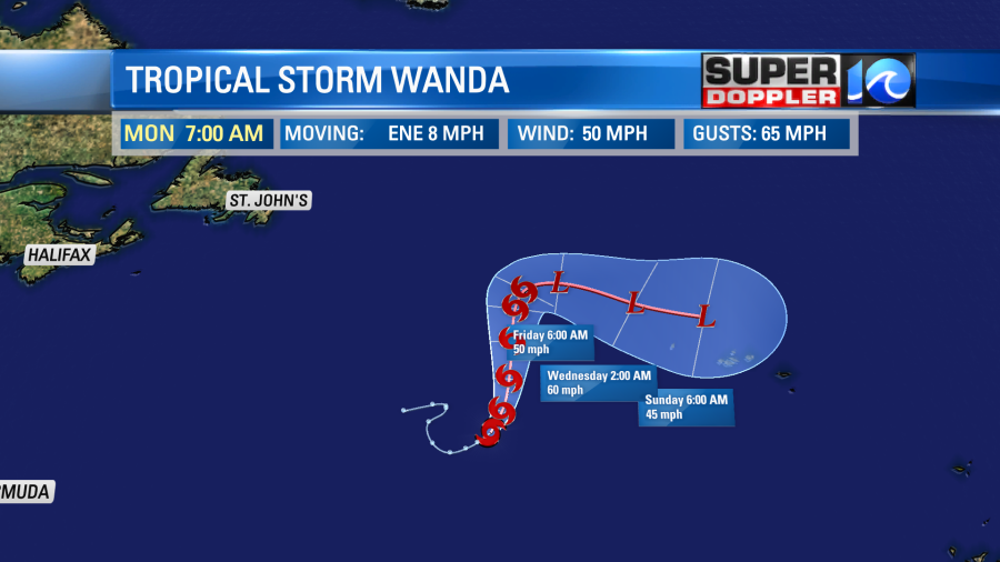
That system will stay out to sea. It will move to the north then east. It will impact the Azores islands as a post-tropical storm.
Meteorologist: Jeremy Wheeler