Well….It happened. The snow has fallen. All of the doubters that thought we wouldn’t get any snow got a surprise this morning. However, the folks that believed the posts a couple of days ago from some (other) meteorologists, who said could see 12-15″, will be disappointed.
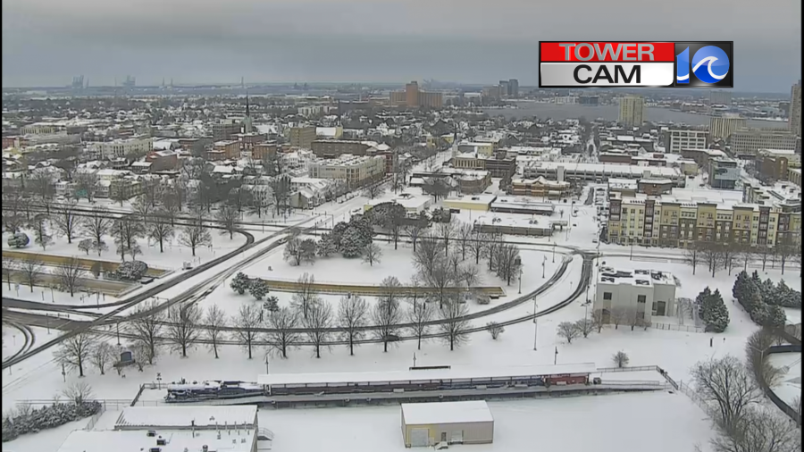
It looked like a Winter wonderland when I got in this morning. I stopped to take a pic in downtown Portsmouth at about 2:30 a.m. Beautiful!

The roads were covered, but the plows were out doing their thing. Snow came down heavy for a time Friday night into early Saturday morning.

The snowed wrapped up around 6:30 a.m. Now snow is covering many roads, walks, and yards.
An area of low pressure moved along a stationary front last night into this morning. It pushed the moisture northward over the colder air mass in place. At first it was fighting the north/dry wind, but the moisture won out eventually. The low has now moved pretty far offshore.
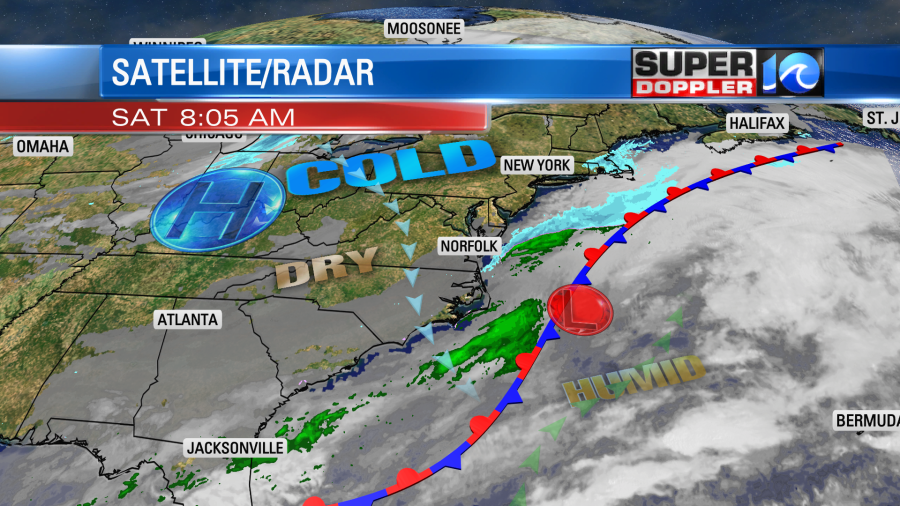
There was also a fast moving pocket of energy in the upper levels zipping through. High pressure will gradually build into the region today at the surface.
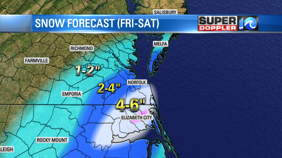
The forecast for this event was pretty good. Here was the snowfall forecast from yesterday.
Here is the map of the snowfall totals that I put together from the snow reports this morning:

Here were some of the actual reports from folks in the region:

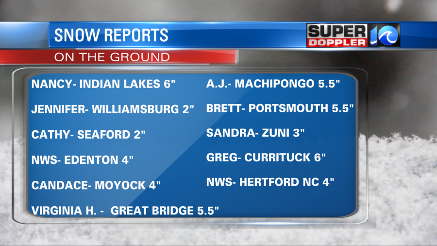
There was a sharp cutoff in eastern North Carolina between the Outer Banks and inland.
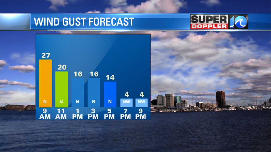
While the snow is done falling, there will be blowing snow today. That will make it difficult to plow. Winds will gust up to 25mph out of the north.
A lot of the main roads will probably be ok, but a lot of the secondaries will probably stay snow covered.

We’ll have quite a bit of clouds with just a few peeks of sun. So high temps will only be near 30 degrees this afternoon. Hence there won’t be any melting naturally. Wind chills will only be in the teens and 20s today.
Tonight skies will partly cloudy. Winds will drop off as well. So temps will drop big-time. They will drop down to the low-mid 20s with possibly a few teens inland. If there is some melting today, then that will likely re-freeze overnight. Tomorrow some of the roads may be in rough shape for those trying to head to Sunday services. Some services may even be cancelled. The good news is that we should warm up on Sunday. High temps will rise to the mid 40s in the afternoon with partly sunny skies. Hopefully, things will be cleared before people have to head back to work/school on Monday. That is more likely to happen in areas that had 2-4″, but less likely for those that had 4-6″.
So have fun today in the snow, but stay safe! There is another system that could bring us some more wintry weather next weekend, but that is way too far out for any details. Stay tuned!
Meteorologist Jeremy Wheeler