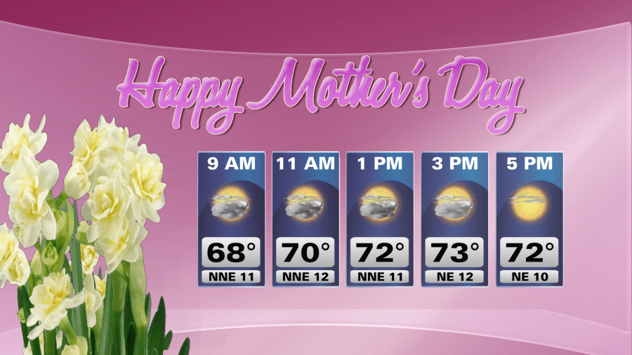
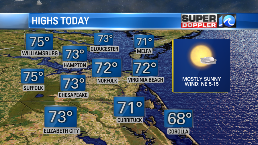
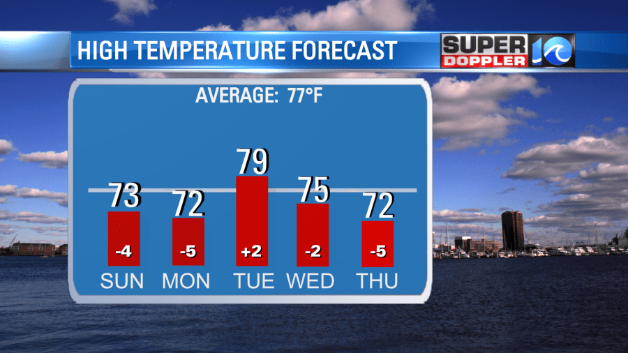
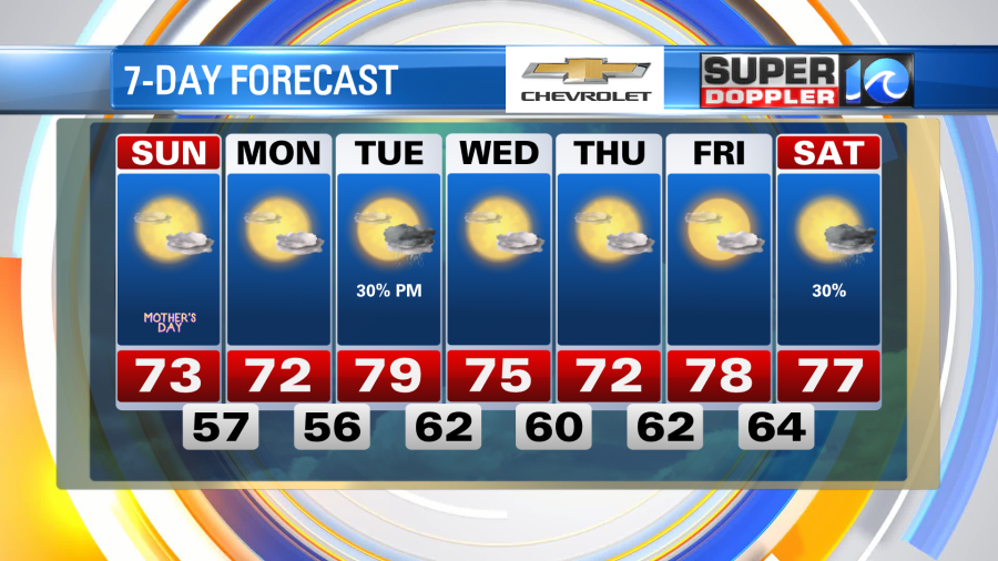
With the NE wind, we’ll see some cooler temperatures on Sunday (and Monday). Highs will be in the low 70s across much of the region this afternoon. We’ll have some clouds Sunday morning with some sunshine returning in the afternoon. Overnight, expect lows to drop into the mid to upper 50s.
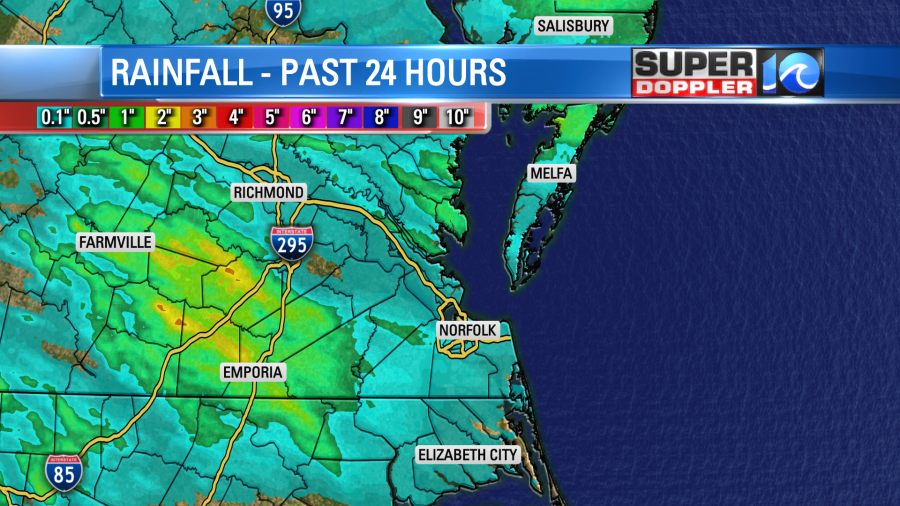
Rainfall totals were not that impressive Saturday evening – in most of the area we barely saw 0.25″ of rain. My house on the Peninsula only picked up 0.06″ of rain. Just enough to wet the ground but that’s about it.
Heavier showers and storms setup west of the metro area – with some flooding in Farmville. For the year, we now sit at -3.02″ of rain and a little over an inch below for the month.
Rain showers are not expected Monday but Tuesday we could see a few more showers and storms late in the day. Some gusty winds and downpours will be possible.
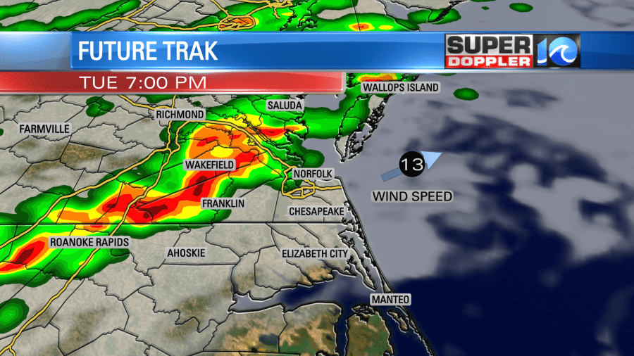
Tuesday looks like the warmest day of the week with highs near 80. After those showers and storms move in, we’ll see a bit of a drop in the temperatures for Wed and Thursday.
Hope you have a great weekend!
Meteorologist Ricky Matthews
Follow Ricky on Facebook and Twitter