Locally today we are going to have a mess on our hands. There is a deep layer of humidity in place from the last couple of days. However, today there is also a slow-moving cool front. Plus, we have a weak upper level disturbance rolling overhead.
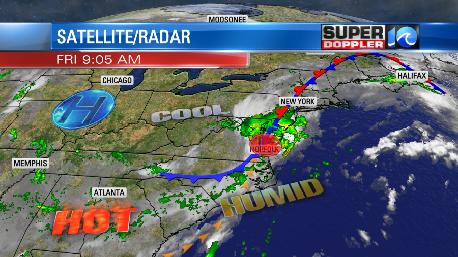
The result is going to be scattered showers and storms through the day with heavy rain possible. We already had some heavy downpours north of the metro this morning.
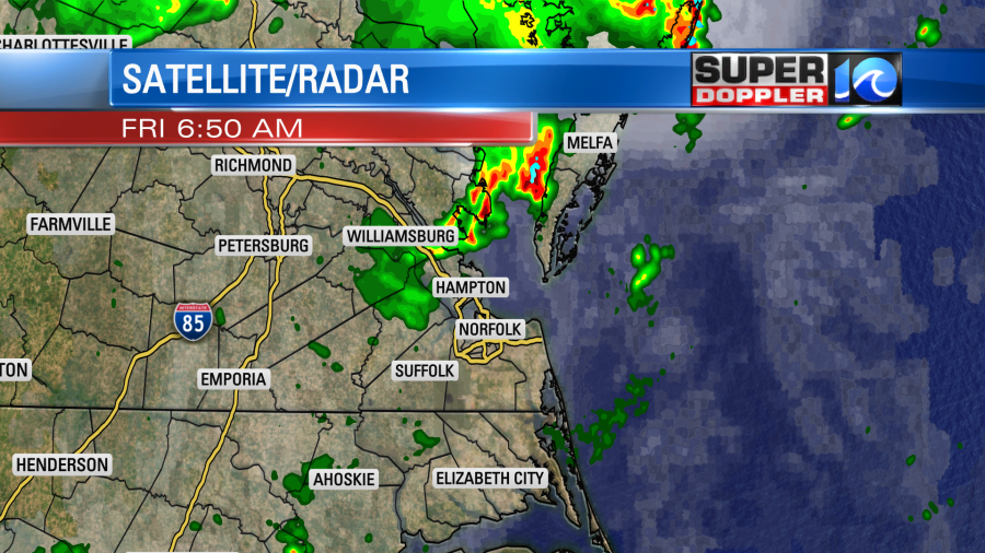
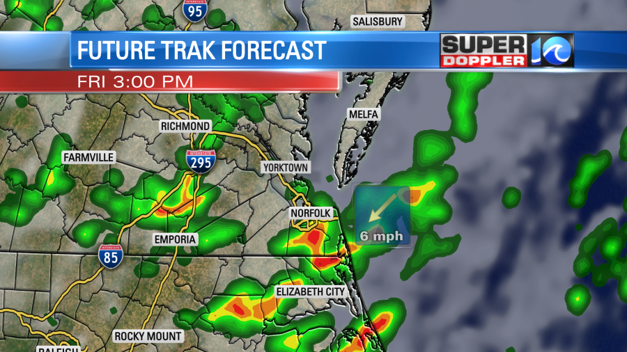
The showers and storms will be on and off today. Heavy rain could move slowly over some cities as we go into the mid afternoon and evening.
This is doubly bad because a lot of the ground is still saturated from recent rains. We’ll have lots of clouds through the day with high temps in the mid 80s. It will be very muggy, and there won’t be much wind.
The showers and storms should taper off this evening. The front will stall out to our south tomorrow. So we’ll still have some more scattered showers and storms. However, we should have more sunshine, and the chance for rain isn’t as high. (80% today, 50% tomorrow). We’ll have quieter weather on Sunday with partly cloudy skies and only some isolated showers or storms. High will be in the 80s all weekend.
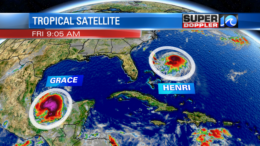
We are watching the tropics closely. This morning Grace has fluctuated in strength over the last 24 hours. It looks like it had minimal damage over the region as it moved over the Yucatan Peninsula yesterday. It was a hurricane upon landfall. Then it weakened to a tropical storm over land. However, now it has restrengthened into a hurricane over the Bay of Campeche.
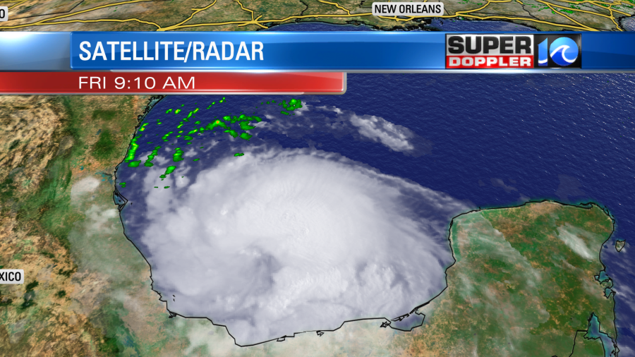
Grace will move towards mainland Mexico late tonight into early tomorrow morning. It is forecast to make landfall somewhere north of Veracruz. Then it will move inland and weaken. However, it could be a tropical storm as it possibly moves close to Mexico City during the weekend. Heavy rain, flooding, and possible mudslides will affect that whole region.
Meanwhile, we are keeping a close eye on Henri. It is a tropical storm as of this writing, but it is forecast to become a hurricane.
The system has been moving generally to the west, but it is forecast to make a sharp turn to the north as an upper level trough (now over us) starts to impact the storm. It will likely be a hurricane a couple hundred miles offshore on Saturday.
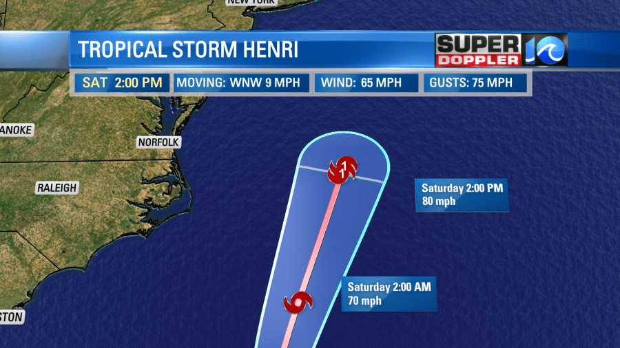
The models are in very good agreement in keeping it well offshore as far as we are concerned.
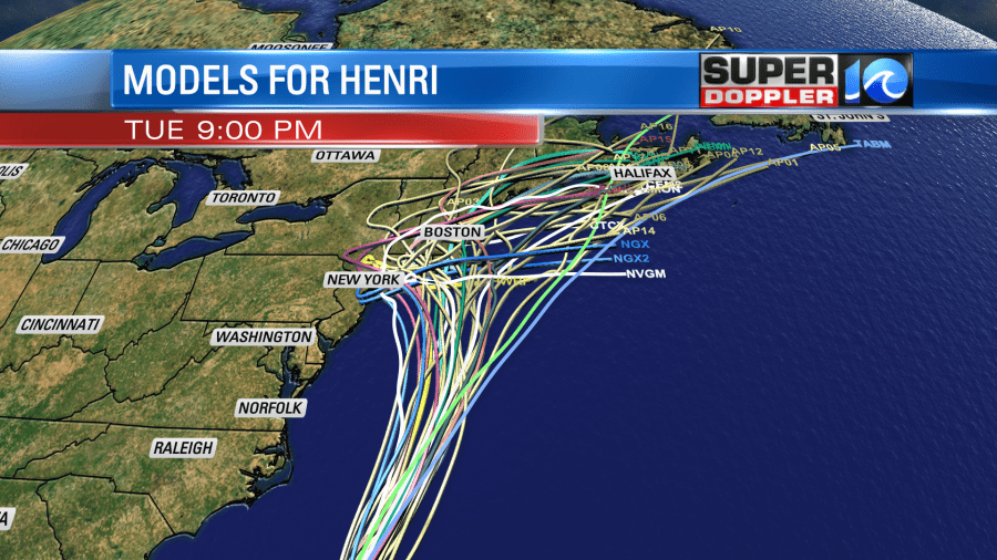
However, the models are also showing Henri taking a bend to the west over the weekend. Unfortunately, this could mean that Henri might be a landfalling hurricane in the northeast states on Sunday.
We are talking about it possibly hitting Long Island, NY, Newport, Rhode Island, and/or Martha’s Vineyard. It is has been a long time since that area has been hit directly by a hurricane. Hurricane Sandy comes to mind, but I think technically it wasn’t a hurricane at the time of landfall. Plus, it made landfall in New Jersey. Someone in the newsroom mentioned hurricane Bob in 1991.
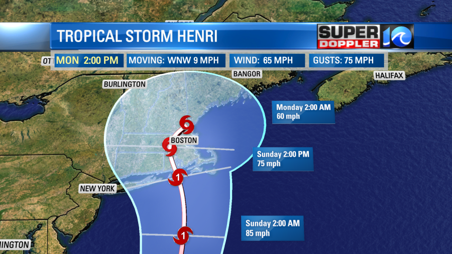
Anyway, Henri will cause a lot of problems up there this weekend. It will move north after landfall and weaken. It could still be a tropical storm as it runs towards Boston. Then it will weaken further and move to the northeast.
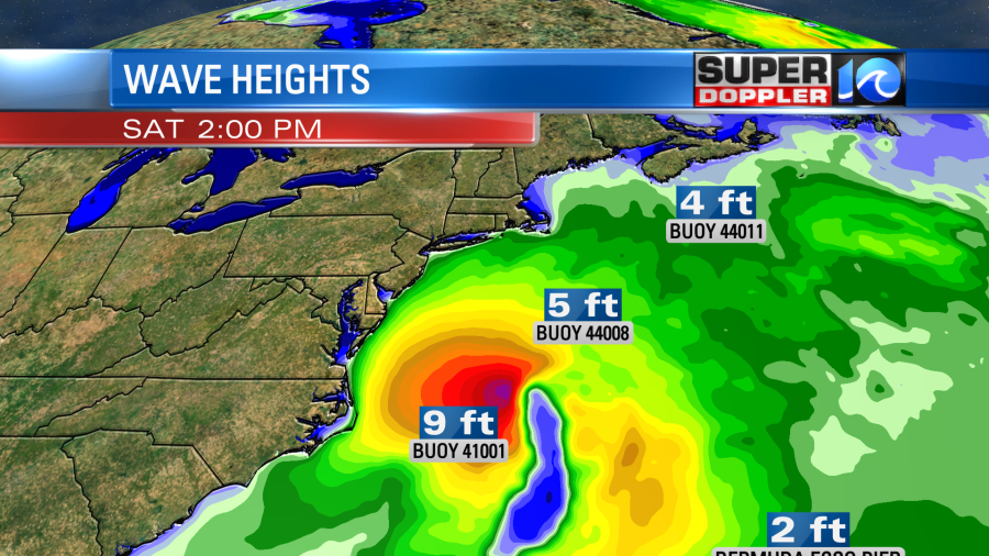
While the rain and wind from Henri will stay offshore from our area. We will still have some indirect impacts. The biggest thing will be the waves. Large swells will push onto the East Coast this weekend. We already have a high threat for rip currents at the beaches today. There will be a high threat on Saturday and possibly Sunday as well. Waves will probably run about 5-6 feet on Saturday along the Outer Banks with possibly a few higher. I think they will run about 3-4 feet in Virginia Beach with a few 5 footers.
So this is great news for surfers, but bad news for swimmers. Some of this is apt to change. Check back for updates through the weekend. Meteorologists Jeff Edmondson and Steve Fundaro are surfers. So they should have a detailed report over the next couple of days.
Meteorologist: Jeremy Wheeler