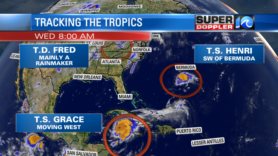
Our local weather is still fairly quiet today. We don’t have any tropical systems nearby. Instead there is high pressure to our southeast with a stationary front to our north. Fred is pretty much just a rainmaker over the Ohio River Valley.

The bulk of the rain form Fred will stay to our northwest. However, we’ll be clipped by a few showers and storms later today. A few spots of heavy rain will be possible, but the showers themselves should be pretty hit-or-miss. High temps will run up to near 90 degrees, but the heat index will be in the upper 90s. We’ll have similar weather tomorrow, but Fred will be dissipating over the Great Lakes. There will be a few showers and storms. Otherwise we’ll have a mix of sun and clouds with high temps near 90. We’ll have a higher chance for rain on Friday.
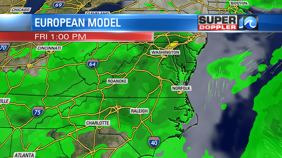
There will still be lot of deep humidity in the region. Plus, a weak disturbance will roll over us overhead. High temps will be more in the upper 80s.
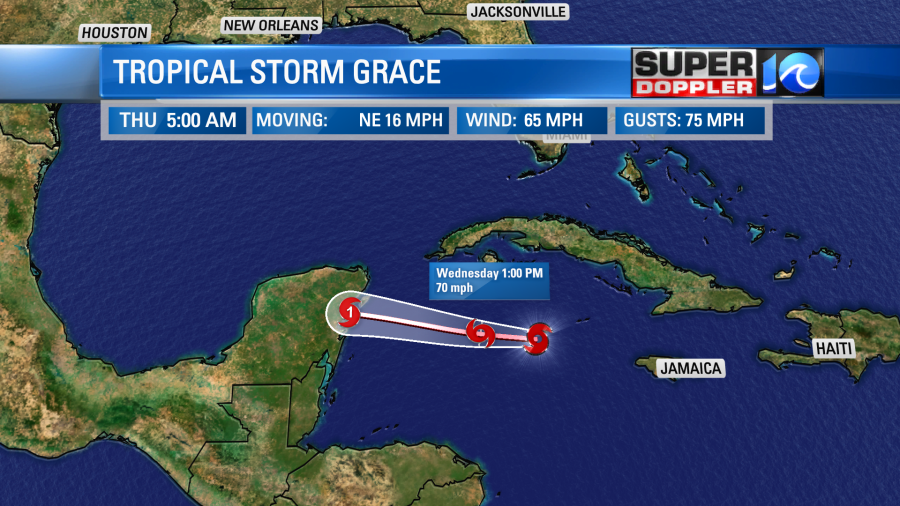
In the meantime… Tropical storm Henri is churning to the southwest of Bermuda. Tropical storm Grace is strengthening southwest of the Cayman Islands.

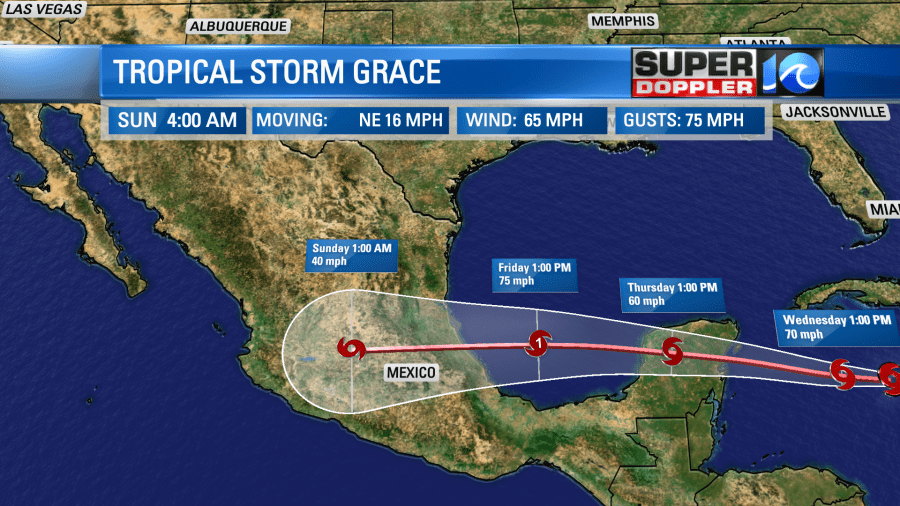
Tropical storm Grace will head west towards the Yucatan Peninsula today. By tomorrow morning it will move over or very near Cozumel, Mexico. It is forecast to be a category 1 hurricane by that time.
After crossing the Yucatan and briefly weakening Grace will move back over the warm waters of the Bay of Campeche. This will likely allow for restrengthening. It could become a hurricane again before making another landfall over eastern Mexico.
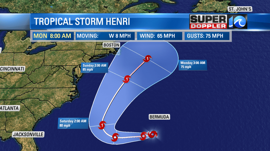
In the central Atlantic we have tropical storm Henri. This is to the southwest of Bermuda, and it is moving generally west. It has also been strengthening, and it is now forecast to become a hurricane in a few days.
The storm will eventually hook around to the northwest, north, then northeast. Before it looked like the track was sure to keep it offshore. Now the western edge of the cone of uncertainty touches part of the northeastern U.S. and Nova Scotia, Canada.
The models have been trending west too. (which is not good).
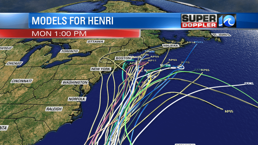
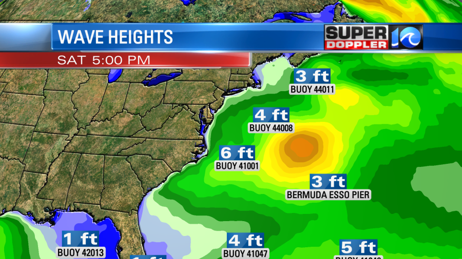
It still looks like it would stay away from our region, but we’ll have to watch this trend closely. I’d be a little more nervous about it if I lived up around Nantucket. Either way I do think we’ll still get some decent swells/waves here from Henri. For now I’m thinking there could be some 4-5 waves over the Outer Banks on Saturday, but that could change.
Check back for updates on these features.
One last thing…NOAA released a statement a few days ago saying that July 2021 was the hottest month on record. No surprise considering some of the regional temps smashed records over a few parts of the globe.
Meteorologist: Jeremy Wheeler