If you look at the temperatures over the last couple of weeks, you’ll notice that there were some steep rises and falls, almost like mountains and canyons if you will.
Take a look:
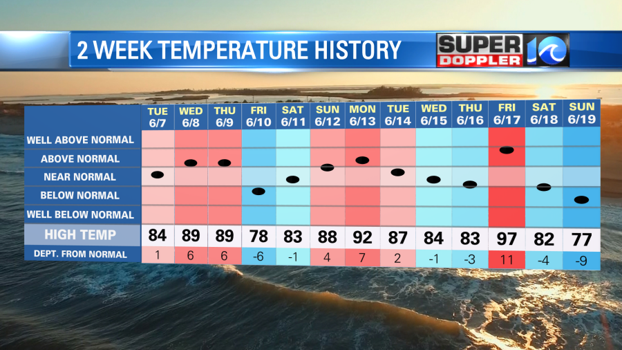
We just came off of a seasonably cool weekend with high temps in the upper 70s to low 80s. We will warm up again this week, but it will be more subtle (more like hills and valleys). So today we’ll have an awesome day. High temps will be in the low 80s with dry conditions.
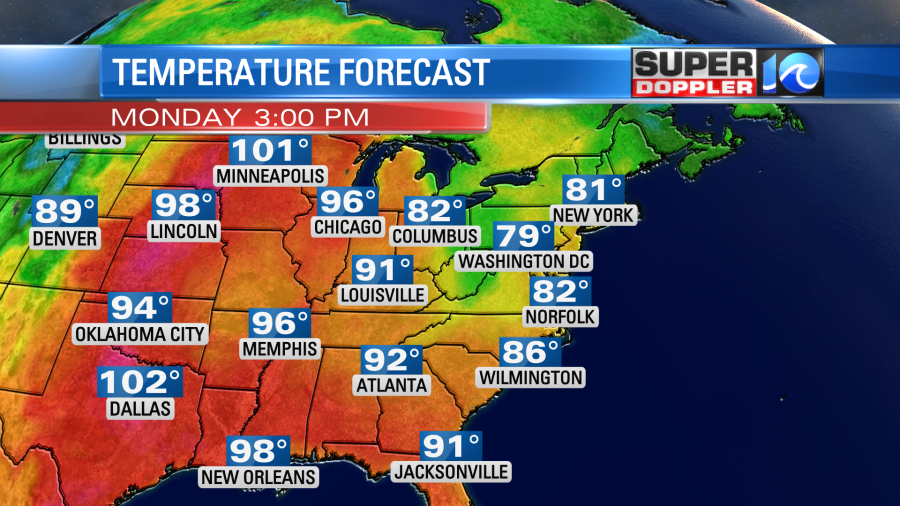
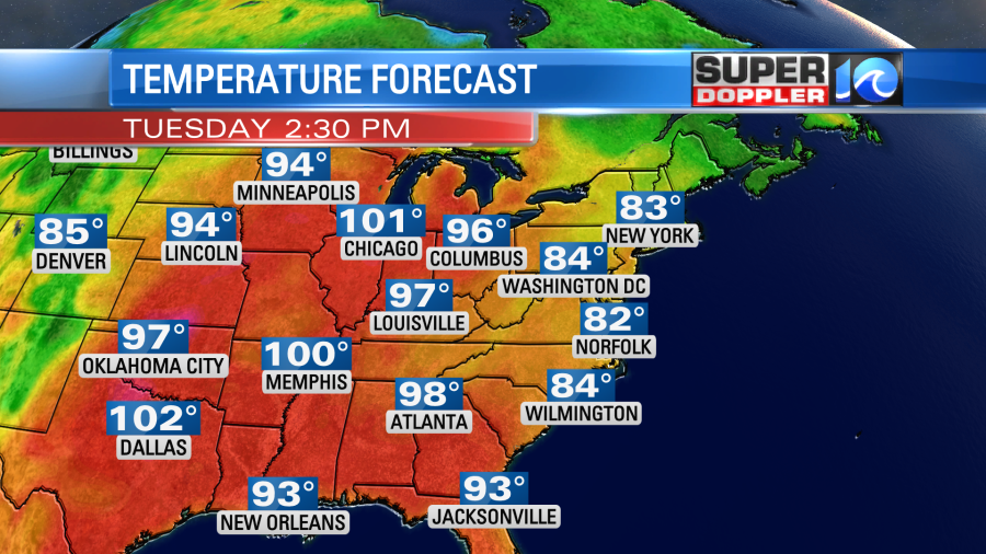
Meanwhile the extreme heat will continue over parts of the central U.S. They will be hitting 90s and 100s again out there. High pressure is in the region with a stalled out cold front way to our south.
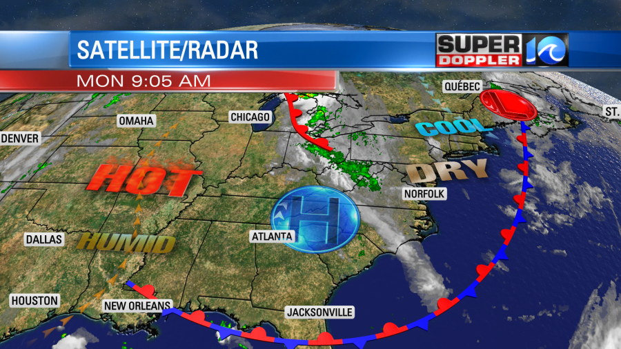
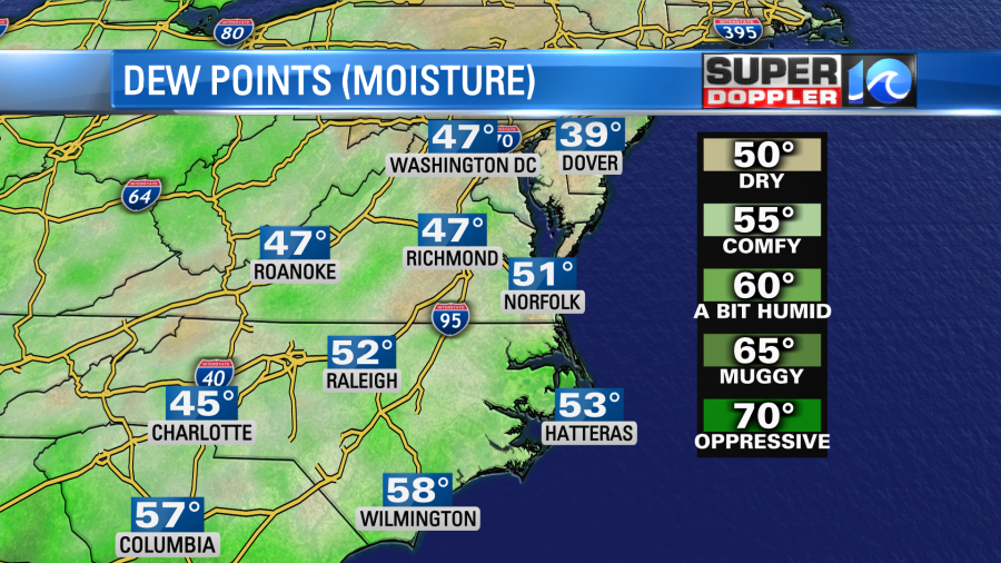
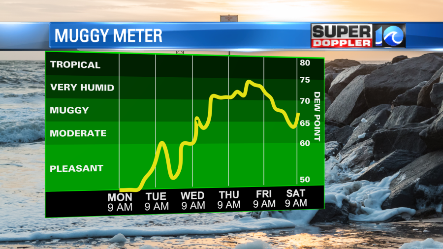
We’ll still have a breeze out of the north, but it will be much lighter than yesterday. It will run at 5-10mph with 5-15mph near the shore. This will continue to pull down the dry air from the north. Dew points have dropped to the 40s and 50s.
Tomorrow high pressure will move a little bit. We’ll have more of a light west wind in the region. The humidity will increase slightly. We’ll be partly cloudy through the day with only some isolated showers possible. We’ll have a light west wind. So temps will be able to warm to the mid 80s. If we get a little more sun, then we’ll likely hit the mid-upper 80s.
By Wednesday we’ll have a back door cool front stalling out over the area with a stronger cold front closing in from the west. The humidity will also be rising through that time.
This will all work together to bring us more clouds and some scattered showers and thunderstorms. Some of the area needs rain more than others. However, I think we could all use a shower by then. (At least our yards and gardens will….he he he). High temps will be in the mid 80s. We’ll have some of that rain continue into Thursday morning, but we’ll probably dry out by the afternoon. Check back for updates on that.
Meteorologist: Jeremy Wheeler


