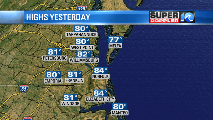
Yesterday we ended up in the low-mid 80s with lots of sunshine. It was awesome out because it was still dry and a bit breezy.
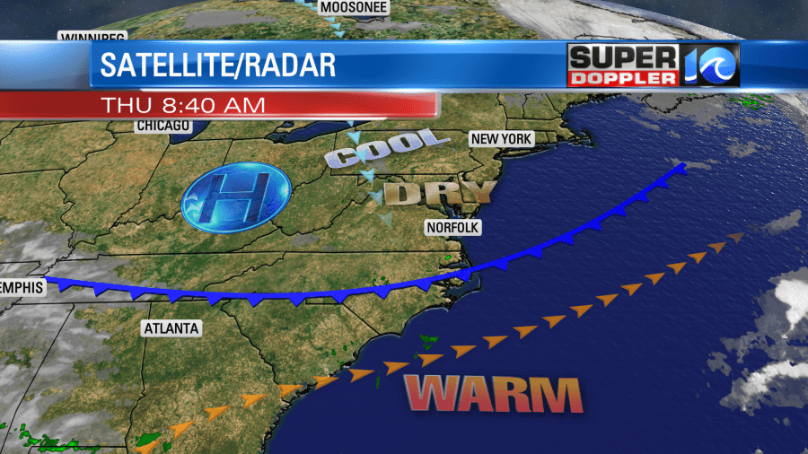
Today a cool front is dropping to our south. It passed through as a dry front early this morning. So there were no clouds and no rain showers. High pressure is edging closer to our area.
We’ll have a lot of sunshine today with a light north breeze. High temps will be in the mid 70s, and the humidity should be low. Awesome! We’ll start off with cooler temps tomorrow. Lows will be in the 50s with a few 40s inland. Then the afternoon will be great! We’ll have mostly sunny skies with high temps in the lower 70s. Saturday still looks pretty decent. We’ll have a mix of sun and clouds. There will be a little bit of moisture moving into the region. So there may be some isolated showers. However, Sunday into Monday looks pretty wet as the deeper moisture from the remnants of Delta move our way.
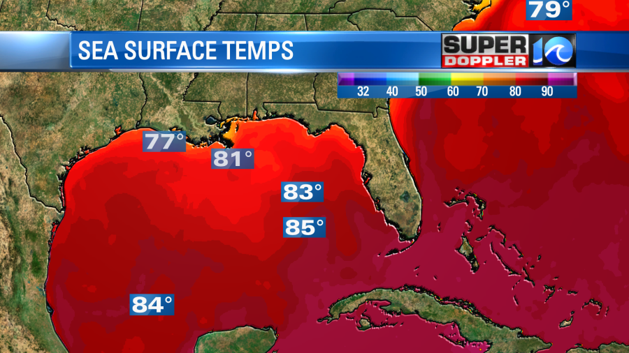
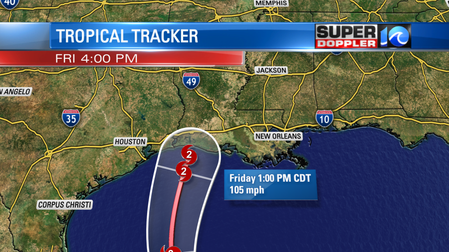
Currently delta is a hurricane in the central Gulf of Mexico. It is moving over very warm water (mid 80s). This should allow for some strengthening over the next 12-18 hours. Also, the wind shear is low. As the system moves northward it should encounter increasing wind shear. Also the water temps near the coast are several degrees cooler.
This could potentially weaken Delta before it makes landfall. Maybe even more than forecast. The latest track has it making landfall as a category 2.
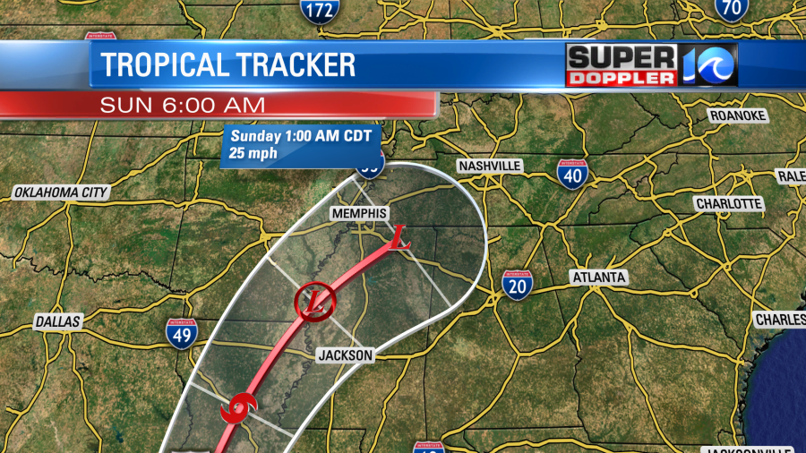
This is over the same area that hurricane Laura hit a few weeks ago. So cross your fingers, and say a prayer for the folks down there in western Louisiana. The hurricane will then move north/northeast and it will weaken quickly. It will fall apart over the Tennessee River Valley by Sunday.
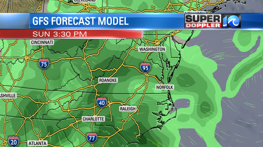
The moisture from the system is still expected to move up into the Mid Atlantic. Yesterday the models were split, but today there is more agreement in this scenario. So there is increasing confidence in rain showers for Sunday into Monday. Here is the GFS model on Sunday.
It’s still early for a decent rain totals forecast, but our area could see about a half inch to an inch of rain, but some models show a little more. I’ll be more specific in tomorrow’s weather blog.
Meteorologist: Jeremy Wheeler