
Update….Tropical depression 5 has become Tropical Storm Danielle.
Locally, we are going to have some great weather over the next few days. Today we started off right with lots of sunshine and temps in the 60s and 70s.
There were even a couple of upper 50s mixing in early on. We have a stationary front to our south with a cool front to the north.
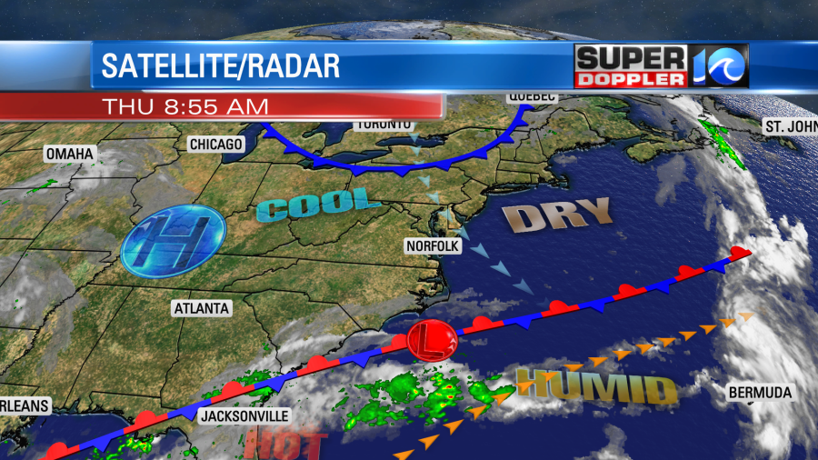
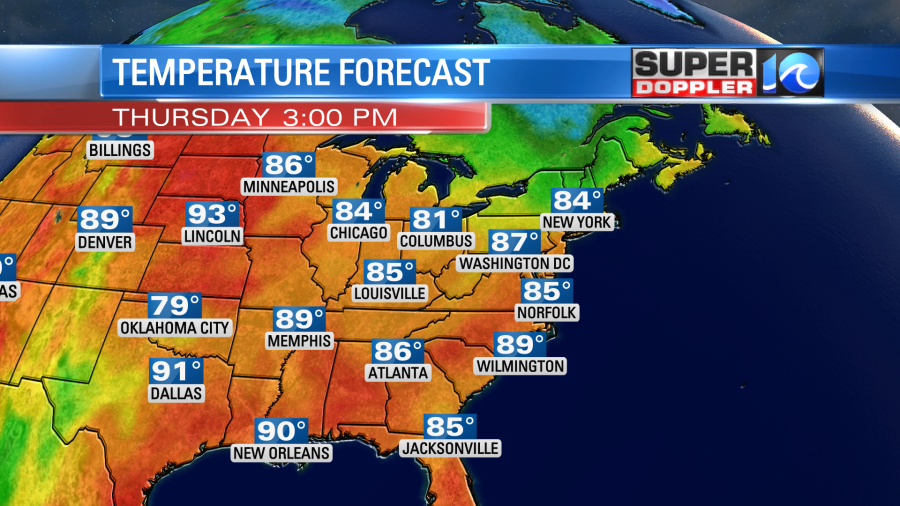
High pressure is centered to our west. We’ll have lots of sun today with a few clouds. There will be a steady north wind at about 10mph. This will keep the temps down a little. So highs will be in the mid-upper 80s with upper 80s inland.
The humidity is down, but it won’t be that early Fall type of dryness. Rather it will be the late Summer type of dry. Dew points will be in the low-mid 60s for a while.
Temps will stay in the 80s through the weekend. That cool front on the above map will move through during the weekend. It will reinforce the mild/dry air.
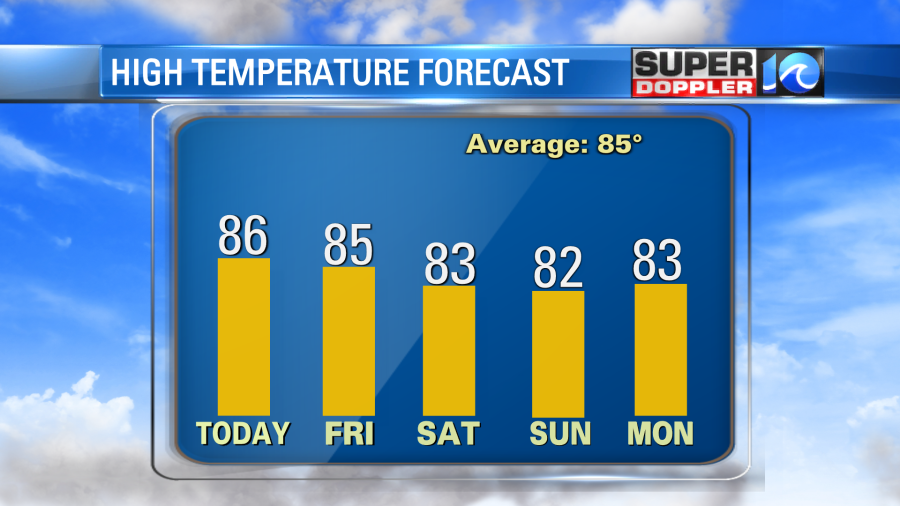
There may be some isolated showers on Monday as the humidity increases a little bit again.
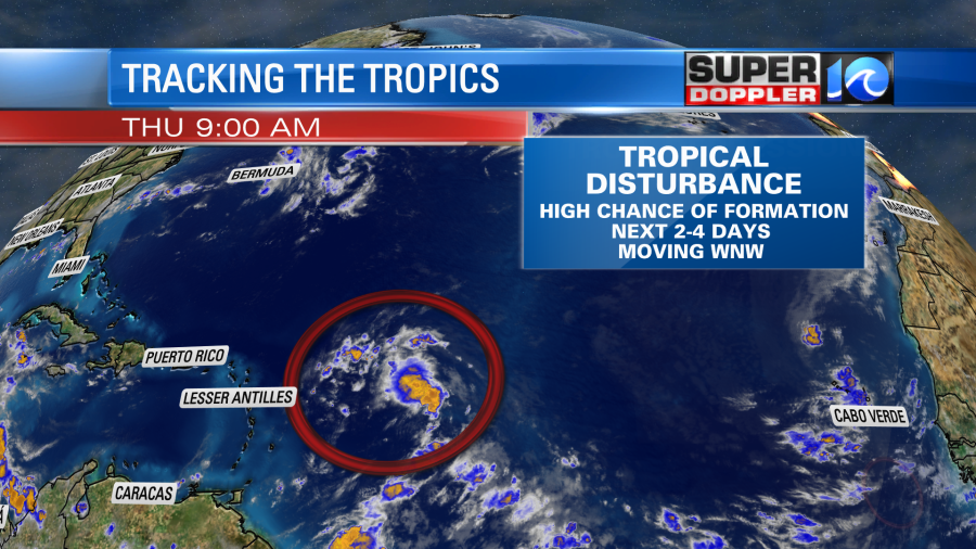
Things are picking up in the tropics. Early this morning the National Hurricane Center labeled the tropical disturbance in the north-central Atlantic as a tropical depression.
Update: Now Tropical Depression 5 is Tropical Storm Danielle. The forecast track is about the same.
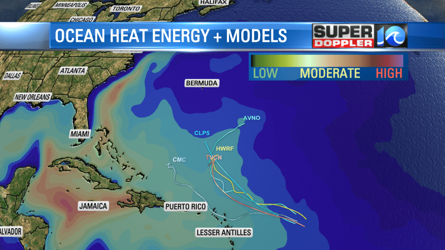
Tropical depression 5 is on a slow easterly track. It is in a region of weak steering currents. So the forecast has it basically drifting around and strengthening over the next few days. There is a strong upper level high overhead and hardly any wind shear. Upper level highs help to induce outflow at the top of a tropical system. That can really help to strengthen a system. So it could become a named storm by midday. It is currently forecast to become a hurricane by the weekend.
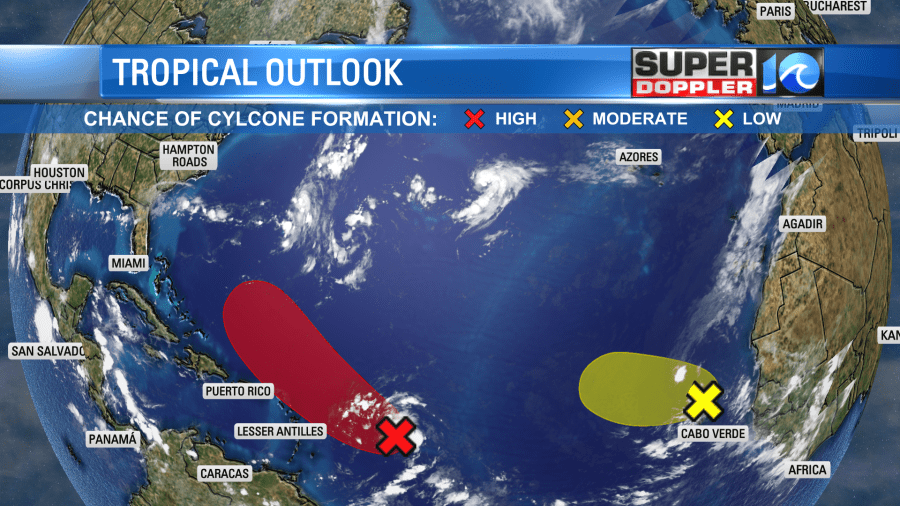
Meanwhile the tropical disturbance in the eastern Atlantic is moving slowly westward. It now has a low chance of formation over the next few days, but it is likely to stay out to sea anyway.
It is running out of time to form as the upper level winds are unfavorable for development down the road (or waterway).
Finally, the tropical disturbance in the middle of the Atlantic is really perking up. It may be a tropical depression or tropical storm by later today.
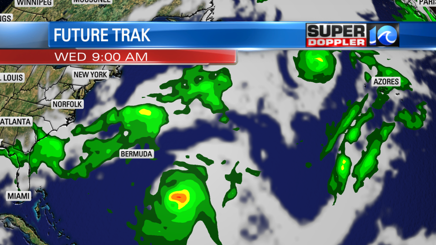
That one is still a little concerning because it is moving to the west/northwest. It is forecast to strengthen as well. However, the latest models keep trending east. So there is a growing confidence that it will stay out to sea.
In fact our Future Trak model now even keeps it to the southeast of Bermuda.
Even if these systems form and stay out to sea, they would likely bring us some higher waves (swells) and a higher threat for rip currents. This could potentially impact folks heading to the beaches on Labor Day. So stay tuned for updates on the tropics.
In world news there is some rare and sad news today. A toddler was killed the other day by a large chunk of hail in Spain. The child was 20 months old. The hail had a diameter of 4 inches. About 50 other people were injured from other hail in the storm. It’s very sad news. Here is the article with more information: Child dies after being hit by large hail.
Meteorologist: Jeremy Wheeler


