Halloween is on a Monday this year. However, there will be some events over the weekend. If you have outdoor plans (Halloween or not), then there will be some speed bumps but no big roadblocks in the weather.
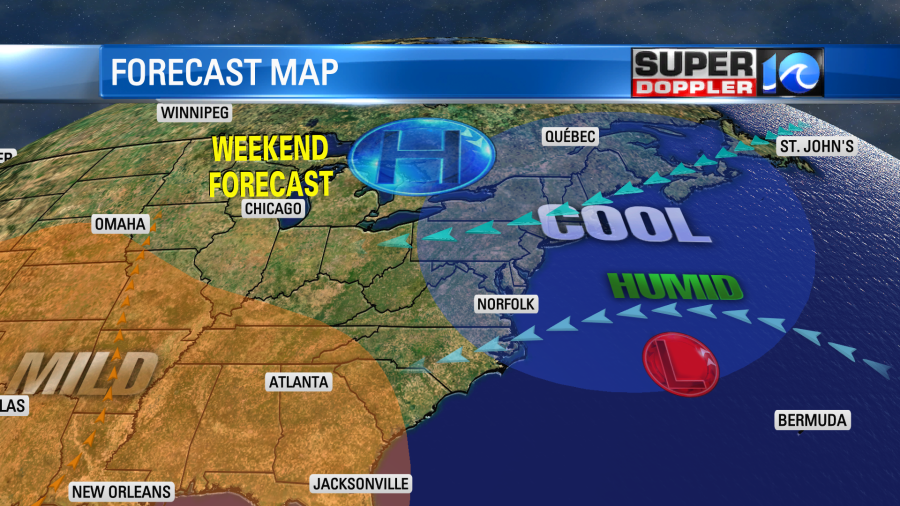
Today we have a cold front moving far offshore and stalling out. It is stopping near an area of low pressure that is also offshore.
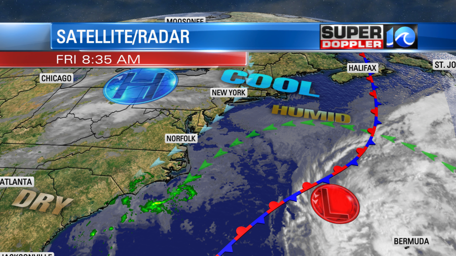
The low will stay out to sea, but it will play a big part in the weekend forecast. Meanwhile high pressure is lifting slowly to the north towards the northeast states. We have already had clouds increasing this morning. At this point it looks like we’ll have lots of clouds through the day. There were even a few spotty showers this morning across the Outer Banks and Mainland Dare county. They were moving slowly to the north.
So get ready for a pretty cloudy, damp, cool, and breezy day today. There won’t be any big rain showers, but there will be some spotty showers and sprinkles.
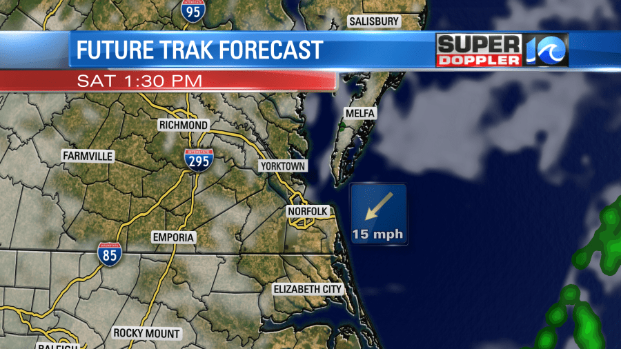
future trak pm
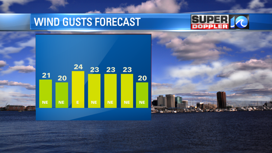
The low chance will start up by midday and it will go through the afternoon. The chance may increase a little more by the evening. That could impact the Friday night football games. Also winds will stay strong out of the northeast. Wind gusts will be up to 25mph with a couple of gusts to 30mph possible near the shore.
The combo of clouds, winds, and spotty showers will keep temps down in the low 60s this afternoon.
This weather pattern will continue into tomorrow. The high will sit to the north. The low will sit offshore. We’ll have the long stretch of northeast winds in-between.
Some of the models have a little clearing for tomorrow. Our Future Trak model actually looks partly cloudy for a while.
However, it doesn’t do well with low-level moisture. So looking at all the models I’m calling for partly to mostly cloudy skies Saturday with some more spotty or isolated showers. They may be more in the morning than the afternoon, but the chance is low either way. Northeast winds will continue. The persistent northeast wind will create some nuisance to minor tidal flooding later today into Saturday.
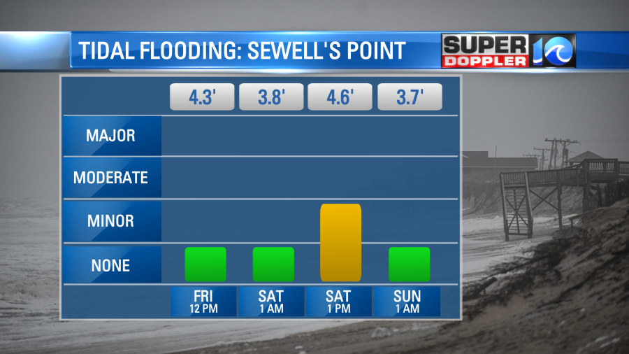
It shouldn’t pose too many problems, but some folks that live in areas prone to tidal flooding may have to move their vehicles.
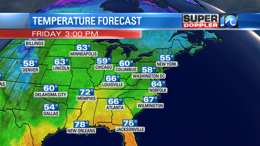
By Sunday the high and the low should shift around a bit. So the wind shouldn’t be as strong. The tidal flooding won’t be as high. However, there will likely still be some rough seas, high waves, and a little ocean overwash all the way through Sunday. Despite the weaker winds Sunday, the moisture will still keep flowing in. So we’ll be mostly cloudy with more spotty showers. Highs temps should be able to warm a bit. They will be in the upper 60s.
By Monday the pattern changes again. We’ll have more of a south wind. There will be a cold front moving in from the west. There will still be some moisture in place, but I think we’ll have more of a mix of sun and clouds. There may be some isolated showers during the day, but it looks like a low chance.
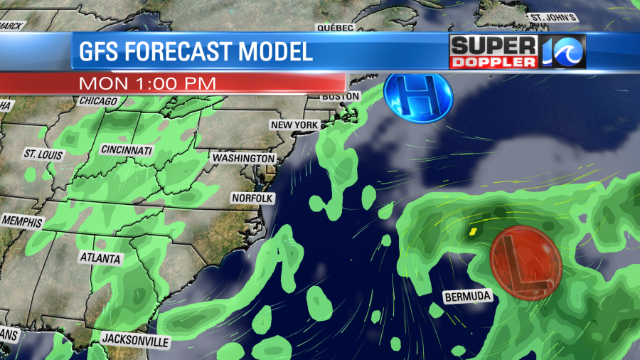
There could be a stray shower in the evening, but it also looks like a low chance during trick-or-treat hours. High temps will be in the low 70s during the day. We’ll likely be in the 60s in the evening. I think it will be good overall, but stay tuned for updates.
There is a little activity in the tropics. There is still a low chance for the low that I mentioned above to become tropical or subtropical.
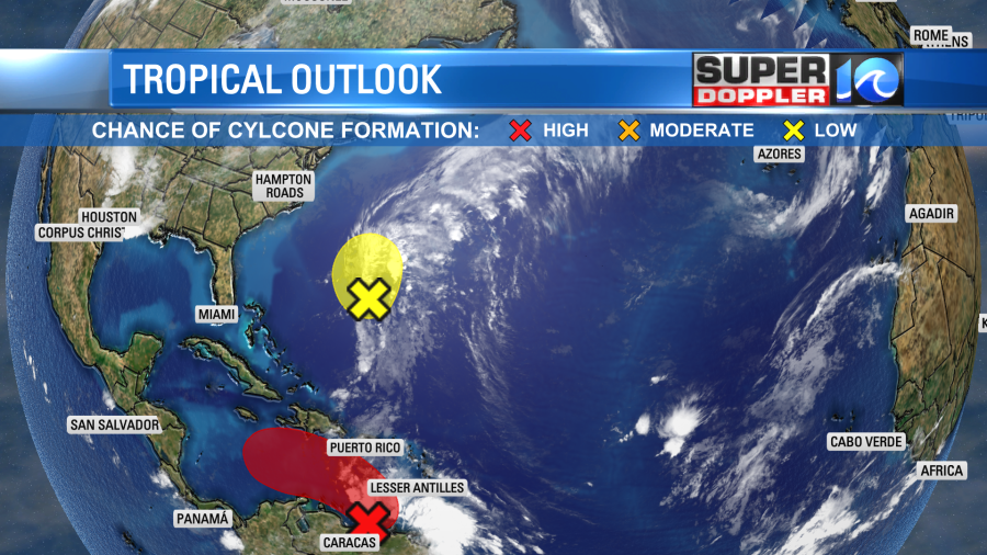
However, whether it becomes tropical or not the effect should be the same over the weekend. There is another feature that is developing near the Lesser Antilles. It is moving west. It now has a high chance of formation over the next few days. It may impact Central America and coastal Mexico with some heavy rain and gusty winds. Stay tune for updates.
Meteorologist: Jeremy Wheeler