If you love warmer weather, then I will say that “I think you’ve had you’re time”. Let us have some cool weather back. It’s mid-December. 50s….fine! Some 60s….fine! But low-mid 70s? That’s a bit too warm for this time of year. Let’s talk about it.
Today we will start the warming trend. This morning we had temps mainly in the 40s with a few 30s inland and a couple of 50s near the shore. High pressure is overhead, but there is also a subtle wind-shift near the shore and bay.
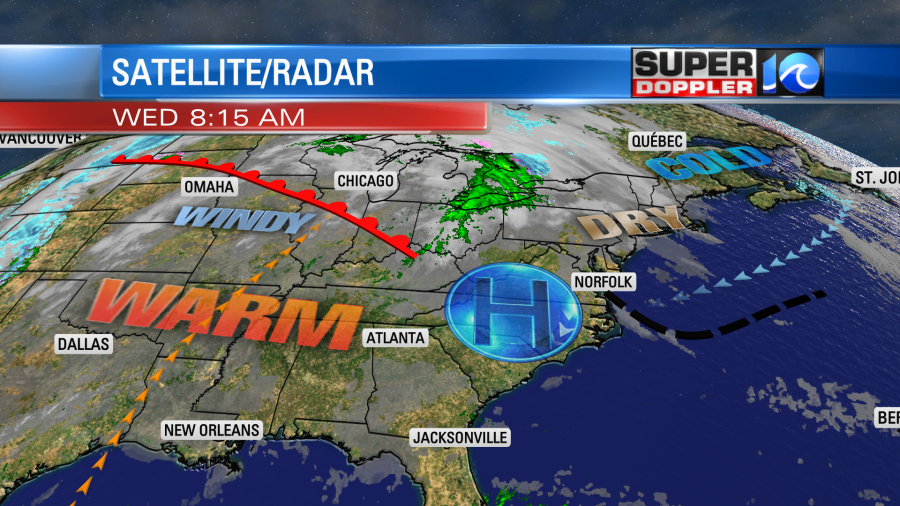
There is a strong warm front over the north-central U.S.
The local wind shift will be from northeast to out of the southeast today. That may kick off an isolated or stray shower, but the bulk of the day (and the area) will be rain-free. High temps will rise to the low 60s this afternoon. Overall, it will be a nice day! It will be very warm over the central U.S. Some of the temps will run about 25-35 degrees above average.
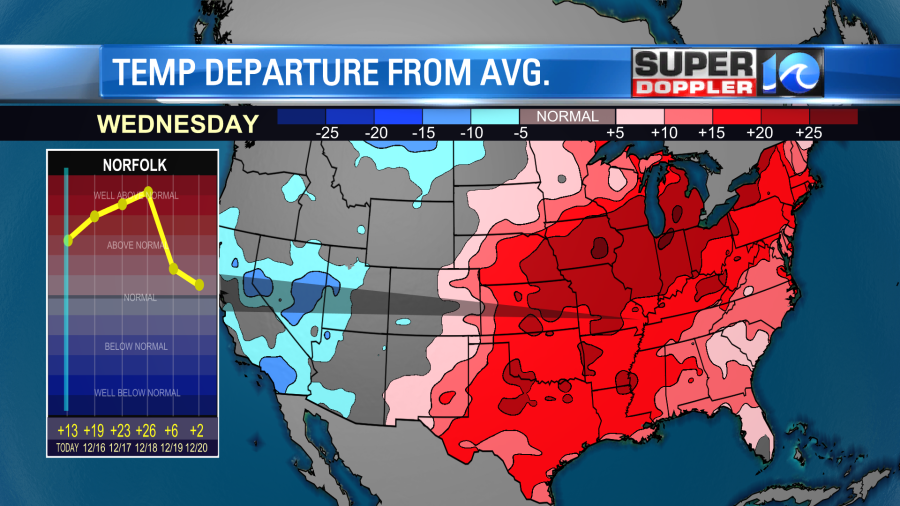
Many records are likely to be broken out there if not smashed. High temps will run up to the 80s in the Deep South and 70s as far north as Iowa and Illinois. It will also be very windy out there. High Wind Warnings cover a large part of the central U.S.
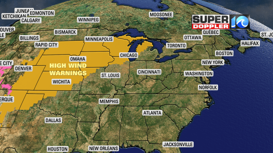
Wind gusts may be up to 60 to 70 mph. That’s outside of any storms. However, there will be some storms out there tonight. Some of those could be severe.
Locally, tomorrow we will warm up even more. We’ll have partly cloudy skies with a southwest wind at 10-15mph. No rain is expected. So our local high temps will push up into the upper 60s. There may already be a couple of 70s inland/south. The average high temperature is in the mid 50s for this time of year. If you think that’s warm, well….. We’ll be near 70 on Friday with partly cloudy skies. It will feel like Spring or early Fall.
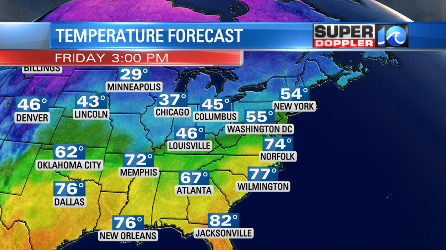
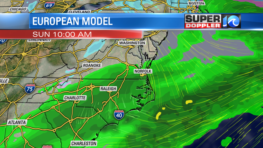
The record for Friday is 73 degrees set back in 1924. We may challenge that record. We’ll warm up even more on Saturday. High temps will (probably) be in the low-mid 70s. However, there will be a cold front to our north. If it gets a little closer, then that could change the forecast. For now I’m calling for a mix of sun and clouds with some isolated showers. Another cold front IS expected to move in by Sunday. This will bring us a cool down and a decent chance for some rain. High temps will be knocked down to the mid 50s. The European computer model has scattered rain showers for the first half of the day.
We’ll likely be in the 50s for most of next week. So no cold air in sight.
Meteorologist: Jeremy Wheeler