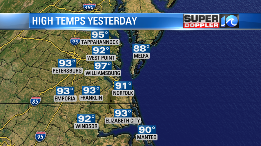
We are going to be cookin again today. I have to say that yesterday was the hottest I’ve felt in a long time. I know that we’ve easily been hotter in the last couple of years. So I don’t know if it’s mostly perceived or if it truly was that hot out. I live a little inland over the Southside. High temps were in the low-mid 90s with a couple of upper 90s inland.
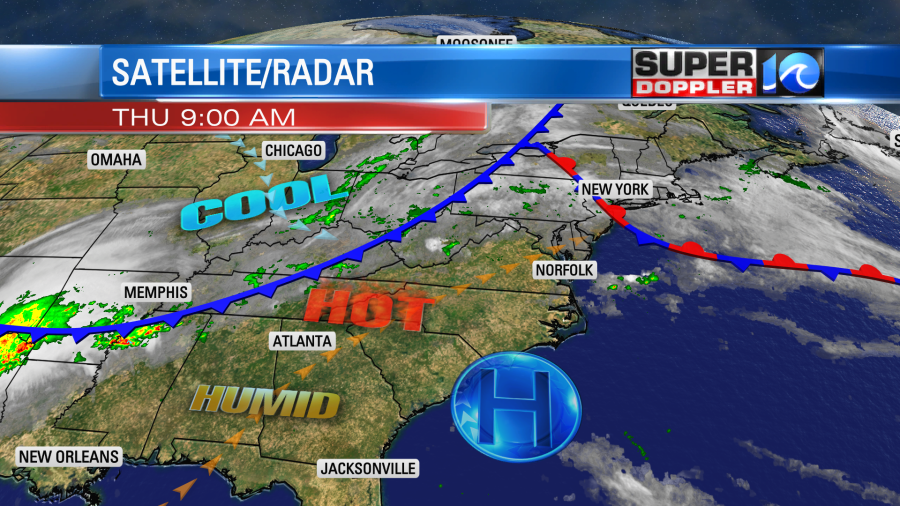
We’ll have that same type of heat today, but there will be more clouds and a few thunderstorms. High pressure is to our south. A stationary front is to the northeast. A strong cold front is to the west.
We’ll have partly cloudy skies and a light southwest wind for a while. This will pump the temperatures up to the low-mid 90s again. The heat indices will be in the mid-upper 90s. We’ll have some scattered showers and storms firing up by the early-to-mid afternoon. Some strong to severe storms will be possible during that time.
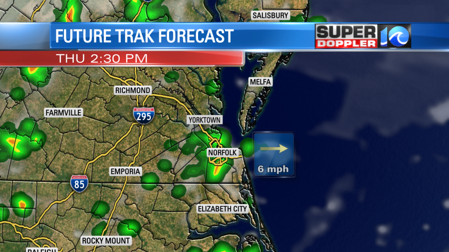
More scattered showers and storms will continue between the mid afternoon and early evening.
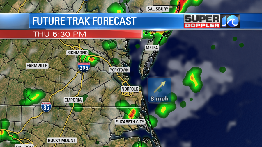
There may be a few strong to severe storms. We do have a slight risk for severe weather for southeast Virginia with a marginal risk for northeast North Carolina.
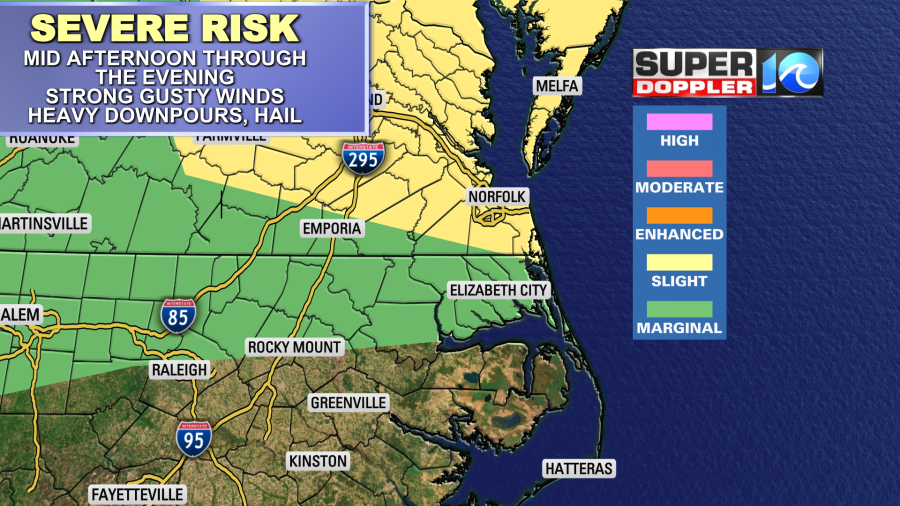
Some of the storms will have some strong gusty winds with heavy downpours. Some hail will also be possible, but it is a lower threat. We will have a high amount of instability, but there won’t be much wind shear. So a lot of these storms could be pulse-type storms. Those are brief strong storms that literally fire up and then go back down in a short period of time. These can create some downbursts of wind if they are water loaded. We’ll see. Either way the storms will taper off later this evening into the overnight. The cold front will move through in the late evening. Then we’ll dry out a little bit overnight. There will still be enough moisture for a few spotty showers to continue into tomorrow morning. The front will slowly drop to the south. So we could hold on to some spotty showers until midday Friday in southeast Virginia. A few showers may continue until 3pm in northeast North Carolina. Either way we will be much cooler and a little drier. High temps will drop to near 80 degrees.
We’ll keep drying out Friday afternoon into the weekend.
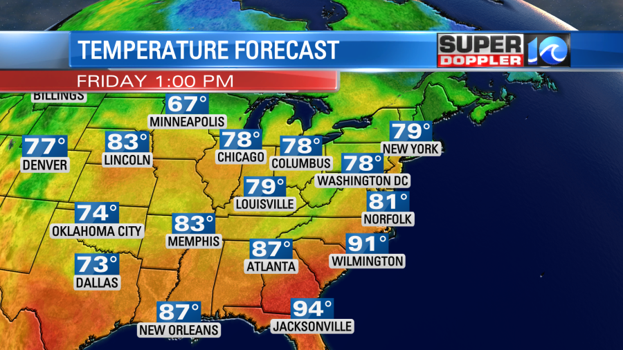
High temps will be in the upper 70s to low 80s Saturday and Sunday. It should be some awesome weather. Then we’ll heat up a little more as we go into the middle of next week.
We are still monitoring that area of disturbed weather in the tropics. A big cluster of thunderstorms was drifting east of the Yucatan Peninsula this morning. It was disorganized, but there were some strong storms down there.
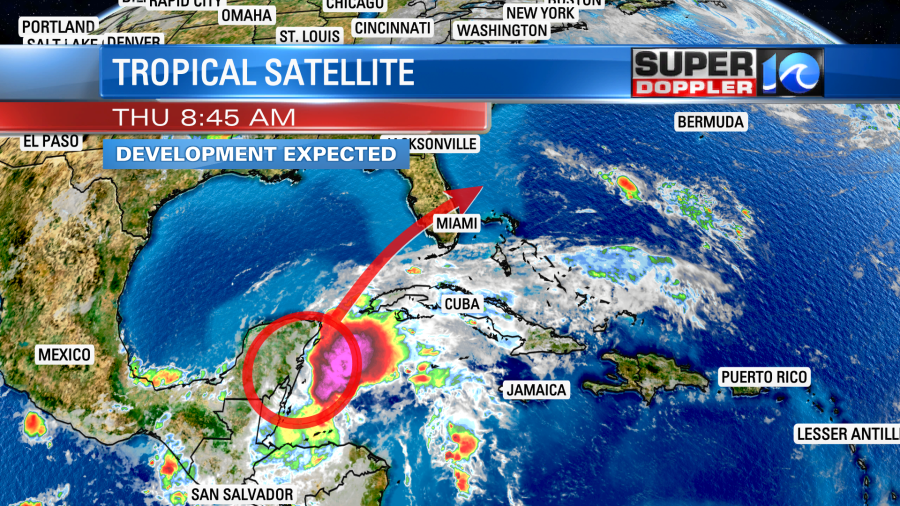
This area has a high chance of developing into a tropical system. It will move to the northeast in the short term. Whether it forms or not, it will bring heavy rain to western Cuba and south Florida.
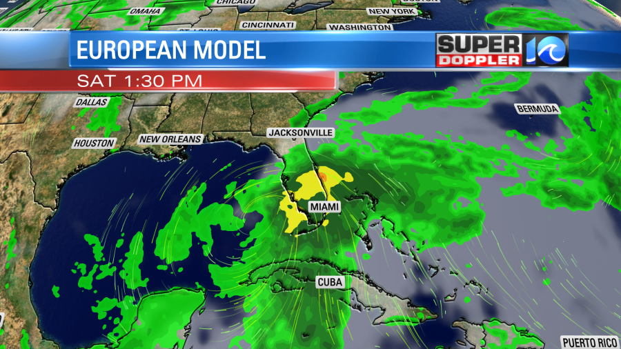
Then the system/feature is likely to move to the east/northeast. It will probably stay out to sea. The GFS and Euro models are coming into better agreement about the track, but they still differ a bit on the strength.

The Euro is a little stronger and a (bit) closer to the coast, but both are offshore after Florida. With the Euro scenario there might be a few showers near Hatteras with a few gusts of wind. However, the bulk of the wind and rain would stay offshore. With the GFS scenario we wouldn’t even get that. The main threat from both outcomes would be a high threat for rip currents along the beaches, and some nice waves for local surfers. It could potentially hit Bermuda. So we’ll have plenty of updates on the tropics over the next couple of days.
Meteorologist: Jeremy Wheeler