Yesterday turned out pretty nice for the region. We had a lot of sunshine through most of the day. However, the temps heated up to the mid 80s. It was humid, but the breeze helped at times. Today we definitely have more clouds. Rain chances will increase through the day. We have high pressure moving farther offshore. There is a long cold front to our west.
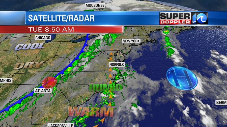
We’ll have a big slug of moisture create some scattered rain showers today ahead of the front.
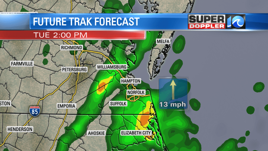
There were already a few this morning. We could have some heavy downpours and a few thunderstorms this afternoon. High temps will rise to the lower 80s. The dew points are in the upper 60s to near 70. This is some pretty muggy air for late September. The average high is in the mid 70s this time of year. So as the cold front moves in tonight it will hit that unstable air mass. There will also be a potent upper level disturbance that will weaken as it moves into our area. The effect will be a line of showers and storms firing up between about 10pm and 2am.
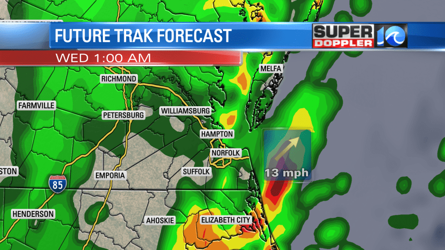
Rain will be heavy at times. There is a marginal risk for severe weather. It’s possible for this afternoon, but I think it’s more likely for tonight. Heavy rain and gusty winds are the main threats. There could be an isolated tornado in the region. There will be a few showers early tomorrow morning. Then they will move out, and we’ll dry out for the rest of the day as the winds pick up out of the west. It will turn into a very nice day with increasing sunshine, highs in the 70s, and dropping humidity.
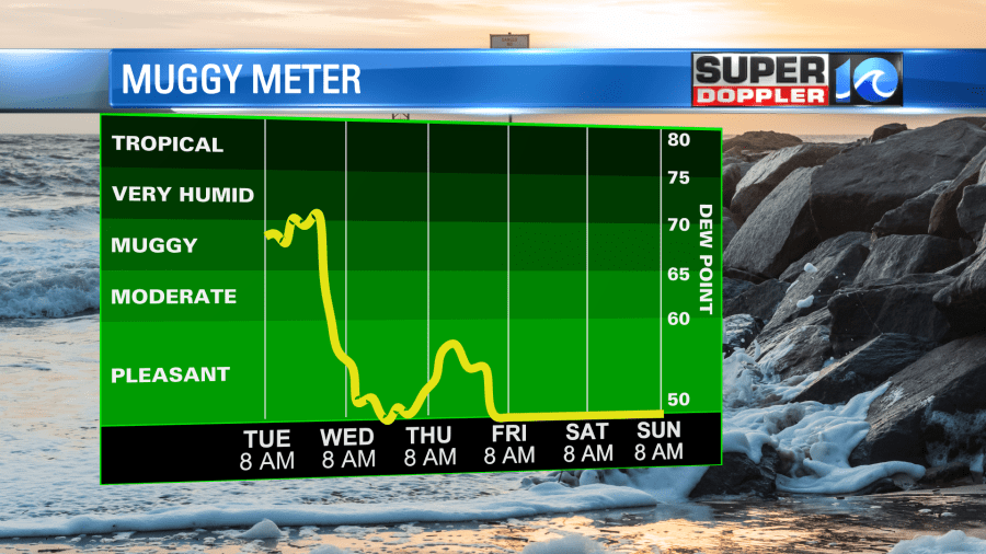
Humidity will basically stay down all the way through the weekend. We’ll be dry and mild on Thursday. A second cold front will move through on Friday. Other than some isolated showers the day should be dry and cool. Then we’ll have cool/dry weather over the weekend.
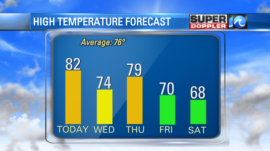
High temps will be in the 60s. Lows will be in the 40s and 50s. It should be great weather for sweat shirts, pumpkin spiced lattes, and camp fires.
However, it is still very hot in the western U.S. The heat has made a comeback there (if it ever let up), and there are more wildfires there as well. Here is an article with more information: Western U.S. heat and wildfires.
The tropics are still quiet, but there may be some development over the next few days over the western Caribbean. Stay tuned for updates.
Meteorologist: Jeremy Wheeler


