Today starts about 3 days of wetter weather in the region. Yesterday, the showers were very isolated/spotty. However, today the coverage will pick up. The overall pattern hasn’t changed much, but high pressure has moved a little farther offshore.
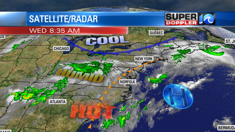
We still have a very hot and humid air mass covering the region. Dew points are in the 70s. The moisture is very thick too. The precipitable water level is 1.5 to 2 inches. That’s basically the total amount of water you could wring out of the atmosphere if you thought of it like a wet washcloth. However, that is over a short period of time. Remember, that type of humidity could hang out for a couple of days. So we could see 1 to 3″ of rainfall between now and Thursday night. It could be locally higher in some places.
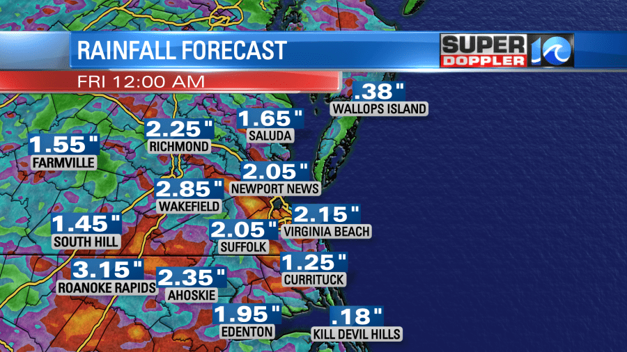
In the next 48 hours some models predict 3-5″ of rainfall:
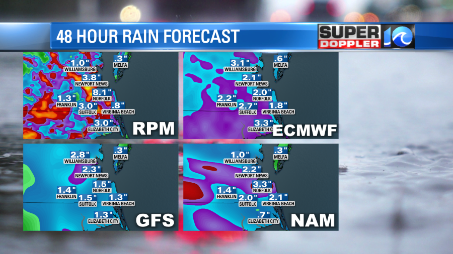
I think the RPM is overdone, but you get the idea that all of this rain could lead to some localized flooding. This afternoon Future Trak shows some heavy downpours and thunderstorms.
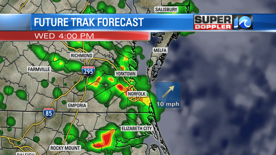
It has some of that rain continuing into the early evening. High temps will run up to near 90, but some of the storms may cool things down this afternoon. Winds will be out of the southwest at 10mph.
We’ll have more clouds tomorrow. There will be more rain and storms popping up in the afternoon and evening. Heavy downpours will be possible. High temps will be more in the 80s. A cool front will finally arrive by Friday. It will move through very slowly though. So high temps will be closer to 80 degrees, but it will still be very humid. There will be more showers and storms.
The front will pass to our south on Saturday. After a few am showers we’ll dry out in the afternoon. High temps will be in the upper 70s. Then we’ll be dry and mild on Sunday with highs in the low 80s. There may be a few showers over the Outer Banks. We’ll see.
So far this month we have had 2.82″ of rainfall in Norfolk. We’ve had 4.68″ over the last 12 days. Some locations still need a little rain, but there are many more that don’t need any for a while.
The tropics are quiet for now, but I am watching a small region east of Nicaragua. A weak area of low pressure could form there over the next few days.

The weather may not cooperate too well for the annular solar eclipse tomorrow morning. It is going to happen around sunrise tomorrow. The maximum in our region will occur at 5:45am (at sunrise). Keep in mind that it will be a partial eclipse in our region. If you are lucky and the clouds break, then you may see something like this:
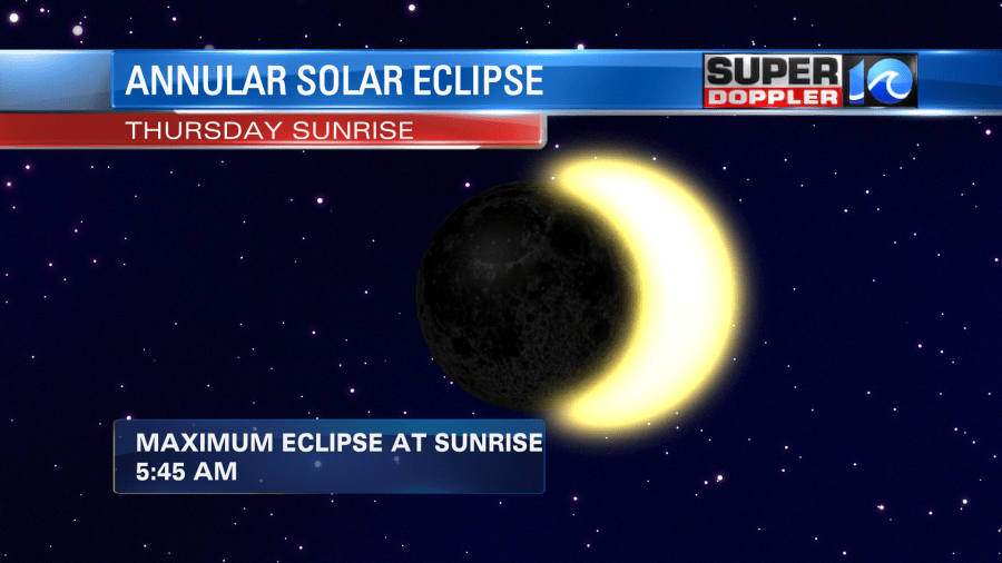
It will end by 6:25am. Don’t look directly at this event. Use a pair of welding goggles or use the special glasses that they made a couple of years ago for the total solar eclipse. Regular sunglasses are not safe enough to use.
Meteorologist: Jeremy Wheeler


