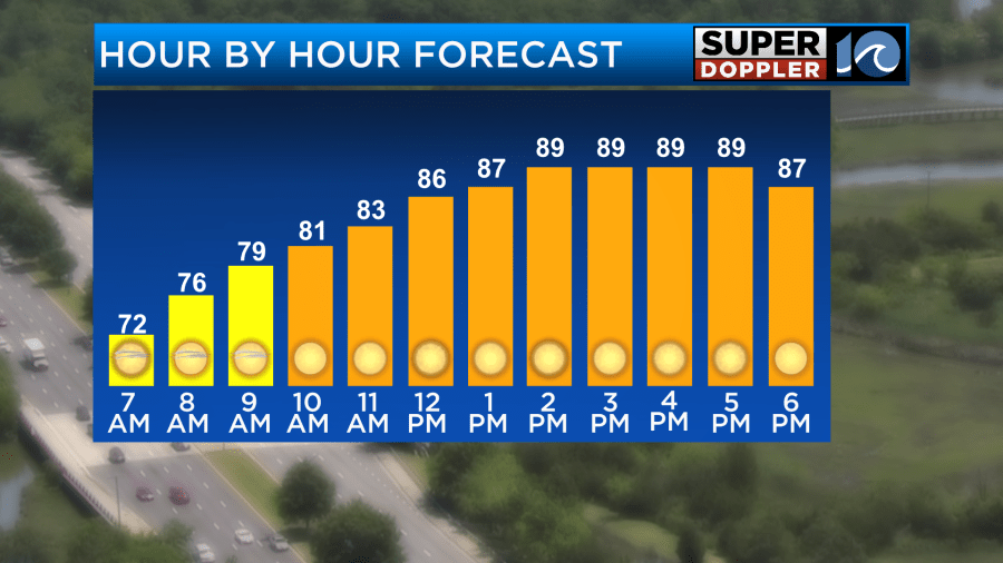
For Friday, temperatures will be closer to 90° with humidity slowly climbing. This will cause the heat index values to be in the low to mid 90s. Not as high as the weekend, but HOT none the less.
The weekend will be the hottest time with highs in the mid 90s and heat indices in the 100° to 105° range! For Saturday, most spots will be around 100 to 102 for a heat index in the afternoon.
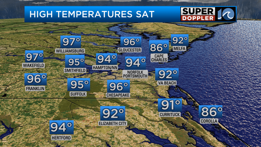
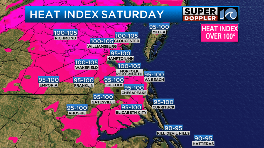
Sunday looks to be the hottest day with heat index values over 105° for a few hours possible. The record air temperature is 99° set in 2015 at the Norfolk Airport. Data from the NWS shows the last time we saw the heat index over 105°F in June was 2018.
Overall, a heat index of at least 100 F is not that uncommon in June, with 55 of 76 years on record at Norfolk (72%). Reaching at least 105 F is less common with 28 of 76 years recording this level at Norfolk (37%).
The last time Norfolk reached 100+ heat index values was June 13th, 2022. The last time Norfolk reached 105+ heat index values was June 19, 2018.
Below is a chart of highest heat index values recorded in June from 1948 to 2023. On the chart, T is temperature, Td is dewpoint. H.I. is heat index.

With us reaching 105+ in a few spots, this level of heat is noteworthy and can be dangerous. Yes, I l know – it gets hot every summer (the stats above show that). However, we know that heat is one of the most impactful and deadly weather events, especially for those who don’t have adaquate cooling, those without a home/shelter, children and elderly. For many of us with good working AC, we just stay inside – but some in our community are not so lucky. So that’s why it’s noteworthy. More people die from heat related issues than hurricanes and tornadoes each year.
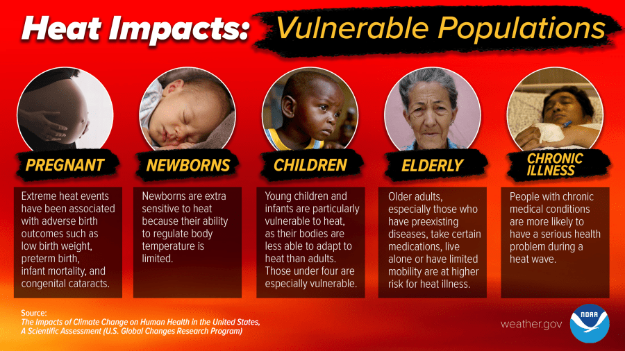
Several Hampton Roads cities will have cooling centers, libraries or community centers open this weekend. For a list of locations, click here. You can also check your local library to see if they will be open.
The hottest time Sunday will be in the afternoon, with heat index values still around the mid 90s even into the evening. Overnight, we drop into the upper 70s for lows.
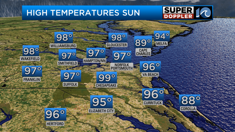
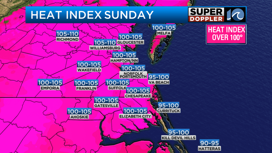
Highs will stay in the 90s for the majority of next week. The best chance for rain is coming Monday. Long term rainfall totals are predicting a half an inch of rain. However, if we see thunderstorms, that could mean totals near one inch for a few spots. Rainfall totals will likely be scattered – with some getting more and some getting less.
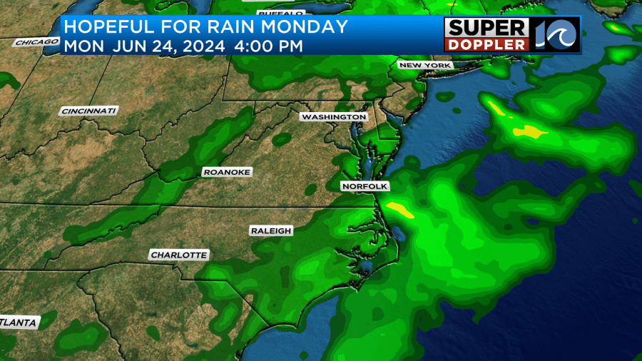
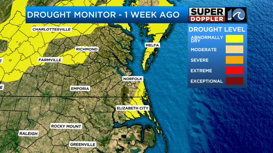
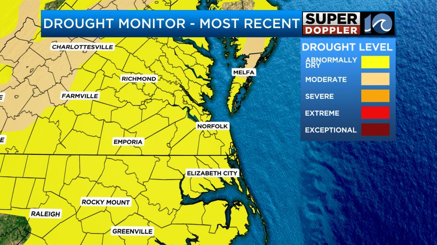
We need 2 inches of rain just to catch up where we need to be this June. Drought conditions have developed across much of Virginia and NC, with abnormally dry conditions being reported on the drought monitor this week.
Hope you have a great Friday! Stay cool this weekend.
Meteorologist Ricky Matthews
Follow Ricky on Facebook and Twitter


