The dry air swooped in yesterday, and it felt great! I took advantage of it and did some extra yard work. I also rode my bike for a while. It was awesome! Today we will still be pretty dry, but the humidity will bounce back soon.
Today we have a cool front stalling out just to our south. High pressure is to our northwest.
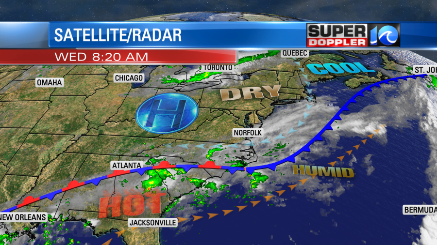
We had a nice breeze out of the northeast yesterday, but today it will be lighter and out of the southeast. This will allow temps to heat up some more. We’ll rise to the low-to-mid 80s this afternoon. Dew points will be mainly in the upper 50s. So it should be a comfortable day.
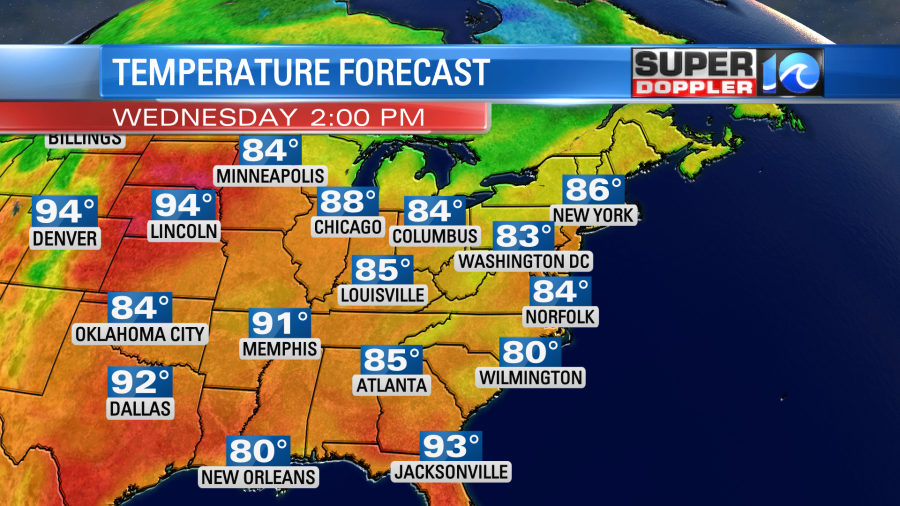
There will be some isolated showers over northeast North Carolina as that area is closer to the front. The showers will be light and isolated. They should stay south of the state line. Tomorrow the front will fall apart, and high pressure will hold where it is. So we will have lots of sunshine with rising humidity. High temps will be in the upper 80s with possibly a few 90s inland.
With the wind turning more out of the south tonight and tomorrow the smoke from the Hyde county wildfire will be able to move back up into Hampton Roads. So you may smell that when you wake up tomorrow morning.
We’ll heat up some more Friday into Saturday. High temps will be near 90 or in the low 90s. Humidity will be high.
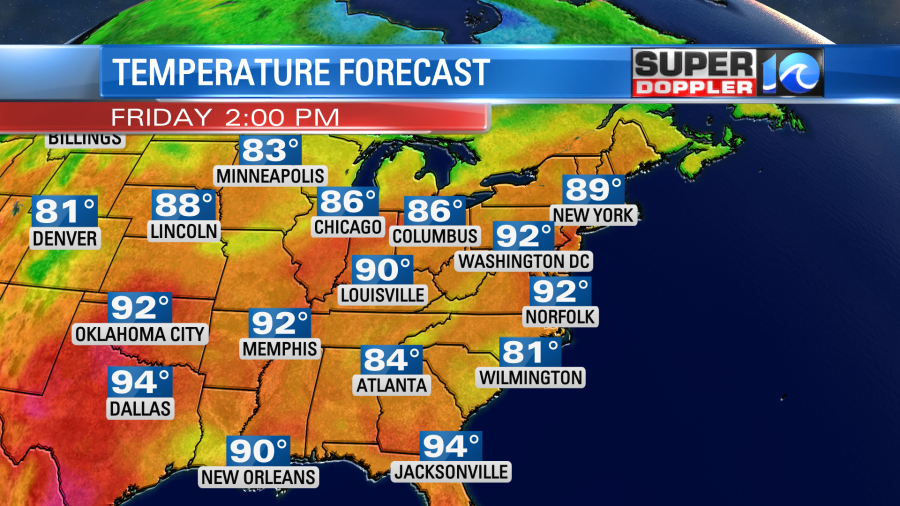
We’ll be pretty hot, humid, and quiet until about Saturday evening. Then we’ll have a few showers and storms. A front will stall out near the region on Sunday. So there will be some scattered showers and storms. Some of these could continue into Monday for the 4th, but they look more isolated by the evening. Stay tuned for updates on that.
We are still tracking that Potential Tropical Cyclone near the coast of Venezuela. It has gained some strength, but it is still not organized yet. It is likely to get a closed circulation in the next 24-48 hours.
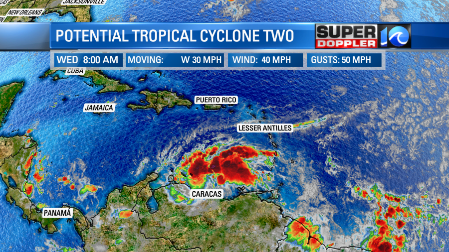
That feature is moving west. It could strengthen some more as it gets away from the coast of South America. It’s still possible that it could become a brief hurricane, but that has been taking out of the official forecast.
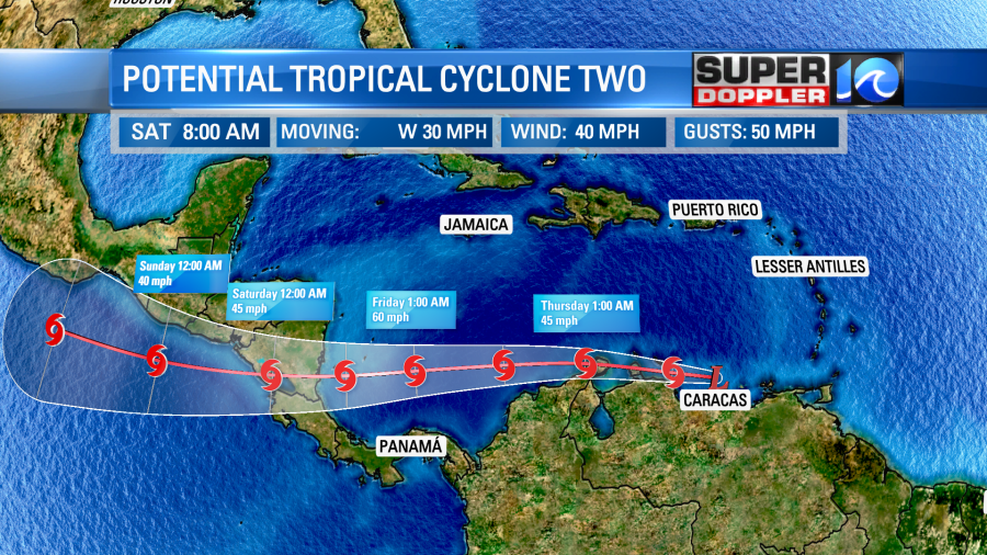
Either way it will stay far from here. There is a cluster of storms near south Texas. It could briefly become a tropical depression before moving onto land. Either way they will get some heavy rain and gusty winds down there from that feature.
Meteorologist: Jeremy Wheeler


