Today is going to be a transition day. We are going from the warm/humid weather pattern to a cooler drier one for a few days. There is a cool front that is pushing down from the Eastern Shore this morning. It will move south through the day.
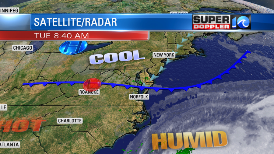
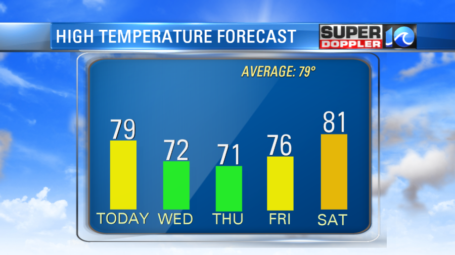
The front may cause a hand full of showers today, but there won’t be too many out there. The wind will pick up out of the northeast. It will gust up to 20mph at times. This will pull down some cooler/drier air into the area, but this will be a gradual filtering. Temps will rise to the upper 70s to low 80s. the dew points will drop from near 70 this morning to near 60 this afternoon. So eventually, skies will clear later this afternoon with the rain pushing inland/west. Then….it’s on! We’ll have cool/dry air for the next few days. High temps will be in the low 70s tomorrow and Thursday. Mid 70s on Friday.
The humidity will be down, and it will stay down for a while. Dew points will drop to the mid 50s tomorrow, and to near 50 by Thursday.

Low temps will be in the 50s and 60s. It will feel awesome! I know some folks need some rain. But if it’s not going to rain, then at least it should be comfortable. Right?
We’ll warm up a little by next weekend, but the humidity shouldn’t rise too much. Highs will be in the 80s.
In the tropics… There is a weak tropical disturbance that probably won’t form near the Texas coast. However, it is bringing some heavy rain to that region today. There is a tropical disturbance over the central Atlantic. It has a high chance of formation over the next couple of days. It is still moving steadily west.
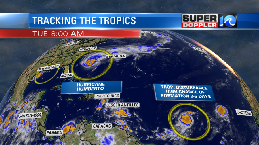
If it does become a tropical storm, then it will be called Imelda. The models have it moving towards the track of Humberto withing the next few days.
Hurricane Humberto has gained more strength since yesterday. Now it is a category 2 hurricane. It is forecast to become a category 3 hurricane within 2 days. The storm is moving east/northeast. It is expected to track just north of Bermuda. Now with the stronger forecast, the island could see a pretty high storm surge. However, the worst of the weather does still look like it will miss Bermuda.
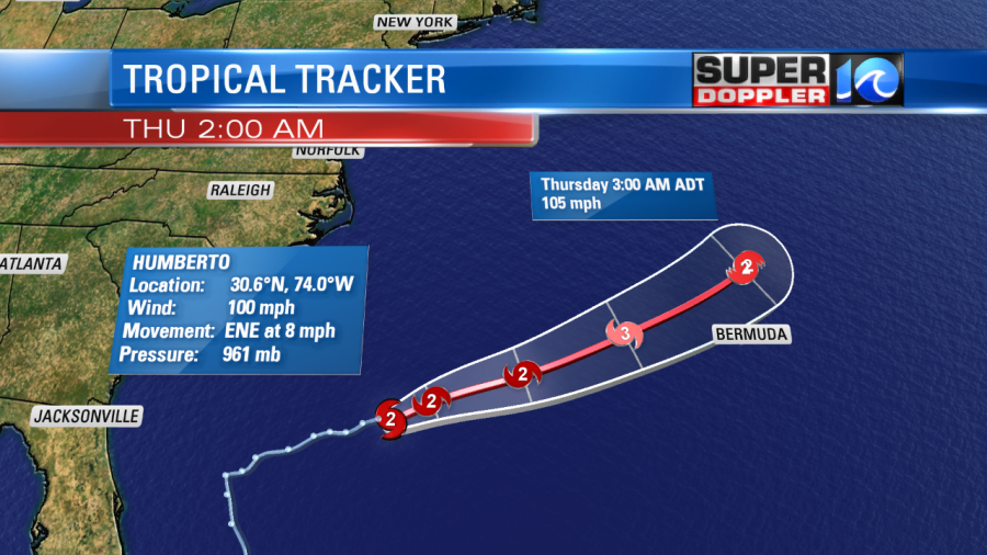
Locally, it is bringing us some waves. They are running about 2-3ft. However, there is also a high threat for rip currents.
In world news… I found a neat article this morning about the melting of the ice around Greenland. I’ve posted some articles over the last few months about the science of Greenland and Global Warming. This article talks a little more about the culture. Here is the article. Greenland’s melting ice.
Meteorologist: Jeremy Wheeler


