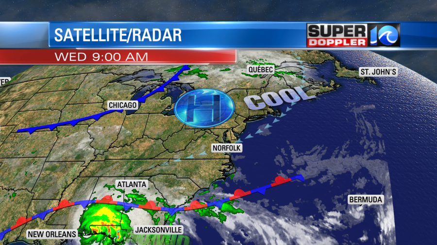
Hurricane Sally made landfall this morning as a category 2 hurricane near Gulf Shores Alabama.
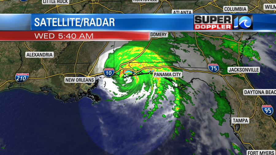
It is now moving over land, and weakening steadily. There was a lot of rain ahead of the storm since yesterday over the Florida Panhandle and southern Alabama. That heavy rain continues today, but now the wind has increased. There were some gusts to around 100 mph near Pensacola, FL this morning.
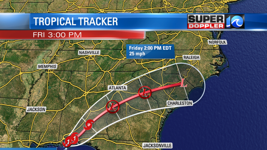
The system will move steadily to the north/northeast today. It will weaken to a tropical storm within the next 12-24 hours. It should become a post-tropical low to our southwest or even fall apart by Friday.
So today we’ll have pretty quiet local weather as high pressure is to our north, and a stationary front is to our south.
We’ll have a mix of sun and clouds with only a stray shower in the region. High temps will be in the 70s, and the humidity will still be fairly low. We’ll have an east wind at 5-10mph with a little more breeziness near the shore.
Tomorrow the deeper moisture will push up into the region. We’ll have mostly cloudy skies. The day should start off quiet. We’ll have quite a bit of clouds and a stray shower. Then as we go through the day, the rain showers will pick up.

The showers will be scattered at first, but a few heavy downpours will be possible. Then as we go into the late afternoon and evening, the rain will become widespread.
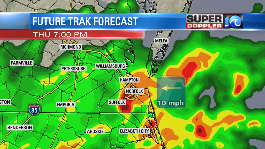
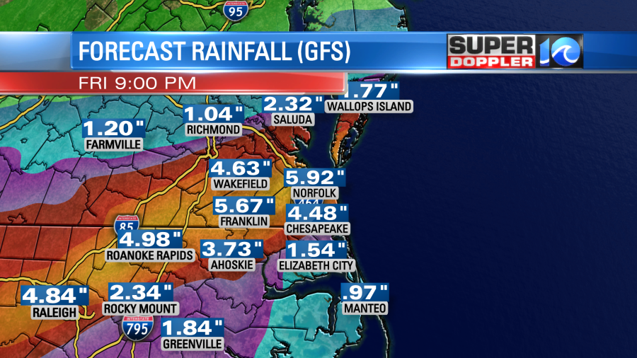
The rain will continue on and off tomorrow night into Friday morning. This is when a cold front will push into the region. It will run into the thick moisture from the remnants of Sally.
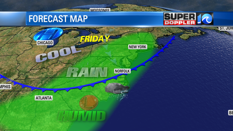
This could lead to some flooding in the region. There is a Flash Flood Watch in effect for most of southeast Virginia tomorrow afternoon through Friday evening. The Rain will taper off late Friday into Saturday morning. However, before it all ends we could see a solid 3-5 inches of rainfall.
The front will drop to our south and stall out over the weekend. We’ll be cooler and drier with high temps near 70. Low temps will be in the 50s and 60s. Except for a few showers Saturday morning the rest of the weekend should be dry. That is unless the timing changes for Sally and the front. I’m optimistic for a dry/cool weekend for now.
Meanwhile the rest of the tropics are still very active. We are still getting some ocean swells from hurricane Paulette. Even though the storm is far out to sea. It is forecast to become more of a nor’easter-type storm over the next couple of days. It will move closer to the Azores islands in about 3-4 days.
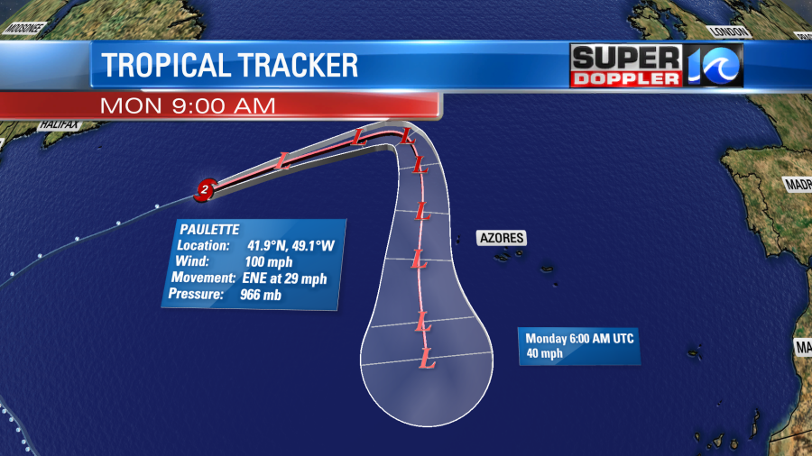
It will likely drop to the south at days 4 and 5. It’s possible that it could eventually become tropical again as it moves over the warmer waters. We’ll see. I saw in the forecast discussion from the National Hurricance Center this morning that some of the waves were about 50ft tall out towards the center of Paulette. Thank God it is out to sea.
There are 2 other systems as I write this. Teddy and Vicky.
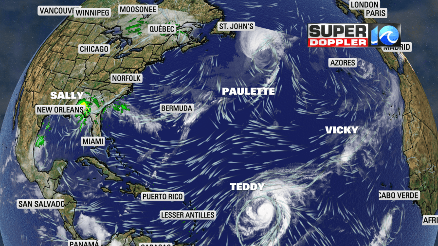
Vicky is very weak, and could fall apart in a few days as it moves west. It is experiencing a good amount of wind shear. However, Teddy has already become a category 2 hurricane. It is forecast to become a category 4 hurricane in a couple of days. It will move on a steady northwest track.
This would put it on a course towards Bermuda in a few days. Possibly as a category 2 hurricane. They just dealt with Paulette. So hopefully, this next storm changes track.
There is another tropical disturbance over in the eastern Atlantic that has a high chance of formation in the next few days.
With all of the tropical systems over the Atlantic and some strengthening northeast winds this weekend, we may have some minor tidal flooding in the area. I’ll update you on that as it gets closer.
Meteorologist: Jeremy Wheeler