Hurricane Ida came ashore yesterday as a fierce and major hurricane. It was the 5th strongest hurricane on record (in terms of wind) as it tied hurricane Laura from last year. Ida has actually made a few records when you look at hurricane climatology.
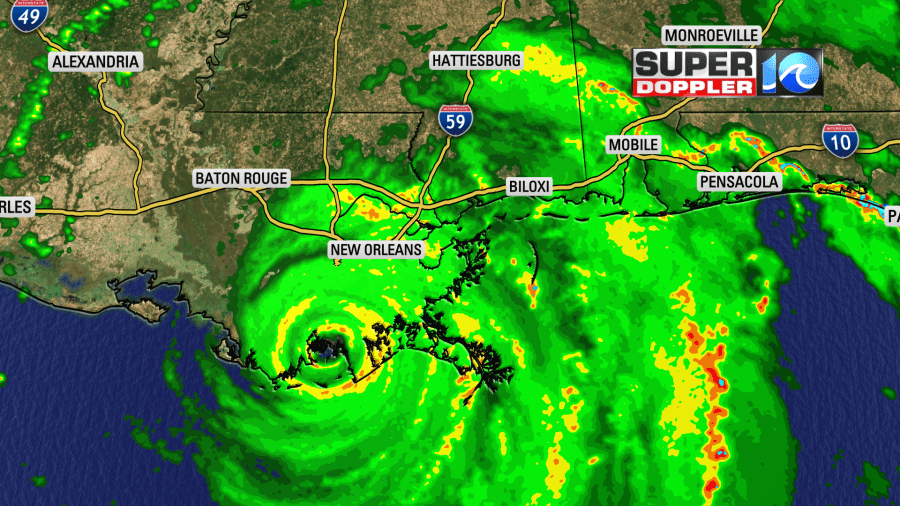
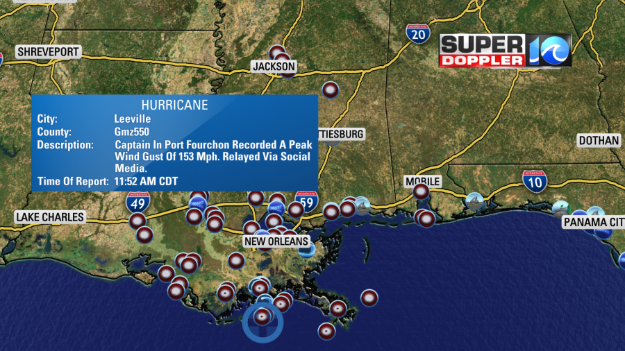
The sustained winds at landfall yesterday were near 150mph with higher gusts. Here was one of the storm reports from Port Fourchon.
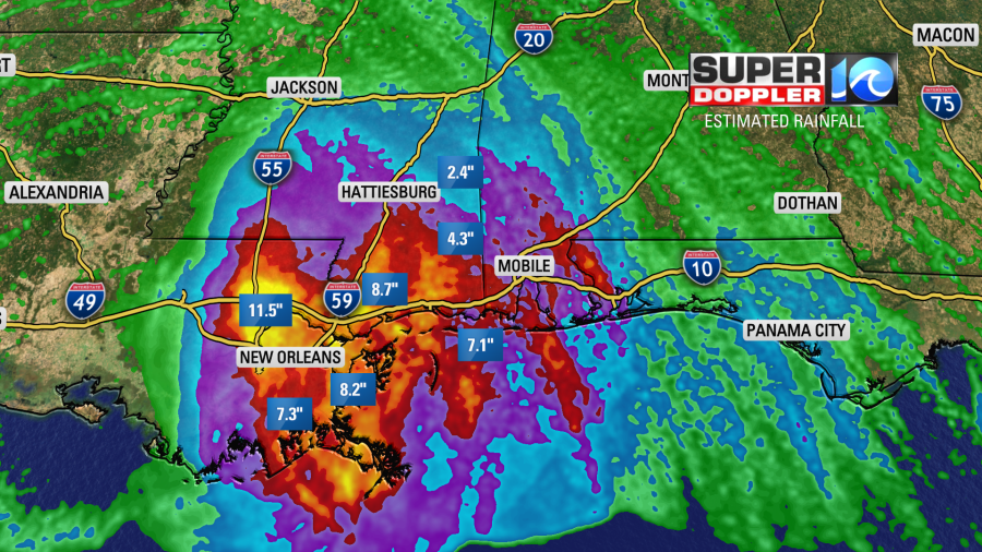
It has also dropped a lot of rain. Our radar estimates almost a foot of rainfall just north of New Orleans.
Now Ida has weakened to a tropical storm, and it is moving through central Mississippi. It will continue to weaken today down to a tropical depression as it moves to the north/northeast. It will weaken even further tomorrow as it gets into the Tennessee River Valley. By Wednesday it will become a post-tropical low as it interacts with a cold front that is currently in the Midwest.
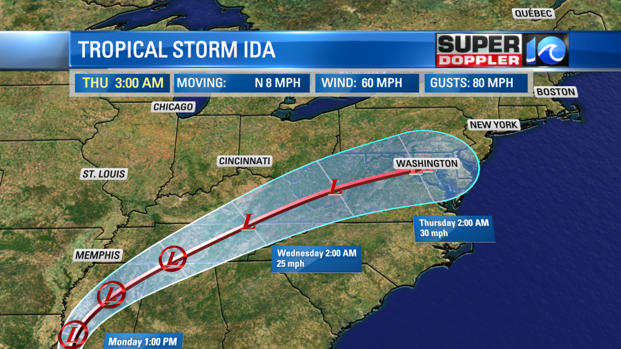
The system will combine with the front Wednesday into Thursday morning. They will bring a line of showers and storms during that time.
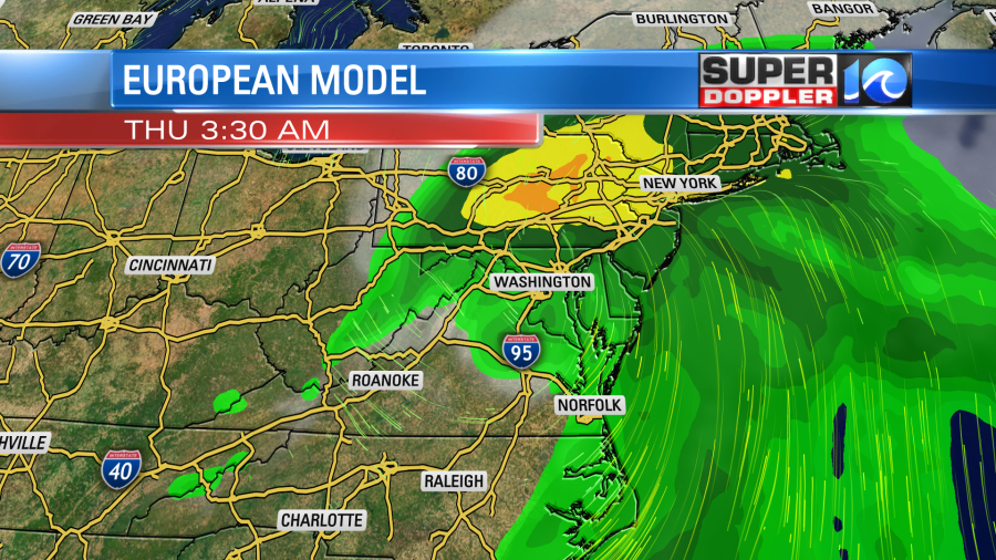
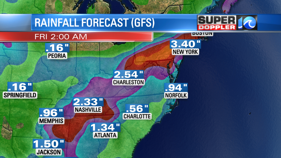
We could see about an inch of an inch and a half of rain between Wednesday afternoon and Thursday evening. This is the GFS model’s forecast which was a bit lower than the previous update.
Then we’ll have some big changes in the weather behind that system. More on that in a moment. Our hearts and prayers go out to those down in the deep south today.
Locally today we’ll have fairly quiet weather.

We’ll be partly sunny with an isolated shower or storm this afternoon. It is still hot and humid with highs near 90. The heat index will be in the upper 90s to near 100. Our model shows a cluster of thunderstorms overnight, but this isn’t from any large weather systems.
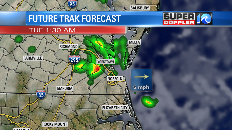
Then it has quiet weather for most of tomorrow with only an isolated shower or storm. We’ll have a mix of sun and clouds. The high temperature will be near 90. We’ll have more clouds on Wednesday with an increasing chance for rain and storms. Highs will still be in the upper 80s. However, we’ll be much cooler on Thursday. High temps will be closer to 80 degrees. After some rain in the first half of the day dry air will finally drop south Thursday night into the weekend. Look at the drop in dew points! Wow!
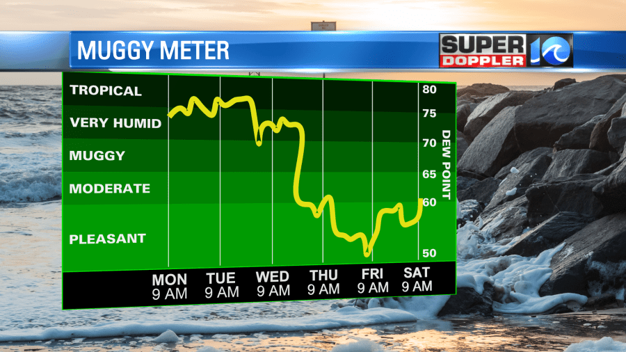
Along with high temps in the upper 70s to near 80 we are looking at some great weather to end the week!
Oh there’s more…. I almost forgot the rest of the tropics. There was actually a tropical storm over the weekend that has already become post-tropical. That is/was Julian. It is over the north Atlantic, and it will stay out to sea.
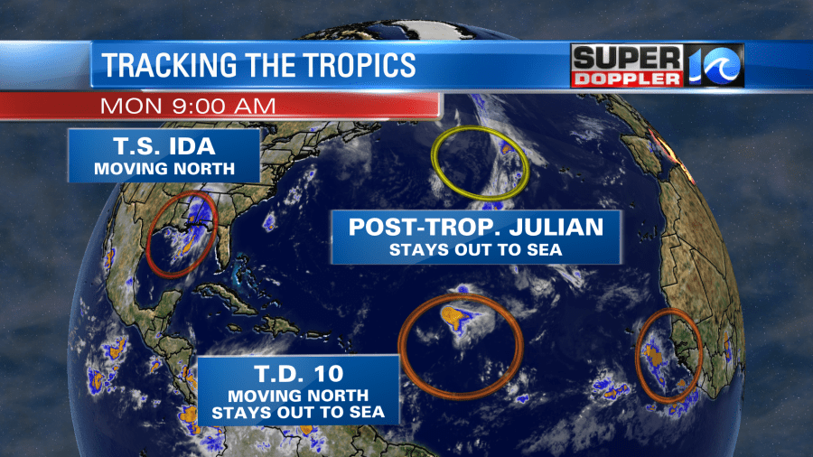
There is also tropical depression 10. It is in the middle of the Atlantic, but it is already moving north. So that one will also stay out to sea. However, it could become a tropical storm briefly.
Update: Tropical depression 10 has strengthened into tropical storm Kate. Still forecast to stay out to sea.
Finally, there is another tropical disturbance coming off of Africa. This has a medium to high chance of formation as it moves to the west/northwest.
Meteorologist: Jeremy Wheeler


