The short answer to the blog title’s question is “No! Winter is not canceled … officially!” However, over the course of the next few days we are going to have some more unseasonably warm temperatures return to the region. High temps yesterday were just a little below average.

Today we’ll have similar temperatures during the afternoon. Highs will be in the mid-upper 40s with a couple of 50s inland and south. We have high pressure to the north with an area of low pressure well to the south.

Some of the moisture is pushing up from the south in the mid levels with drier weather riding in at the surface from the northeast. The surface wind will run out of the northeast at 5-15mph through the day. Skies will be mostly cloudy today with a few breaks in the clouds from time-to-time. Tomorrow the low will be farther offshore. High pressure will hold to our north. So we’ll have partly cloudy skies for most of the day. It will be pretty nice out for the bulk of the day. High temps will be in the low 50s. However, clouds will build in by the end of the day. There will also be some spotty showers by the late afternoon/early evening.
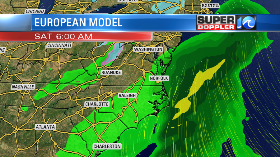
Friday night an area of low pressure will form to our southwest. It will move through the area Friday night into Saturday morning.

The low will quickly move offshore by the morning. Then we’ll have (some) clearing during the afternoon. High temps will be near 50. We may catch a few showers Saturday night into early Sunday morning, but the models are coming in a little drier during that time now. Either way Sunday’s weather looks pretty good. We’ll be partly cloudy with highs in the 50s. So it’s still looking good for Groundhog Day and for viewing the big game Sunday evening.
Going into early next week high temps will rise the 60s. That will be for at least 3 days. It was a shock to me when Don Roberts stated this morning that “We will be starting February with 60s.” Yep. We probably will.
In other warm news…There was a recent article about some (relatively) very warm water that was detected below the Thwaites Glacier in Antarctica. After drilling a core, a team of scientists found water temperatures above freezing at the “grounding line” under one part of the glacier. Scientists are concerned that the glacer could eventually break off and melt. If that were to happen, then the article states that sea levels could rise about 1 meter or about 3 feet. Here is the article with more information: Melting below the Thwaites Glacier.
Meteorologist: Jeremy Wheeler


