We had some more good weather for kids heading back to school today. Skies were partly cloudy and temps were mild. However, there will be a few storms during the afternoon bus routes. Let’s talk about it…
There is a weak stationary front over the region with high pressure offshore. There is a stronger cool front over the Midwest that is steadily dropping to the southeast.
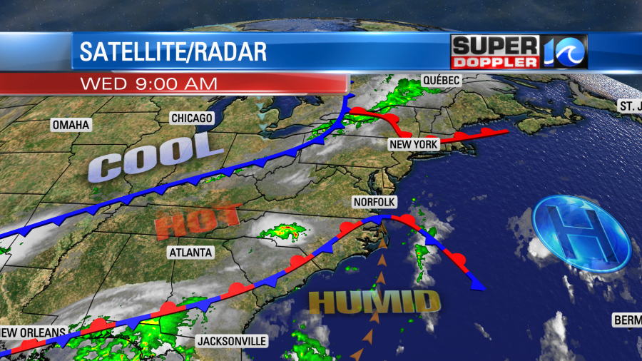
We’ll build the heat and humidity today. Winds will be out of the south at 8-12 mph. Skies will be partly cloudy. So temps will rise to the upper 80s to near 90 this afternoon. Dew points will climb above 70. The combination of the weak front, the increasing humidity, and temps in the upper 80s will produce a few pop-up storms this afternoon. However, The chance for rain and storms increases this evening. There are several models that show a cluster of storms sweeping in from the west.
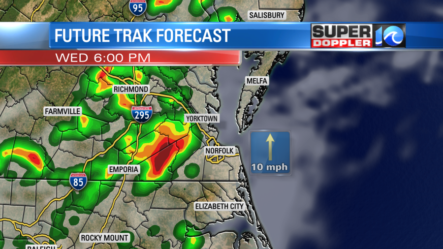
They could speed up or slow down a bit. So keep that in mind. This could impact the evening commute. Some storms could be strong to severe. There is a marginal risk for severe weather. It is possible for the scattered afternoon storms, but it is more likely this evening.
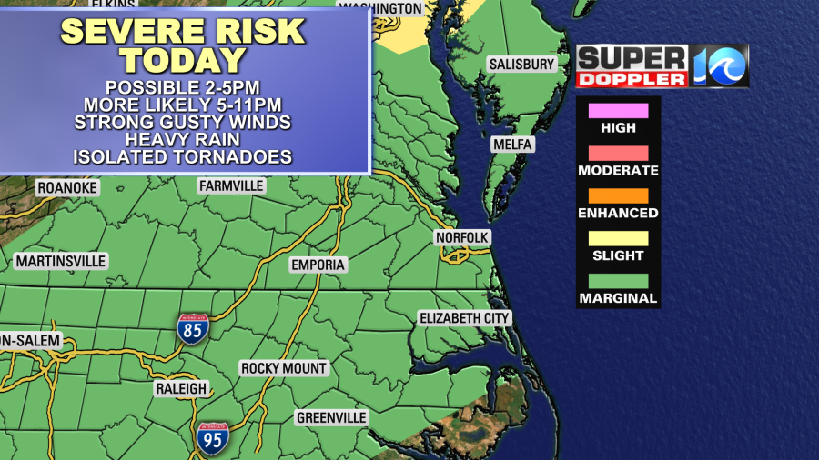
Strong gusty winds will be the main threat along with heavy downpours. An isolated tornado can’t be ruled out. The storms should weaken after 11pm. However, some scattered rain showers will continue into tomorrow morning.
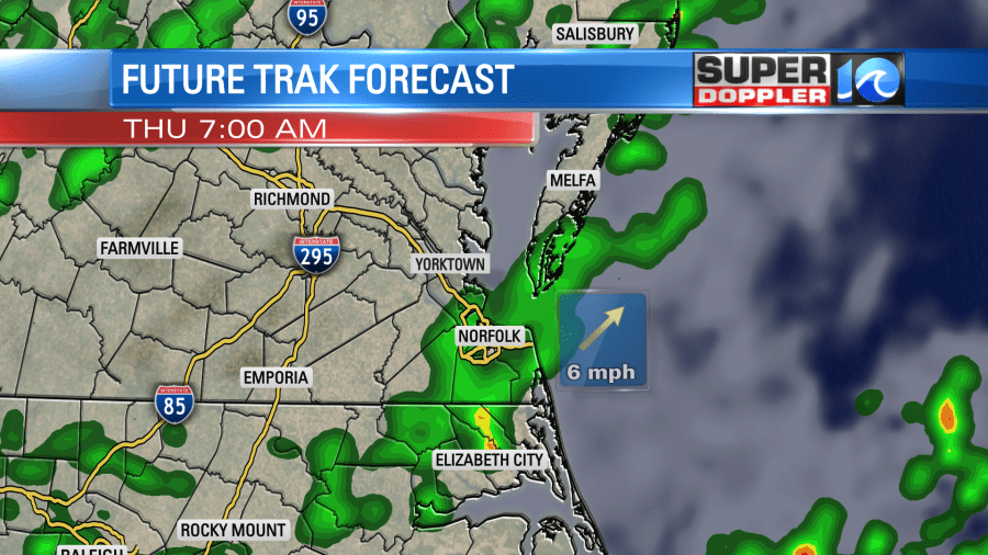
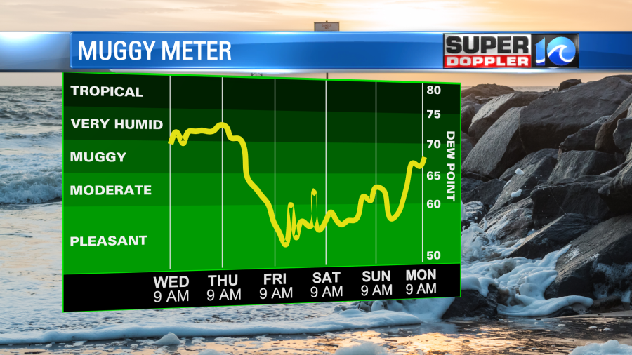
We’ll have more scattered rain showers through the day tomorrow with lots of clouds. The cool front won’t arrive until around midday. This will produce a few more storms during the day. Mostly near the state line into North Carolina. It will be cooler tomorrow as the winds turn out of the north. High temps will be in the upper 70s to near 80. There could be some mid 80s in North Carolina before the front arrives. The rain will finally end Thursday night as the front drops to our south. Then we’ll have some great weather Friday through the weekend. We’ll be dry with high temps in the low-mid 80s.
We have varying amounts of rainfall between this afternoon and Thursday evening. We could pick up a half in up to 1-2″.
The tropics are steady as she goes. Hurricane Larry is still a major hurricane over the central Atlantic. We are also watching that tropical disturbance over the Gulf of Mexico.
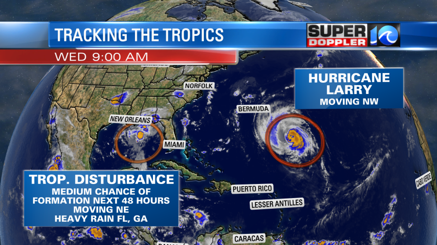
Hurricane Larry is still forecast to pass east of Bermuda in the next 36 hours. It is expected to weaken a bit as it rolls past the island.
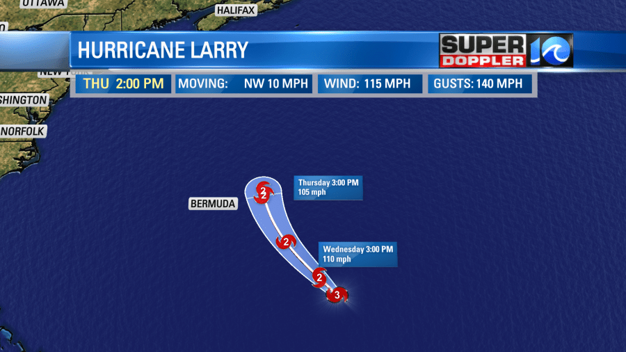
They will have some storm surge, and they could have some rain and wind. However, the worst of the weather is still forecast to stay offshore. Yesterday, we saw the wave forecast on our model was high with some 20ft waves near the island in the next day or two. We are already seeing some elevated waves here along the coast. This has prompted red flags to fly at the local beaches. We have a high threat for rip currents out there. So experienced surfers only. Waves are about 1-3 feet today. They could reach up to 7-8ft along the Outer Banks by Friday.
Larry will then move north and northeast in the next 3-5 days. Newfoundland is still in the cone of uncertainty. This morning’s forecast had Larry as a category 1 hurricane near there by early Saturday morning.
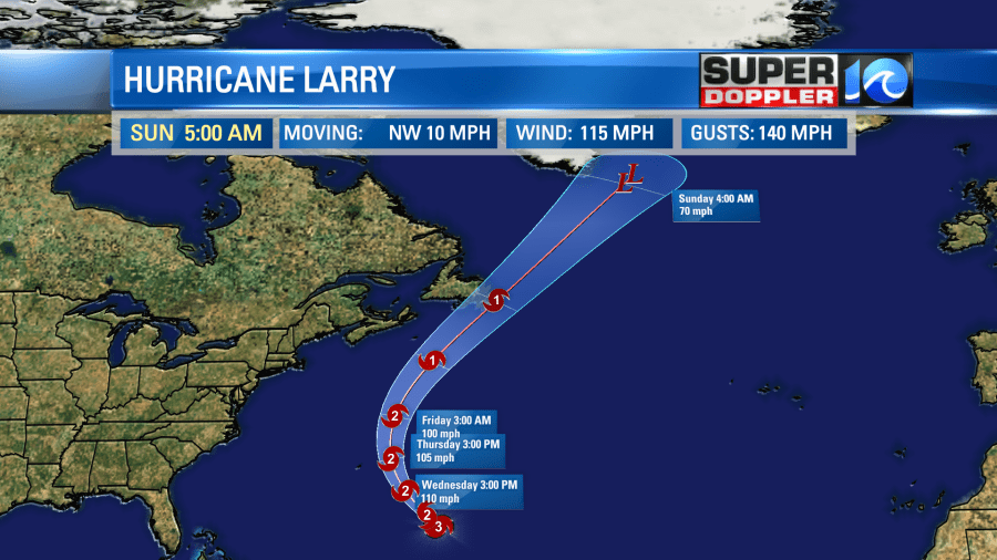
After that it would move northeast and would likely become post-tropical as it heads for….Greenland! How often do you talk about the tropics and Greenland? There’s a low chance that it could still contain some tropical features by that time on Sunday. We’ll see.
Meanwhile the tropical disturbance in the Gulf of Mexico has a cluster of thunderstorms around it.
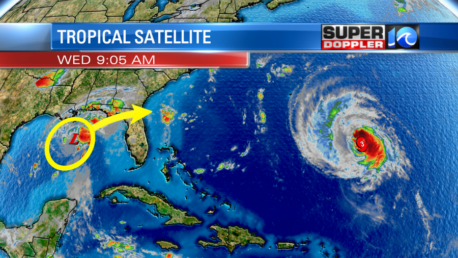
This feature is forecast to move northeast now by more models.
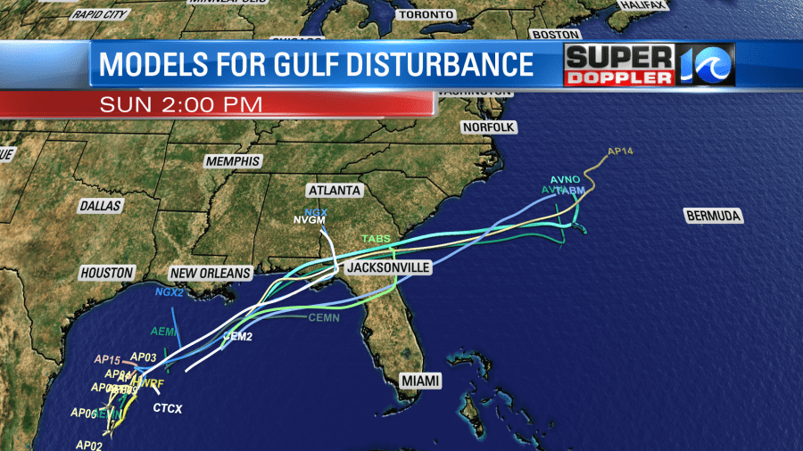
I think it will mainly bring some heavy rain to northern Florida and southern Georgia over the next day or two. This is what the European model shows.
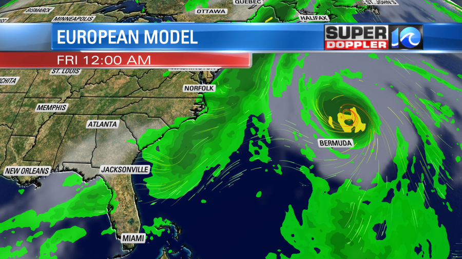
It then has the feature moving offshore over the Atlantic. However, it no longer looks like it forms into a system during that time. Even if it does, it would likely stay to our south and offshore. Stay tuned for updates.
Meteorologist: Jeremy Wheeler


