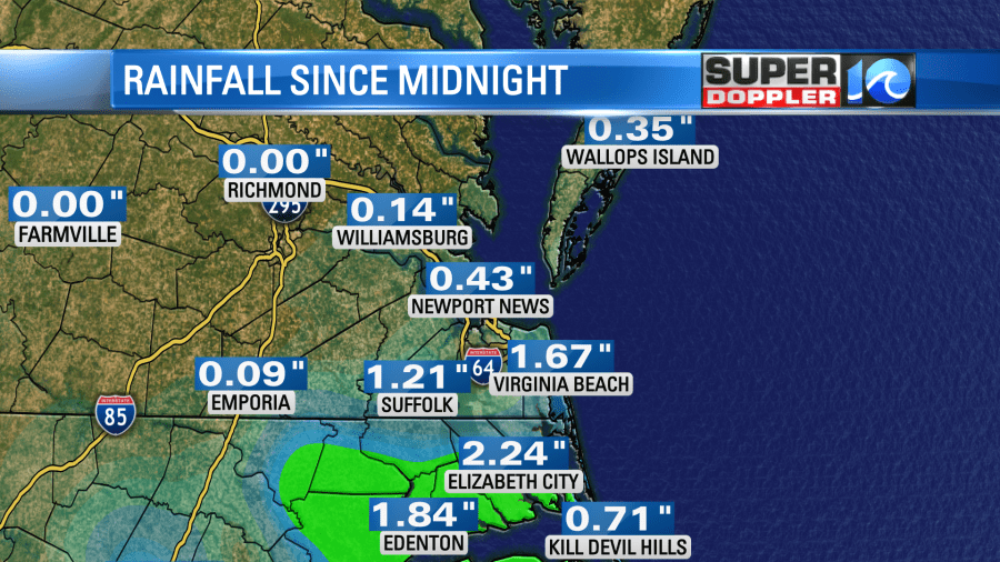
The morning commute Wednesday was definitely wet. Since midnight we picked up about 1-2″ of rain to the southeast with a couple of tenths of an inch from the Peninsula northward. Southern Dare County has seen about 1-3″ of rain in that time, and about 1-3″ more were possible Wednesday. A flash flood warning is in effect in southern Dare until 10:15 a.m.
We have a stationary front on top of the region with an area of low pressure creeping northeast along the front.
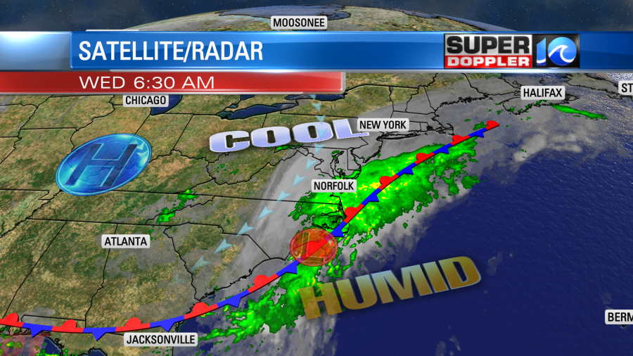
We’ll have a lot of rain in the region through the early afternoon. There will be a few downpours and also a few thunderstorms through that time.
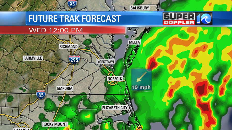
During the afternoon the showers and storms will become more scattered. We’ll still have clouds, but there will be more breaks in-between the rain. A few showers will continue into the early evening.
The forecast calls for a big gradient in the rainfall. The highest amounts will fall over the Outer Banks with about 3-5″ of additional rainfall there. Hampton roads will see about 1-2″ of additional rainfall. It will be less than an inch north of the metro.

With the low scooting through the region we will have some breeziness through the day. It will run out of the northeast at 10-15mph with some gusts up to 25mph. This isn’t a destructive wind, but you may want the thicker rain jacket. Not only will rain be blowing around, but high temps will only be in the mid-upper 70s. So some folks may actually be a bit chilly today. Especially if you get soaked. Part of that is also due to our bodies not being used to the cooler conditions. I’ll admit though it was nice for doing some yard work yesterday. I doubt anyone will be doing yard work today. However, the next 2 days you will probably be able to.
Tomorrow the low will be to our northeast over the ocean. The front will drift a bit to the south/southeast.

We’ll have a few scattered showers tomorrow morning. However, it looks like we’ll dry out during the afternoon. With the sun coming back and the wind dying down we’ll warm up a bit. Highs will rise to the low 80s. For now it looks like Friday will also have some pretty good weather. We’ll be partly cloudy with only some isolated showers or storms in the region. The front will sag to the south. However, the front will pop back west a bit on Saturday. That will bring in some scattered showers and a few storms. Then on Sunday the pesky front will finally fall apart and move offshore. So we’ll have a hotter/quieter pattern set up from Sunday into early next week. High temps will be back to the 90s. Back to Summer for a bit.
Meteorologist: Jeremy Wheeler