We’ll have some mild weather in the forecast today, but some wintry weather is on the way over the next few days. Let’s talk about it. Today we have high pressure to our southwest with a weak stationary front just offshore.
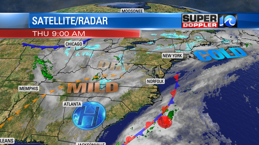
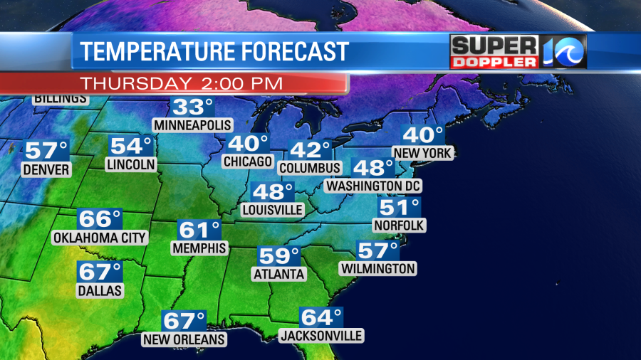
There is a weak area of low pressure near the front. This will move north/northeast through the day. It might produce an isolated shower near the shore. Otherwise, most of the area is looking at a pretty nice day. We’ll have a mix of sun and clouds with light and variable winds. High temps will rise to the low 50s.
Tomorrow a cold front will swipe through the region, but it won’t come through until later in the day. So we’ll be partly cloudy with only a stray shower possible. High temps will be in the upper 40s to low 50s. The exact high will depend on how soon the front comes through. Either way colder air will drop-in on Saturday. High temps will drop to the mid-upper 30s. We’ll be cold, dry, and breezy.
So the Sunday forecast is taking shape. The models are in fairly good agreement, and now the time frame is in range of the NAM model. It still looks like an area of low pressure will form and strengthen over the Tennessee River Valley.
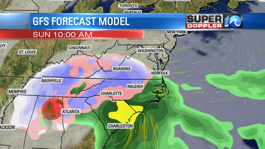
This will move east and ride into our region on Sunday. We’ll have moisture and precip ahead of the low. It could start as a brief wintry mix Sunday morning, but it should turn into rain through the day as temperatures warm. Winds will be out of the east/southeast. Then we’ll have a lot of rain Sunday afternoon into Sunday night. It might end as a brief mix Monday morning before the system moves out.
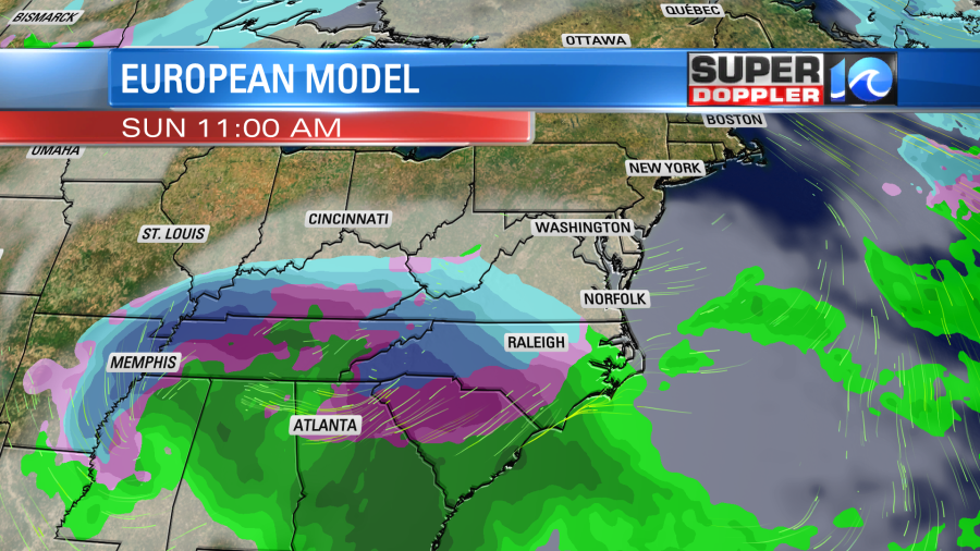
Thankfully, the models are still in good agreement about the overall scenario. The European model flipped a couple of days ago. It does have the low forming to the west of us now (as does the GFS). However, it is later with the precip Sunday morning.
The NAM also has the precip starting later in the day. This would allow some time to warm up, and would probably limit the wintry mix to western areas.
The Euro has rain for eastern Virginia and North Carolina Sunday afternoon.
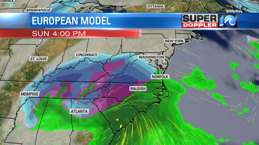
However, it has a lot of snow in the western parts of both states. It has a lot of rain Sunday night. It then has rain ending with a hint of a wintry mix early Monday morning. It finally dries things out as the low moves to our northeast through the day.
The GFS model has a similar trend, but it does start up the precip sooner.
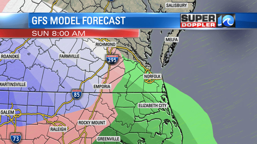
It also changes a lot of the precip over to rain through the day with a wintry mix around Richmond and snow farther west.

It also has rain Sunday night with a mix west of I-95. . It does have a brief mix Monday morning before the system moves out.
So the bottom line is this. Based off the latest forecast, there might be a brief wintry mix Sunday morning and Monday morning, but the bulk of this system looks to be rain and wind for us. We could see about 1-2 inches of rain which will help out the current drought situation. There could be some isolated flooding even along with some tidal flooding, but we’ll see how much. The wind may not be that conducive to tidal flooding for a long stretch of time. It could be more of a problem for Sound-side flooding. Either way the wind will be very strong and gusty between Sunday and Monday. I could see some gusts to 35mph, and that might be upgraded. We’ll have more details on the wind and tide in tomorrow’s weather blog.
There could be a lot of snow in the western parts of the region with a possible mess for a time in central Virginia. This could really disrupt travel.
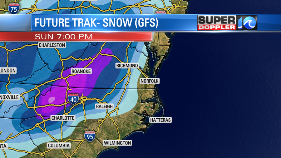
If the forecast trends colder, then that rain/snow line could get closer to our region for a time. Stay tuned for updates on this active weekend forecast.
Meteorologist: Jeremy Wheeler


