Nicholas has weakened to a tropical depression over Louisiana. The winds have weakened, but it is causing more heavy rain to fall.
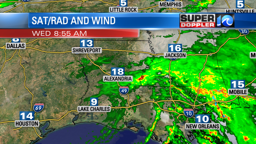
Flash Flood Watches are up for areas from south/central Louisiana all the way to the Florida panhandle. Isolated tornadoes may also be an issue. Nicholas will eventually grind down as it trudges east. However, the rain will keep falling even after it falls apart.
Some local amounts will be much higher. This is terrible news for the folks recovering down there from Ida. Hopefully, they will catch a break soon.
Meanwhile we have high pressure in our region today. It is sliding a bit to the east.

We’ll have a light wind out of the south. We’ll be partly cloudy with some isolated p.m. showers and/or storms. High temps will be in the upper 80s, but it will feel like the low 90s with the heat index.
Tomorrow there will be an area of low pressure that will likely form offshore. This is tied to the tropics. It is currently a tropical disturbance northeast of Bermuda.

This feature will move north/northwest into tomorrow. It will (probably) stay offshore, but it could get close a little close to the coast. Either way it should be a pretty weak system. It has a moderate to high chance of formation in the next couple of days. The European model has it as a very weak system and to our southeast late tomorrow.
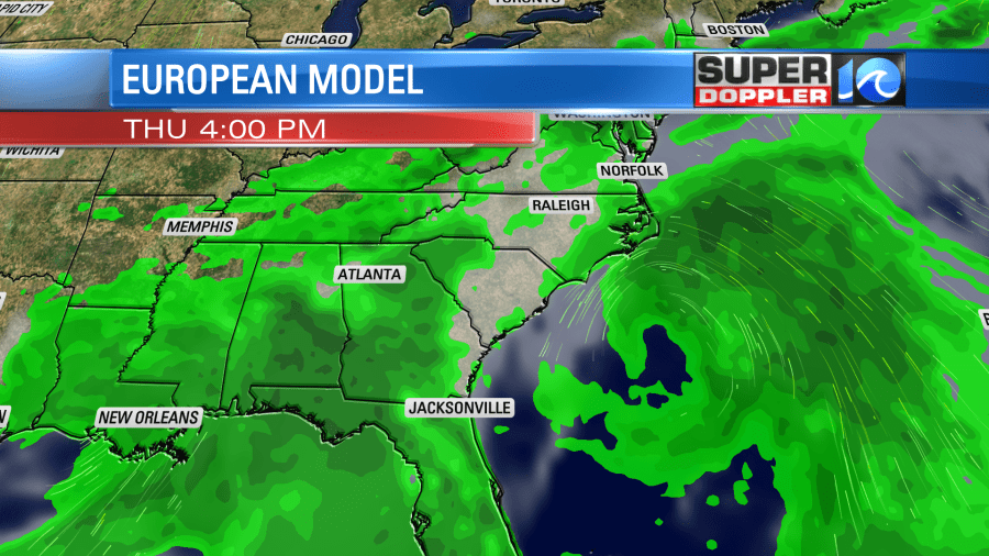
While that model keeps it offshore it does have some scattered rain showers coming in from the coast. Our Future Trak model does as well.
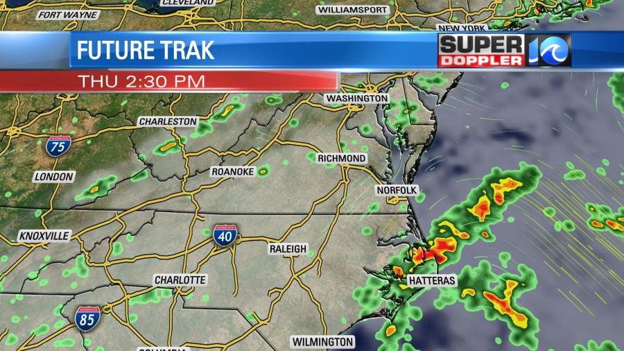
The GFS model has a similar scenario. A very weak offshore low with a few showers. However, it has less rain, and it is a bit farther offshore.
Here are several of the other forecast models for the disturbance:
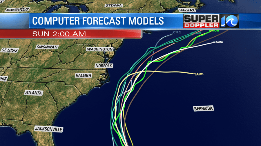
So the bottom line is that the strongest winds should stay offshore, and they will probably be minimal anyway. There will be some scattered rain showers coming in off of the ocean, but the chance for rain depends on how far the system is from the coast. With the extra clouds and east/northeast wind (10-15mph) it will stay cooler. High temps will be in the lower 80s. A cool front will drop down into our region tomorrow into Friday, but it will die out. The wind behind the low will be out of the north though. So between those two things we should cool down even more on Friday. Highs will be in the upper 70s. We’ll have a mix of sun and clouds with a few showers. We’ll have a few showers possible on Saturday with highs in the low 80s. Otherwise it will be partly cloudy. Then we’ll be dry and mild on Sunday.
There is another tropical disturbance in the eastern Atlantic that has a high chance of formation in the next few days.
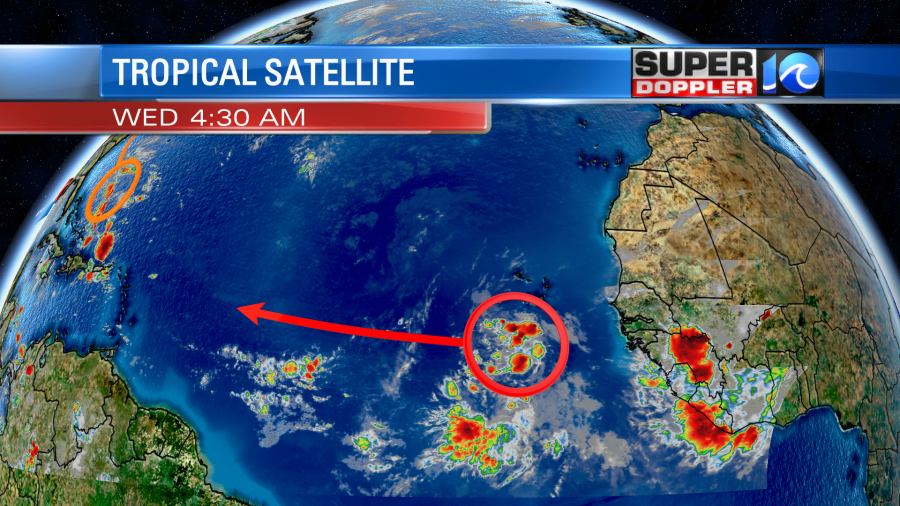
It is moving generally west today. It will move to the west/northwest over the next few days. Another thing we’ll have to watch closely. Great!!! (tired sarcasm).
Meteorologist: Jeremy Wheeler