With an onshore wind, we’ll see temperatures in the 80s on Wednesday. These temperatures are actually a degree or two below (average high is 86°F).
Summer sunshine continues through the remainder of the week with temperatures increasing. Only a few clouds passing in and out each day.

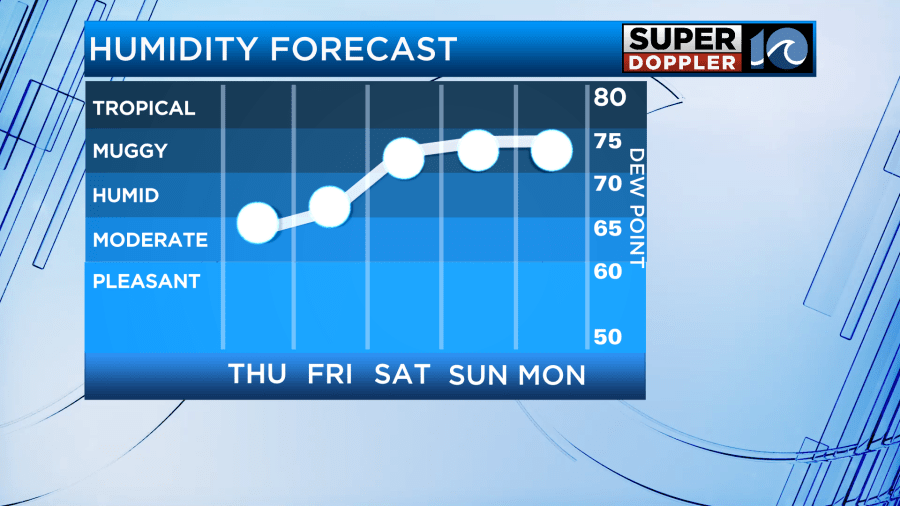
By the end of the week, temperatures should be closer to 90° with humidity slowly climbing. This will cause the heat index values to be in the low to mid 90s, before the weekend could prove even hotter with highs in the mid 90s and heat indices in the 100° to 110° range!

The heat continues into next week, with more 90s in the forecast. The overnight temperatures will only drop into the mid 70s as well, so not a huge amount of heat relief overnight.

In terms of rainfall chances, we won’t see a ton of rainfall chances the rest of the week. However, into next week, a few isolated-scattered showers and storms will be possible on Monday. Any rainfall would be welcomed, as we are almost 2″ behind in rainfall for June.

This lack of rain, combined with the heat will result in abnormally dry conditions (D0 drought conditions) to rapidly develop over VA, NC and parts of surrounding states over the next week. This rapid development of drought is often refered to as a flash drought. The NWS says that flash drought is “simply the rapid onset or intensification of drought. It is set in motion by lower-than-normal rates of precipitation, accompanied by abnormally high temperatures, winds, and radiation. Together, these changes in weather can rapidly alter the local climate.” Here’s more on what a flash drought is and how climate scientists are trying to better predict it and it’s impacts.

In the tropics, Potential Tropical Cyclone 1 has struggled to organize over the past few days. It’s still pretty disorganized this morning. The NHC still expects Tropical Storm Alberto to try and form in the Gulf of Mexico today. It’ll move ashore over northern Mexico by Thursday morning.

An additional weak system could develop off the SE US coast, but it’s just likely to just provide some coastal showers for the Florida peninsula. Another system could develop again in the Gulf of Mexico next week. Nothing to worry about locally through the next week.
Hope you have a great Wednesday!
Meteorologist Ricky Matthews
Follow Ricky on Facebook and Twitter


