Yesterday we started with some clouds in the morning, but then skies started clearing by midday. Then we had a lot of heat and sunshine in the afternoon. High temps made it into the mid-upper 80s.
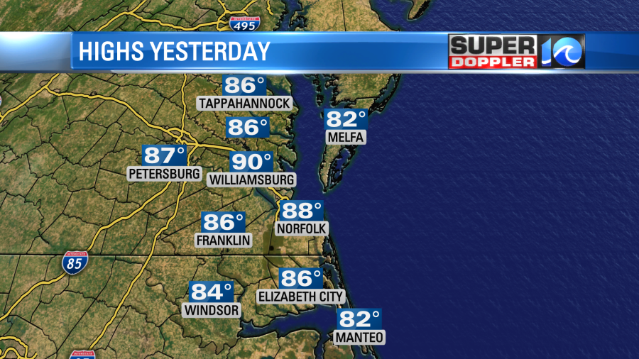
I was doing some yard work for a while yesterday. If it wasn’t for the breeze, then the chores would have been rough. Today will almost be a repeat. We have some clouds around this morning, but clearing skies are expected this afternoon. High pressure is to our south, and the winds have already been blowing out of the southwest.
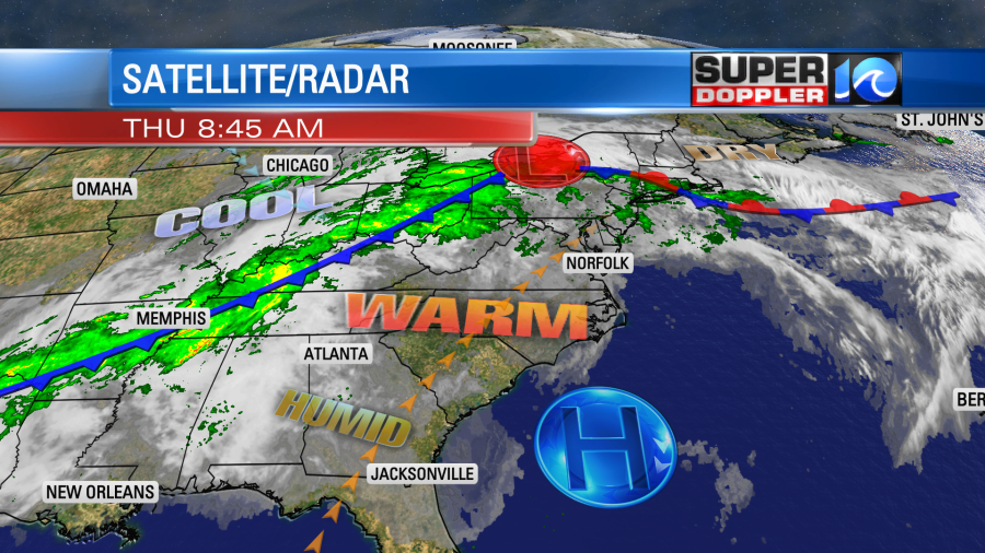
High temps will rise to the upper 80s to low 90s this afternoon. I think Norfolk could hit 90 if the clearing goes as expected. If we do hit 90, then that will be 2 degrees shy of the record.
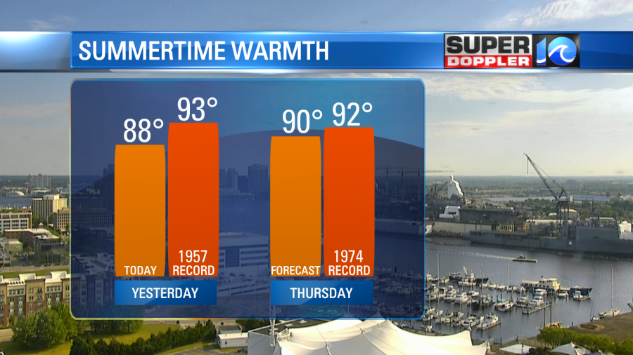
Winds will be a little stronger today. They will run out of the southwest at 10-20mph with some gusts up to 30mph. By early tomorrow we’ll start to see some changes. There will be lots of clouds in the morning with some scattered rain showers moving in from the west.

These will all be early in the day. I’m thinking that they’ll be from about 3am until 7am (ish). Rain amounts will be very light. After that we’ll dry out, and winds will turn to out of the west/northwest. We’ll have clearing skies, and high temps will be in the upper 70s to near 80 during the afternoon. It should be nice out for most of the day. (Just A bit breezy).
We’ll have a cooler and drier weekend. Highs will be in the upper 60s on Saturday and upper 70s on Sunday.
There will be some more scattered showers early next week. I’ll have the update on that in tomorrow’s weather blog.
Meteorologist: Jeremy Wheeler


