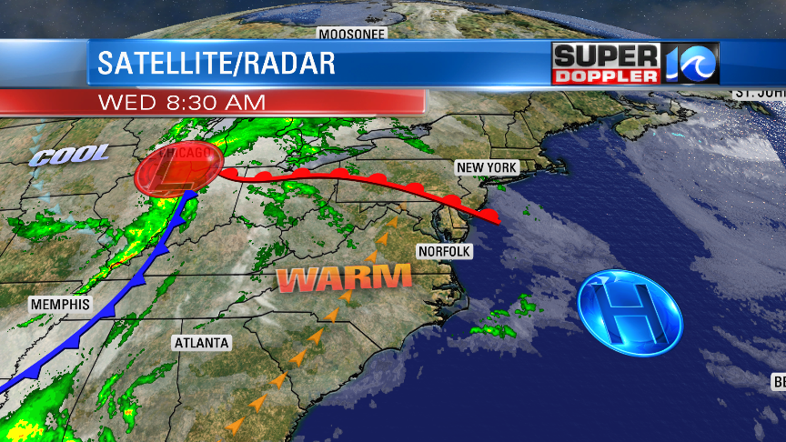
Today we are going to have some pretty nice weather. It is going to be warm, breezy, and very Springy! We have an area of high pressure just offshore. There is a warm front pushing to our north. At same time, there is also a cold front that I’m tracking over towards Tennessee.
We’ll be solidly in the warm zone today. High temps will rise to the lower 80s this afternoon. We’ll have a breezy southwest wind. It will gust up to 25mph. Tree pollen levels are moderate to high. Grass is low-moderate. The models hint at a stray shower or two in the region this afternoon, but most folks will not see it.
We’ll have increasing clouds tonight. It be warm, breezy, and humid overnight. Low temps will be in the lower 60s.
Tomorrow will start off fairly quiet. Most of the rain will still likely be to our west during the morning commute. We may have a few isolated showers during that time though. The cold front will steadily march towards our region through the day. Moisture will stream north ahead of the front. Dew points will rise to the 60s. Temperatures will warm to the mid 70s before the rain moves in. By midday we’ll have a line of showers and storms in our inland areas.
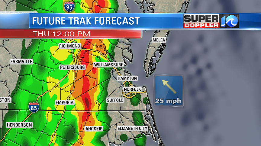
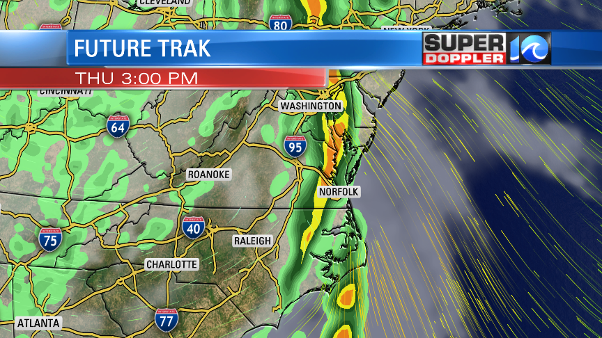
The line of showers and storms will move very slowly east through the afternoon. There likely won’t be many breaks from north to south.
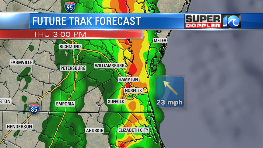
The line won’t really move out to sea until around 10-11pm.
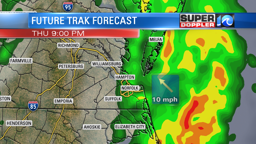
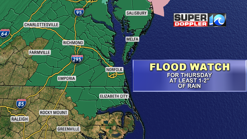
That’s a long time to get heavy rain. So it will add up in the rain gauges. We’ll see a solid 1-2″ of rain, and we could see 2.5 – 3″ in some places.

This will lead to some flooding. We have a Flood Watch in effect for Thursday for most of the region.
We’ll have strong winds out of the southwest. Gusts could be up to 30mph outside of any thunderstorms. Some of the rain and storms could focus that wind in a small area for a time. So we do have a marginal risk for severe weather for northeast North Carolina and the Southside. You can check the update on that from the Storm Prediction Center here: SPC severe risk.
The front will move to our east on Friday. We’ll be cooler with high temps in the upper 60s. An upper level low will hang back behind the front. So we’ll have a mix of sun and clouds with some scattered rain showers possible. However, the precip on Friday will be much less in coverage and amounts.
We’ll have great weather on Saturday with partly cloudy skies. High temps will be in the 70s. We’ll be near 80 on Sunday. Most of the day should be rain-free, but some isolated showers may come in late.
Stay tuned for updates!
Meteorologist: Jeremy Wheeler